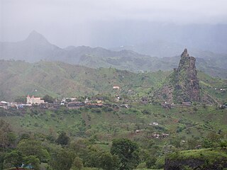
Assomada is a city on the Sotavento (leeward) island of Santiago in Cape Verde. Since 1912, it is the seat of the municipality of Santa Catarina, which comprises the central western part and much of the interior of the island. It is the largest city in that region.
Picos, also known as Achada Igreja, is a city in the central part of the island of Santiago, Cape Verde. It is the seat of São Salvador do Mundo municipality. Picos is located 4 km southeast of Assomada and 23 km northwest of the capital city of Praia, near the national road from Praia to Tarrafal via Assomada (EN1-ST01).

Achadinha is a subdivision of the city of Praia in the island of Santiago, Cape Verde. Its population was 8,483 at the 2010 census. It is situated north of the city centre. Adjacent neighbourhoods include Bairro Craveiro Lopes to the south, Fazenda in the east, Achada Eugênio Lima in the west and Calabaceira in the north, on the other side of the Ribeira da Trindade.
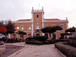
Praia is a concelho (municipality) of Cape Verde. It is situated in the southern part of the island of Santiago. Its seat is the city Praia, the capital of Cape Verde. Its area is 120.6 km2 (46.6 sq mi), and its population was 131,719 at the 2010 census. The municipality consists of one freguesia, Nossa Senhora da Graça. The city hall is located in the Platô part of the city.

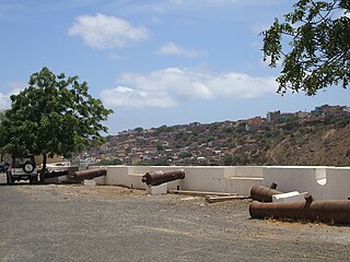
Chã de Areia is a subdivision of the city of Praia in the island of Santiago, Cape Verde. Its population was 247 at the 2010 census. It is situated south and west of the city centre. Adjacent neighbourhoods include Plateau to the northeast, Achadinha to the north, Várzea to the west, Achada Santo António to the southwest and Prainha to the south. Its main streets are Avenida Combatentes da Liberdade da Patria and Avenida Cidade de Lisboa. Points of interest in Chã de Areia include the beach of Gamboa, the old port of Praia and the Cape Verdean National Archives, housed in the former customs building.

Achada Santo António is a subdivision of the city of Praia in the island of Santiago, Cape Verde. Its population was 12,965 at the 2010 census. It is situated near the Atlantic coast, southwest of the city centre.

Várzea is a subdivision of the city of Praia in the island of Santiago, Cape Verde. Its population was 4,834 at the 2010 census. It is situated west of the city centre. Adjacent neighbourhoods are Bairro Craveiro Lopes to the north, Platô to the east, Achada Santo António to the south and Terra Branca to the west.

Achada Grande Tras is a subdivision of the city of Praia in the island of Santiago, Cape Verde. Its population was 2,958 at the 2010 census. It is situated east of the city centre, and south of the Nelson Mandela International Airport. Adjacent neighbourhoods include Achada Grande Frente and Lem Ferreira to the west.

Quebra Canela is a subdivision of the city of Praia in the island of Santiago, Cape Verde. Its population was 19 at the 2010 census. It is situated southwest of the city centre. Adjacent neighbourhoods are Palmarejo to the west, Achada Santo António to the north and Prainha to the east. It has a popular beach.
The following is a timeline of the city of Praia, capital of Cape Verde.
Achada Grande Frente is a subdivision of the city of Praia in the island of Santiago, Cape Verde. Its population was 4,436 at the 2010 census. It is situated east of the city centre, between the Praia Harbour to the south and the Nelson Mandela International Airport to the north. The former Francisco Mendes International Airport was located in Achada Grande Frente.

Palmarejo is a subdivision of the city of Praia in the island of Santiago, Cape Verde. Its population was 12,037 at the 2010 census. It is situated southwest of the city centre. Adjacent neighbourhoods are Tira Chapéu to the north, Achada Santo António in the east, Quebra Canela in the southeast, Cidadela in the west and Palmarejo Grande in the northwest. The main campus of the University of Cape Verde is located in Palmarejo.

Fazenda is a subdivision of the city of Praia in the island of Santiago, Cape Verde. Its population was 1,848 at the 2010 census. It is situated directly north of the city centre (Platô). Bordering neighbourhoods include Lem Cachorro to the northeast, Paiol to the east, Platô to the south and Achadinha to the west. Its northern and eastern borders are formed by Ribeira da Trindade.
Bairro Craveiro Lopes is a subdivision of the city of Praia in the island of Santiago, Cape Verde. Its population was 1,519 at the 2010 census. It is situated northwest of the city centre. Adjacent neighbourhoods include Achadinha to the north, Fazenda to the east, Várzea to the south and Achada Eugénio Lima to the northwest.
Tira Chapéu is a subdivision of the city of Praia in the island of Santiago, Cape Verde. Its population was 5,785 at the 2010 census. It is situated west of the city centre. Adjacent neighbourhoods are Terra Branca to the northeast, Achada Santo António to the southeast, Palmarejo to the southwest and west and Bela Vista to the northwest.

Mato Raia is a settlement in the central part of the island of Santiago, Cape Verde. It is part of the municipality São Lourenço dos Órgãos. It is located about a kilometer north from the city of João Teves. In 2010 its population was 181.
São Martinho Grande is a settlement in the southern part of the island of Santiago, Cape Verde. It is part of the municipality Ribeira Grande de Santiago. It is located 4 km east from Cidade Velha and 6.5 km west of Praia city centre. The national road EN1-ST05 passes north of the village. 1.5 km south of the village is a small bay of the Atlantic Ocean, Calheta de São Martinho. It was mentioned as "Kalyete de S. Martin" on the 1747 map by Jacques-Nicolas Bellin.

The Universidade de Santiago is a private Cape Verdean university. The main campus is in Assomada, located in the middle of the Island of Santiago. There are two satellite campuses, one in Praia and another one in Tarrafal. It is one of the eight existing universities in Cape Verde; it was established on November 24, 2008. Since its opening in 2008, it has been run by the current rector Gabriel António Monteiro Fernandes, who holds a Ph.D. in Sociology.
Terra Branca is a subdivision of the city of Praia in the island of Santiago, Cape Verde. Its population was 4,470 at the 2010 census. It is situated west of the city centre. Adjacent neighbourhoods are Várzea to the east, Achada Santo António to the south and Tira Chapéu to the west.