Prophetstown, Illinois

Last updated

Prophetstown
Whiteside County Illinois Incorporated and Unincorporated areas Prophetstown Highlighted.svg
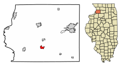
Location of Prophetstown in Whiteside County, Illinois
Illinois in United States (US48).svg
Location of Illinois in the United States
Coordinates: 41°40′14″N89°56′9″W / 41.67056°N 89.93583°W / 41.67056; -89.93583
CountryUnited States
StateIllinois
County Whiteside
Area
[1]
  Total
1.37 sq mi (3.54 km2)
  Land1.34 sq mi (3.47 km2)
  Water0.03 sq mi (0.07 km2)
Population
 (2020)
  Total
1,946
  Density1,453.32/sq mi (561.11/km2)
Time zone UTC-6 (CST)
  Summer (DST) UTC-5 (CDT)
ZIP Code(s)
61277
Area code 815
FIPS code 17-61977
Wikimedia CommonsProphetstown, Illinois
Website prophetstownil.org

Prophetstown is a city in Whiteside County, Illinois, United States. The population was 2,080 at the 2010 census, up from 2,023 in 2000.

Contents

Geography

Prophetstown is located at 41°40′14″N89°56′9″W / 41.67056°N 89.93583°W / 41.67056; -89.93583 (41.670504, -89.935869). [2]

According to the 2010 census, Prophetstown has a total area of 1.394 square miles (3.61 km2), of which 1.37 square miles (3.55 km2) (or 98.28%) is land and 0.024 square miles (0.06 km2) (or 1.72%) is water. [3]

History

An 1825 treaty established an unnamed "Winnebago village" about 40 miles above the mouth of the Rock River as a boundary point of the Winnebago, corresponding to the location of Prophetstown. [4]

Prophetstown occupies the site of the village of the Winnebago prophet, which the Illinois volunteers destroyed on May 10, 1832, in the first act of hostility in the Black Hawk War. [5] Prophetstown was named for Wabokieshiek (White Cloud), the prophet who lived upon the land. Wabokieshiek served as an advisor to Black Hawk and took part in the Black Hawk War. Wabokieshiek and his followers, the Sauk people, resided where the current Prophetstown State Park (of Illinois) is now located. They left the land in 1832 as the Black Hawk War ended, when Wabokieshiek was taken captive by the United States. This area is now a state park, but at one time it held a community of 14 villages.

It is believed that residents of Prophetstown petitioned to move the U.S. government from Washington D.C. to Prophetstown in the 1800s because of its supposed central location of the lower 48 states.

Prophetstown once held community events such as Cruise Night, an event which showcased many classic cars, held at Eclipse Park in the town center. Eventually the event fell out of favor and a memorial was built in the park to honor those who served in the Armed Forces.

Prophetstown is still held in high esteem for having one of the largest Fourth of July fireworks shows in the area. Prophetstown also hosts a Lighted Christmas Parade as the highlight of the start of the holiday season the Saturday before Thanksgiving. Prophetstown is an Illinois Main Street Community. The downtown features a series of historical murals and Eclipse Square Park as well as a selection of stores and restaurants.

Demographics

Historical population
CensusPop.Note
1870 276
1880 803190.9%
1890 694−13.6%
1900 1,14364.7%
1910 1,083−5.2%
1920 1,1597.0%
1930 1,35316.7%
1940 1,4698.6%
1950 1,69115.1%
1960 1,8026.6%
1970 1,9156.3%
1980 2,14111.8%
1990 1,749−18.3%
2000 2,02315.7%
2010 2,0802.8%
2020 1,946−6.4%
U.S. Decennial Census [6]

As of the census [7] of 2000, there were 2,023 people, 809 households, and 533 families residing in the city. The population density was 1,484.5 inhabitants per square mile (573.2/km2). There were 865 housing units at an average density of 634.7 per square mile (245.1/km2). The racial makeup of the city was 97.92% White, 0.89% African American, 0.10% Native American, 0.10% Asian, 0.25% from other races, and 0.74% from two or more races. Hispanic or Latino people of any race were 1.14% of the population.

There were 809 households, out of which 25.5% had children under the age of 18 living with them, 56.1% were married couples living together, 7.4% had a female householder with no husband present, and 34.0% were non-families. 31.6% of all households were made up of individuals, and 17.8% had someone living alone who was 65 years of age or older. The average household size was 2.31 and the average family size was 2.89.

In the city, the population was spread out, with 21.4% under the age of 18, 7.2% from 18 to 24, 25.2% from 25 to 44, 23.3% from 45 to 64, and 23.0% who were 65 years of age or older. The median age was 43 years. For every 100 females, there were 93.4 males. For every 100 females age 18 and over, there were 88.3 males.

The median income for a household in the city was $37,452, and the median income for a family was $47,589. Males had a median income of $33,828 versus $21,438 for females. The per capita income for the city was $19,572. About 3.9% of families and 9.5% of the population were below the poverty line, including 8.4% of those under age 18 and 4.0% of those age 65 or over.

Education

Prophetstown-Lyndon-Tampico Community Unit School District 3 is the public school district. [8]

Besides the local public schools, Christ Lutheran School, located in nearby Sterling, serves students of various religious backgrounds from Walnut to Milledgeville and from Morrison to Dixon. As part of the largest network of Protestant schools in the US, CLS provides an education for students from age 3 through 8th grade. [9]

Notable people

See also

Related Research Articles

<span class="mw-page-title-main">Winnebago County, Illinois</span> County in Illinois, United States

Winnebago County is a county located in the U.S. state of Illinois. According to the 2020 census, it had a population of 285,350 making it the seventh most populous county in Illinois behind Cook County and its five surrounding collar counties. Its county seat is Rockford. Winnebago County is the central county of the Rockford metropolitan area.

<span class="mw-page-title-main">Whiteside County, Illinois</span> County in Illinois, United States

Whiteside County is a county located in the U.S. state of Illinois. According to the 2020 census, it had a population of 55,691. Its county seat is Morrison. The county is bounded on the west by the Mississippi River. Whiteside County comprises the Sterling, IL Micropolitan Statistical Area, which is also included in the Dixon-Sterling, IL Combined Statistical Area. U.S. President Ronald Reagan was born in 1911 in the Whiteside County community of Tampico.

<span class="mw-page-title-main">Stephenson County, Illinois</span> County in Illinois, United States

Stephenson County is a county located in the U.S. state of Illinois. According to the 2020 United States Census, it had a population of 44,630. Its county seat is Freeport. Stephenson County is included in the Freeport, IL Micropolitan Statistical Area, which is also included in the Rockford-Freeport-Rochelle, IL Combined Statistical Area.

<span class="mw-page-title-main">Loves Park, Illinois</span> City in Illinois, United States

Loves Park is a city in Boone and Winnebago counties in the U.S. state of Illinois. Most of the city is in Winnebago County, with a tiny sliver in the east located in Boone County. The population was 23,397 at the 2020 census.

<span class="mw-page-title-main">Nelson, Illinois</span> Village in Illinois, United States

Nelson is a village in Lee County, Illinois, United States. The population was 170 at the 2010 census, up from 163 in 2000.

<span class="mw-page-title-main">Polo, Illinois</span> City in Illinois, United States

Polo is a city in Ogle County, Illinois, United States. The population was 2,355 at the 2010 census, down from 2,477 in 2000.

<span class="mw-page-title-main">Lake Summerset, Illinois</span> Census Designated Place in Illinois, United States

Lake Summerset is a census-designated place (CDP) in Stephenson and Winnebago counties in Illinois. The population was 2,048 at the 2010 census.

<span class="mw-page-title-main">Pearl City, Illinois</span> Village in Illinois, United States

Pearl City is an incorporated village in Stephenson County, Illinois, with a population of 838 at the 2010 census, up from 780 in 2000.

<span class="mw-page-title-main">Lyndon, Illinois</span> Village in Illinois, United States

Lyndon is a village in Whiteside County, Illinois, United States. The population was 648 at the 2010 census, up from 566 in 2000.

<span class="mw-page-title-main">Tampico, Illinois</span> Village in Illinois, United States

Tampico is a village located in Tampico Township, Whiteside County, Illinois, United States next to Rock Falls and Sterling, Illinois. As of the 2010 census the village had a total population of 790, up from 772 at the 2000 census. It is known as the birthplace of Ronald Reagan, the 40th President of the United States.

<span class="mw-page-title-main">Durand, Illinois</span> Village in Illinois, United States

Durand is a village in Winnebago County, Illinois, United States. It is part of the Rockford, Illinois Metropolitan Statistical Area The population was 1,443 at the 2010 census, up from 1,081 in 2000.

<span class="mw-page-title-main">Machesney Park, Illinois</span> Village in Illinois, United States

Machesney Park is a village located in Winnebago County, Illinois, United States. The population was 23,499 at the 2010 census, up from 20,759 in 2000. Machesney Park is part of the Rockford, Illinois Metropolitan Statistical Area.

<span class="mw-page-title-main">New Milford, Illinois</span> Village in Illinois, United States

New Milford is a village in Winnebago County, Illinois, United States on the south bank of the Kishwaukee River overlooking the south side of Rockford. It is part of the Rockford, Illinois Metropolitan Statistical Area. The population was 697 at the 2010 census, up from 541 in 2000.

<span class="mw-page-title-main">Winnebago, Illinois</span> Village in Illinois, United States

Winnebago is a village in Winnebago County, Illinois. It is part of the Rockford-Winnebago Metropolitan Statistical Area. The population was 3,101 at the 2010 census, up from 2,958 in 2000.

<span class="mw-page-title-main">Scarville, Iowa</span> City in Iowa, United States

Scarville is a city in Winnebago County, Iowa, United States. The population was 74 at the time of the 2020 census.

<span class="mw-page-title-main">Branchdale, Pennsylvania</span> CDP in Pennsylvania, United States

Branchdale is a census-designated place (CDP) in Schuylkill County, Pennsylvania, United States. The population was 436 at the 2000 census.

<span class="mw-page-title-main">Omro, Wisconsin</span> City in Wisconsin, United States

Omro is a city in Winnebago County, Wisconsin, United States. The population was 3,517 at the 2010 census. The city is located along the Fox River, approximately 10 miles west of Oshkosh, Wisconsin.

<span class="mw-page-title-main">Fairfield Township, Bureau County, Illinois</span> Township in Illinois, United States

Fairfield Township is one of twenty-five townships in Bureau County, Illinois, USA. As of the 2020 census, its population was 379 and it contained 142 housing units.

<span class="mw-page-title-main">Loraine Township, Henry County, Illinois</span> Township in Illinois, United States

Loraine Township is one of twenty-four townships in Henry County, Illinois, USA. As of the 2020 census, its population was 244 and it contained 125 housing units.

<span class="mw-page-title-main">Yorktown Township, Henry County, Illinois</span> Township in Illinois, United States

Yorktown Township is one of twenty-four townships in Henry County, Illinois, USA. As of the 2020 census, its population was 447 and it contained 185 housing units.

References

  1. "2020 U.S. Gazetteer Files". United States Census Bureau. Retrieved March 15, 2022.
  2. "US Gazetteer files: 2010, 2000, and 1990". United States Census Bureau. February 12, 2011. Retrieved April 23, 2011.
  3. "G001 - Geographic Identifiers - 2010 Census Summary File 1". United States Census Bureau. Archived from the original on February 13, 2020. Retrieved December 27, 2015.
  4. "Treaty with The Sioux etc - 1825". www.firstpeople.us. Retrieved June 12, 2020.
  5. "Prophetstown".
  6. "Census of Population and Housing". Census.gov. Retrieved June 4, 2015.
  7. "U.S. Census website". United States Census Bureau . Retrieved January 31, 2008.
  8. "2020 CENSUS - SCHOOL DISTRICT REFERENCE MAP: Whiteside County, IL" (PDF). U.S. Census Bureau . Retrieved December 13, 2024. - Text list
  9. "Welcome to Christ Lutheran School". Christ Lutheran School. Retrieved February 17, 2024.
  10. 'Illinois Blue Book 1963-1964,' Biographical Sketch of George S. Brydia, pg. 272
  11. 'Illinois Blue Book 1967-1968,' Biographical Sketch of Paul E. Rink, pg. 278-279