Purple Line (San Diego Trolley)

Last updated

Purple Line
Overview
StatusAnnounced
Owner SANDAG
Locale San Diego County, California, United States
Stations12 (proposed)
Service
Type Commuter rail
System San Diego Trolley
Route number582 (in internal documents only) [1] [2]
Operator(s) San Diego Trolley, Inc.
History
Planned opening2035 (proposed, Sorrento Mesa to National City) [1]
2050 (National City to San Ysidro) [2]
2011Draft 2050 Regional Transportation Plan published
2019Project announced as the Purple Line
2021Mode changed from light rail to commuter rail
Technical
Line length30.5 mi (49.1 km)
Track gauge 4 ft 8+12 in (1,435 mm) standard gauge
Electrification Overhead line,  600 V DC
Operating speed110 miles per hour (180 km/h) (max)
Route map

Contents

BSicon exKBHFa lavender.svg
Mira Mesa Boulevard/Pacific Heights Boulevard
BSicon exBHF lavender.svg
UTC Transit Center Logo Blue Line (San Diego Trolley).svg Blue Line
BSicon exBHF lavender.svg
Clairemont Mesa Boulevard/Ruffner Street
BSicon exBHF lavender.svg
Anrae Street/Mesa College Drive
BSicon HUB2.svg
BSicon exhBHFa lavender.svg
BSicon HUBc3.svg
Stadium
BSicon gCONTgq.svg
BSicon HUBc1.svg
BSicon xmhKRZe lavender+g.svg
BSicon HUB4.svg
BSicon gHSTq.svg
BSicon gCONTfq.svg
BSicon exBHF lavender.svg
Dwight Street/43rd Street
BSicon HUB2.svg
BSicon exhBHFa lavender.svg
BSicon HUBc3.svg
Euclid Avenue
BSicon CONTgq carrot.svg
BSicon HUBc1.svg
BSicon xmhKRZe lavender+carrot.svg
BSicon HUB4.svg
BSicon HSTq carrot.svg
BSicon CONTfq carrot.svg
BSicon exBHF lavender.svg
East Plaza Boulevard/Highland Avenue
BSicon exBHF lavender.svg
E Street/4th Avenue
BSicon exBHF lavender.svg
Orange Avenue/4th Avenue
BSicon CONTgq denim.svg
BSicon xmABZg+r lavender+denim.svg
BSicon HST denim.svg
Iris Avenue
BSicon KHSTe denim.svg
San Ysidro
Greyhound no dog.svg

Wheelchair symbol.svg All stations are accessible

The Purple Line is a commuter rail line proposed by the San Diego Association of Governments (SANDAG) as part of the San Diego Trolley system. It would run from San Ysidro Transit Center at the Mexico-United States Border to Kearny Mesa with a possible extension to Carmel Valley. Most of it would run along a similar route to I-805. The Purple Line could include up to 12 stations, a new maintenance facility, and a storage yard.

Projected ridership on the Purple Line was previously expected to be over 40,000 daily trips when previously studied as a light rail line with a peak hour frequency of 7–10 minutes. With its mode being changed to higher-speed and higher-capacity commuter rail, a new study will eventually be conducted to determine how many more daily trips will be generated. [3] The line is proposed to be opened in 2035 if funding is available at a proposed total project cost of $15.56B. [4]

History

Planning

In April 2011, the San Diego Association of Governments (SANDAG) released a draft of its 2050 Regional Transportation Plan, which the SANDAG board of directors approved on October 28, 2011. An inland Trolley line from San Ysidro to Kearny Mesa, though not yet called the Purple Line, was included in the plan. [5] [6] [7]

Line name announced

In April 2019, SANDAG approved the final version of a November ballot initiative to increase the countywide sales tax by a half-cent, which further detailed future transit plans and specifically mentioned and estimated the cost to build the proposed San Ysidro-Kearney Mesa trolley extension. It was then given its official title, the Purple Line. [8]

Mode changed from light rail to commuter rail

In 2021, SANDAG released their 2021 Regional Plan, in which they updated the mode of the Purple Line proposal from light rail to commuter rail. As a commuter rail line, trains could run as fast as 110 miles per hour (180 km/h). [9]

Potential stations

Potential stations according to the SANDAG plan could include: [10]

Related Research Articles

<span class="mw-page-title-main">Interstate 805</span> Interstate highway in California

Interstate 805 (I-805) is a major north–south auxiliary Interstate Highway in Southern California. It is a bypass auxiliary route of I-5, running roughly through the center of the Greater San Diego region from San Ysidro near the Mexico–U.S. border to near Del Mar. The southern terminus of I-805 at I-5 in San Ysidro is less than 1 mi (1.6 km) north of the Mexican border. I-805 then traverses the cities of Chula Vista and National City before reentering San Diego. The freeway passes through the San Diego neighborhoods of North Park, Mission Valley, Clairemont, and University City before terminating at I-5 in the Sorrento Valley neighborhood near the Del Mar city limit.

<span class="mw-page-title-main">California State Route 125</span> Highway in California

State Route 125 (SR 125) is a state highway in the U.S. state of California that serves as a north–south route in the San Diego area. It runs from SR 11 and SR 905 in Otay Mesa, near the Mexican border, to SR 52 in Santee. SR 125 also connects SR 54, SR 94, and I-8.
<span class="mw-page-title-main">Coaster (rail service)</span> Commuter rail service in San Diego County, California

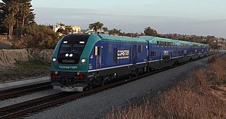
Coaster is a commuter rail service in the central and northern coastal regions of San Diego County, California, United States, operated by the North County Transit District (NCTD).

<span class="mw-page-title-main">San Diego Trolley</span> Light rail system serving San Diego, California

The San Diego Trolley is a light rail system operating in San Diego County, California. The trolley's operator, San Diego Trolley, Inc., is a subsidiary of the San Diego Metropolitan Transit System (MTS). The trolley operates as a critical component of MTS, with connections to and integrated travel tickets with the local bus systems.
<span class="mw-page-title-main">SEPTA subway–surface trolley lines</span> Philadelphia trolley lines

The SEPTA subway–surface trolley lines are a collection of five SEPTA trolley lines that operate on street-level tracks in West Philadelphia and Delaware County, Pennsylvania, and also underneath Market Street in Philadelphia's Center City. The lines, Routes 10, 11, 13, 34, and 36, collectively operate on about 39.6 miles (63.7 km) of route.

<span class="mw-page-title-main">Sprinter (rail service)</span> Hybrid rail service in San Diego County, California

Sprinter is a hybrid rail service operating in the North County area of San Diego County between the cities of Escondido and Oceanside, California, United States. The service uses the 22-mile (35 km) Escondido Subdivision of the San Diego Northern Railroad. Station platforms were constructed for the line's fifteen stations serving the cities of Oceanside, Vista, San Marcos, and Escondido. The line provides service to California State University, San Marcos and Palomar College. Sprinter service operates every 30 minutes and is targeted towards students and commuters.

The North County Transit District (NCTD) is the agency responsible for public transportation in Northern San Diego County, California. The agency manages the COASTER commuter rail service between Oceanside and San Diego, the SPRINTER hybrid rail service between Escondido and Oceanside, the BREEZE transit bus service, LIFT paratransit service, and FLEX on-demand and point-deviation service.

<span class="mw-page-title-main">Transportation in San Diego County</span>

The following is a list of transportation options in San Diego County, California.

<span class="mw-page-title-main">Old Town Transit Center</span> Passenger train, light rail, and bus station in San Diego, California, United States

Old Town Transit Center, also known as San Diego–Old Town station, or Old Town San Diego station, is an intermodal transportation station in the Old Town neighborhood of San Diego, California. It is served by Amtrak's Pacific Surfliner, the COASTER commuter rail service, and the San Diego Trolley, as well as numerous San Diego Metropolitan Transit System bus lines.

<span class="mw-page-title-main">San Diego Metropolitan Transit System</span> Public transportation agency in Southern San Diego County, California

The San Diego Metropolitan Transit System is a public transit service provider for San Diego County, California. The agency operates a transit system that includes the San Diego MTS bus system, San Diego Trolley, and Rapid. MTS also controls the San Diego and Arizona Eastern (SD&AE) freight railway and regulates taxicabs, jitneys, and other private for-hire passenger transportation services.

<span class="mw-page-title-main">Blue Line (San Diego Trolley)</span> Light rail line in San Diego County, California

The Blue Line is a 26.3-mile (42.3 km) light rail line in the San Diego Trolley system, operated by San Diego Trolley, Inc., an operating division of the San Diego Metropolitan Transit System (MTS). With an end-to-end travel time of one hour and twenty-three minutes, it operates between the UTC Transit Center and the San Ysidro Transit Center, the latter of which is at the Mexico–United States border directly adjacent to the San Ysidro Port of Entry, facilitating easy connections across the border. The line serves La Jolla, downtown San Diego, National City, Chula Vista, and San Ysidro.

<span class="mw-page-title-main">Orange Line (San Diego Trolley)</span> Light rail line in San Diego County, California

The Orange Line is an 17.1-mile (27.5 km) light rail line in the San Diego Trolley system, operated by San Diego Trolley, Inc. an operating division of the San Diego Metropolitan Transit System. The route connects downtown San Diego with the cities of Lemon Grove, La Mesa, and El Cajon. The Orange Line has the lowest ridership of the San Diego Trolley's three core lines, transporting 10,896,289 riders during FY 2014 according to the MTS.

<span class="mw-page-title-main">San Ysidro Transit Center</span> San Diego Trolley station

San Ysidro Transit Center is a San Diego Trolley station in the San Ysidro neighborhood of San Diego, California. The station is the southern terminus of the Blue Line and is located on a short rail spur off the San Diego and Arizona Eastern Railway main line which hosts the Blue Line to downtown San Diego.

The following is a list of transportation options in San Diego, California.

<span class="mw-page-title-main">Rapid (San Diego)</span> Bus Rapid Transit System

Rapid is a bus rapid transit system operating in San Diego County, California. It is part of the San Diego Metropolitan Transit System (MTS). The system mainly operates on the HOV lanes of Interstate 15 and 805. Freeway-level stations are located in the medians of Interstate 15, Park Boulevard, and East Palomar Street.

<span class="mw-page-title-main">San Diego Climate Action Plan</span> Climate impact reduction blueprint for San Diego, California

The San Diego Climate Action Plan was adopted by the city of San Diego in December 2015. It is a local climate action plan whose rules are defined by the Global Warming Solutions Act of 2006, with the goal of reducing greenhouse gas emissions. Through this plan, the city initially set goals of eliminating half of all greenhouse emissions and sourcing all energy from renewable sources by the year 2035. With a coalition of business owners, environmental advocates, and community leaders, Mayor Kevin Faulconer approved the Climate Action Plan. The plan consists of several policies to ensure the economic and environmental growth of the city of San Diego. It was referred to in The San Diego Union-Tribune as "the most aggressive climate action plan in California."

<span class="mw-page-title-main">Clairemont Drive station</span> San Diego Trolley station

Clairemont Drive station is an at-grade San Diego Trolley station in San Diego, California. The station platform is located on the westside of Morena Boulevard where the tracks are, while the parking structure will be built across the street on the eastside of Morena between Ingulf Street and Clairemont Drive. Service began on November 21, 2021 after the completion of the Blue Line Mid-Coast Trolley extension project.

<span class="mw-page-title-main">Balboa Avenue Transit Center</span> San Diego Trolley station

Balboa Avenue Transit Center is a San Diego Trolley station in San Diego. The station is located along Balboa Avenue between Interstate 5 and Morena Boulevard. Service began on November 21, 2021 after the completion of the Blue Line Mid-Coast Trolley extension project.

References

  1. 1 2 "2021 Regional Plan - Appendix A: Transportation Projects, Programs, and Phasing" (PDF). San Diego Association of Governments. 2021. p. 17 (A-13). Retrieved October 2, 2024. 2035 - Transit Leap - Commuter Rail 582 - Sorrento Mesa to National City via UTC, Kearny Mesa, and University Heights
  2. 1 2 "2021 Regional Plan - Appendix A: Transportation Projects, Programs, and Phasing" (PDF). San Diego Association of Governments. 2021. p. 18 (A-14). Retrieved October 2, 2024. 2050 - Transit Leap - Commuter Rail 582 - National City to U.S. Border
  3. "SANDAG 2023 Regional Transportation Improvement Plan" (PDF). p. 141.
  4. "A Transformative Transportation Vision For the 2021 Regional Plan". p. Explore.
  5. "2050 Regional Transportation Plan – Chapter 6 – Systems Development: Offering More Travel Choices" (PDF). SANDAG. October 28, 2011. pp. 6–15–6–18 & 6–33. Retrieved August 1, 2013.
  6. Ojeda, Artie (October 28, 2011). "SANDAG Approves Transportation Plan". NBC San Diego (KNSD) . Retrieved October 30, 2011.
  7. "PROJECTS :: San Diego's Regional Planning Agency". SANDAG. October 28, 2011. Retrieved August 1, 2013.
  8. "SANDAG Board of Directors Agenda, June 24, 2016, Item 16-06-10, FIRST READING: REGIONAL TRANSPORTATION COMMISSION ORDINANCE NO. RTC-CO-2017-01: THE SAN DIEGO COUNTY ROAD REPAIR, TRANSIT, TRAFFIC RELIEF, SAFETY, AND WATER QUALITY ORDINANCE AND EXPENDITURE PLAN PROVIDING FOR THE IMPOSITION OF A ONE-HALF OF ONE CENT RETAIL TRANSACTIONS AND USE TAX FOR A FORTY-YEAR PERIOD COMMENCING ON APRIL 1, 2017
  9. "Central Mobility Hub and Connections Comprehensive Multimodal Corridor Plan" (PDF). p. 89.
  10. "Purple Line Concept Map 2023-03-23" (PDF). March 23, 2023.