Puryear, Tennessee

Last updated
Puryear, Tennessee
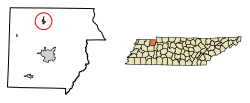
Henry County Tennessee Incorporated and Unincorporated areas Puryear Highlighted 4761160.svg
Location in Henry County, Tennessee
Coordinates: 36°26′41″N88°20′2″W / 36.44472°N 88.33389°W / 36.44472; -88.33389
Country United States
State Tennessee
County Henry
Area
[1]
  Total0.95 sq mi (2.45 km2)
  Land0.95 sq mi (2.45 km2)
  Water0.00 sq mi (0.00 km2)
Elevation
[2]
607 ft (185 m)
Population
 (2020) [3]
  Total706
  Density745.51/sq mi (287.86/km2)
Time zone UTC-6 (Central (CST))
  Summer (DST) UTC-5 (CDT)
ZIP code
38251
Area code 731
FIPS code 47-61160 [4]
GNIS feature ID1298712 [2]

Puryear is a city in Henry County, Tennessee, United States. The population was 671 at the 2010 census. [5]

Contents

Geography

Puryear is located in northern Henry County at 36°26′41″N88°20′2″W / 36.44472°N 88.33389°W / 36.44472; -88.33389 (36.444853, -88.333770). [6] U.S. Route 641 passes through the east side of the city, leading north 4 miles (6 km) to Hazel, Kentucky, and south 10 miles (16 km) to Paris, the Henry county seat. Tennessee State Route 140 passes through the center of Puryear, leading east 12 miles (19 km) to U.S. Route 79 near Paris Landing State Park on Kentucky Lake, and west 8 miles (13 km) to SR 69 near Jones Mill.

According to the United States Census Bureau, Puryear has a total area of 0.93 square miles (2.4 km2), all land. [5] The Tennessee Valley Divide runs along the western edge of the city; most of Puryear drains north via the East Fork of the Clarks River, eventually reaching the Tennessee River just south of its confluence with the Ohio River, while the westernmost part of Puryear drains west via Clear Creek to the North Fork of the Obion River, a tributary of the Mississippi.

Demographics

Historical population
CensusPop.Note
1910 254
1920 32528.0%
1930 3518.0%
1940 3684.8%
1950 43016.8%
1960 408−5.1%
1970 45812.3%
1980 62436.2%
1990 592−5.1%
2000 66712.7%
2010 6710.6%
2020 7065.2%
Sources: [7] [8] [3]

As of the census [4] of 2000, there were 667 people, 284 households, and 191 families residing in the city. The population density was 730.0 inhabitants per square mile (281.9/km2). There were 328 housing units at an average density of 359.0 per square mile (138.6/km2). The racial makeup of the city was 95.65% White, 2.70% African American, 0.15% Native American, 0.45% Asian, 0.45% from other races, and 0.60% from two or more races. Hispanic or Latino of any race were 0.75% of the population.

There were 284 households, out of which 26.8% had children under the age of 18 living with them, 53.9% were married couples living together, 9.5% had a female householder with no husband present, and 32.7% were non-families. 27.5% of all households were made up of individuals, and 14.1% had someone living alone who was 65 years of age or older. The average household size was 2.27 and the average family size was 2.73.

In the city, the population was spread out, with 19.8% under the age of 18, 8.7% from 18 to 24, 26.8% from 25 to 44, 22.9% from 45 to 64, and 21.7% who were 65 years of age or older. The median age was 41 years. For every 100 females there were 92.2 males. For every 100 females age 18 and over, there were 91.1 males.

The median income for a household in the city was $28,750, and the median income for a family was $36,042. Males had a median income of $22,315 versus $20,481 for females. The per capita income for the city was $17,131. About 7.4% of families and 10.8% of the population were below the poverty line, including 24.3% of those under age 18 and 9.3% of those age 65 or over.
Related Research Articles

<span class="mw-page-title-main">Weakley County, Tennessee</span> County in Tennessee, United States

Weakley County is a county located in the northwest of the U.S. state of Tennessee. As of the 2020 census, the population was 32,902. Its county seat is Dresden. Its largest city is Martin, the home of the University of Tennessee at Martin. The county was established by the Tennessee General Assembly on October 21, 1823, and is named for U.S. Congressman Robert Weakley (1764–1845). Weakley County comprises the Martin, TN Micropolitan Statistical Area.

<span class="mw-page-title-main">Henry County, Tennessee</span> County in Tennessee, United States

Henry County is a county located on the northwestern border of the U.S. state of Tennessee, and is considered part of West Tennessee. As of the 2020 census, the population was 32,199. Its county seat is Paris. The county is named for the Virginia orator and American Founding Father Patrick Henry.

<span class="mw-page-title-main">Hardin, Kentucky</span> City in Kentucky, United States

Hardin is a home rule-class city in Marshall County, Kentucky, United States. The population was 580 at the 2020 census.

<span class="mw-page-title-main">Whitley City, Kentucky</span> Census-designated place in Kentucky, United States

Whitley City is an unincorporated community and census-designated place (CDP) in McCreary County, Kentucky, United States. The population was 968 at the 2020 census, down from 1,170 in 2010. It is the county seat of McCreary County. Whitley City is one of two unincorporated county seats in Kentucky.

<span class="mw-page-title-main">Morristown, Minnesota</span> City in Minnesota, United States

Morristown is a city in Rice County, Minnesota, United States. The population was 987 at the 2010 census.

<span class="mw-page-title-main">Norlina, North Carolina</span> Town in North Carolina, United States

Norlina is a town in Warren County, North Carolina, United States. The population was 1,118 at the 2010 census.

<span class="mw-page-title-main">Hunter, Tennessee</span> CDP in Tennessee, United States

Hunter is a census-designated place (CDP) and unincorporated community located northeast of Elizabethton in Carter County, Tennessee, United States, along Tennessee State Route 91 and the Watauga River. Its population was 1,854 as of the 2010 census. It is part of the Johnson City Metropolitan Statistical Area, which is a component of the Johnson City–Kingsport–Bristol, TN-VA Combined Statistical Area – commonly known as the "Tri-Cities" region. Hunter is a suburb of Elizabethton.

<span class="mw-page-title-main">Manchester, Tennessee</span> City in Tennessee, United States

Manchester is a city in Coffee County, Tennessee, United States. The population was 12,213 at the 2020 census. It is the county seat of Coffee County. The city is located halfway between Nashville and Chattanooga on Interstate 24.

<span class="mw-page-title-main">Vanleer, Tennessee</span> Town in Tennessee, United States

Vanleer is a town in Dickson County, Tennessee, United States. The population was estimated to be 422 in 2019, up from 395 at the 2010 census. The town is approximately 49 miles northwest of Nashville and is located within the city's greater metropolitan area.

<span class="mw-page-title-main">Savannah, Tennessee</span> City in Tennessee, United States

Savannah is a city in and the county seat of Hardin County, Tennessee, United States. The population was 7,213 at the 2020 census. Savannah is located along the east side of the Tennessee River.

<span class="mw-page-title-main">Hornbeak, Tennessee</span> Town in Tennessee, United States

Hornbeak is a town in Obion County, Tennessee, United States. The population was 424 as of the 2010 census. It is part of the Union City, TN–KY Micropolitan Statistical Area. Hornbeak was originally known as Wilsonville, not to be confused with the settlement of the same name in Cocke County. It was renamed Hornbeak after the owner of the town's general store, Frank Hornbeak.

<span class="mw-page-title-main">Cumberland City, Tennessee</span> Town in Tennessee, United States

Cumberland City is a town in Stewart County, Tennessee. The population was 311 at the 2010 census. It is part of the Clarksville, TN — Kentucky Metropolitan Statistical Area.

<span class="mw-page-title-main">Dover, Tennessee</span> City in Tennessee, United States

Dover is a city in and the county seat of Stewart County, Tennessee, 67 miles (108 km) west-northwest of Nashville on the Cumberland River. Fort Donelson National Cemetery is in Dover. The population was 1,442 at the 2000 census and the 2010 census showed a population of 1,417.

<span class="mw-page-title-main">Greenfield, Tennessee</span> City in Tennessee, United States

Greenfield is a city in southwestern Weakley County, Tennessee, United States. The population was 2,182 at the 2010 census and 2,078 in 2018.

<span class="mw-page-title-main">Martin, Tennessee</span> City in Tennessee, United States

Martin is a city in Weakley County, Tennessee, United States. The population was 11,473 according to the 2010 census. The city is the home of the University of Tennessee at Martin.

<span class="mw-page-title-main">Troutdale, Virginia</span> Town in Virginia, United States

Troutdale is a town in Grayson County, Virginia, United States. The population was 140 at the 2020 census.

<span class="mw-page-title-main">Troy, Walworth County, Wisconsin</span> Town in Wisconsin, United States

Troy is a town in Walworth County, Wisconsin, United States. The population was 2,355 at the 2020 census. The unincorporated communities of Adams, Little Prairie, and Troy Center are located in the town. The ghost town of Mayhews was also located in the town.

<span class="mw-page-title-main">Monroe, Ohio</span> City in Ohio, United States

Monroe is a city in east central Butler and west central Warren counties in the southwestern part of the U.S. state of Ohio. The population was 15,412 at the 2020 census. Monroe is a part of the Cincinnati metropolitan area.

<span class="mw-page-title-main">McKenzie, Tennessee</span> City in Tennessee, United States

McKenzie is a city at the tripoint of Carroll, Henry, and Weakley counties in Tennessee, United States. The population was 5,310 at the 2010 census.

<span class="mw-page-title-main">Farley, Kentucky</span> Census-designated place in Kentucky, United States

Farley is a census-designated place (CDP) in McCracken County, Kentucky, United States. The population was 4,374 as of the 2020 census, down from 4,701 in 2010. It is part of the Paducah, KY-IL Micropolitan Statistical Area. The area was listed by the U.S. Census Bureau as Woodlawn-Oakdale starting with the 1980 census and as Farley starting with the 2010 census.

References

  1. "ArcGIS REST Services Directory". United States Census Bureau. Retrieved October 15, 2022.
  2. 1 2 U.S. Geological Survey Geographic Names Information System: Puryear, Tennessee
  3. 1 2 "Census Population API". United States Census Bureau. Retrieved Oct 15, 2022.
  4. 1 2 "U.S. Census website". United States Census Bureau . Retrieved 2008-01-31.
  5. 1 2 "Geographic Identifiers: 2010 Census Summary File 1 (G001): Puryear city, Tennessee". American Factfinder. U.S. Census Bureau. Archived from the original on February 13, 2020. Retrieved February 1, 2018.
  6. "US Gazetteer files: 2010, 2000, and 1990". United States Census Bureau. 2011-02-12. Retrieved 2011-04-23.
  7. "Census of Population and Housing: Decennial Censuses". United States Census Bureau . Retrieved 2012-03-04.
  8. "Incorporated Places and Minor Civil Divisions Datasets: Subcounty Resident Population Estimates: April 1, 2010 to July 1, 2012". Population Estimates. U.S. Census Bureau. Archived from the original on 11 June 2013. Retrieved 11 December 2013.