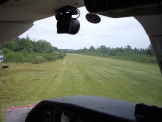
Brampton-Caledon Airport is a privately owned general aviation airport in Caledon, near Brampton, Ontario, Canada, northwest of Toronto.

Lake Simcoe Regional Airport, formerly the Oro Barrie Orillia Regional Airport, is a registered aerodrome that operates as a regional airport located near Highway 11 in the township of Oro-Medonte, Ontario, Canada. The airport is operated by Lake Simcoe Regional Airport Inc., a municipal service corporation jointly owned by the County of Simcoe (90%) and the City of Barrie (10%).

Deer Lake Airport is located 3 nautical miles north of Deer Lake, Ontario, Canada.

Porters Lake Airport is located 2 nautical miles south of the community of Porters Lake, Nova Scotia, Canada. This aerodrome is located on privately owned land with lake frontage on Porters Lake, where the Porters Lake Water Aerodrome is also located.

Bearskin Lake Airport,, is located 3 nautical miles northwest of Bearskin Lake, Ontario, Canada.

North Spirit Lake Airport,, is located 5 nautical miles southeast of the First Nations community of North Spirit Lake, Ontario, Canada.

Wunnumin Lake Airport is located 2 nautical miles south of the First Nations community of Wunnumin Lake First Nation, Ontario, Canada.

Anahim Lake Airport is located 1 nautical mile south of Anahim Lake, British Columbia, Canada. It is a year-round airport serving the West Chilcotin area, operated by Cariboo Regional District.

Fort Nelson/Gordon Field Airport is located near to Fort Nelson, British Columbia, Canada.

Cree Lake/Crystal LodgeAerodrome is located adjacent to Crystal Lodge, a fly-in fishing lodge on Cree Lake, Saskatchewan, Canada. The airport is located on Ispatinow Island, the largest island in the lake.

Quamichan Lake Airport is located 2.7 nautical miles north northeast of Duncan, adjacent to Quamichan Lake, British Columbia, Canada.

Avey Field State Airport is a public use airport located on the Canada–US border at Laurier, in Ferry County, Washington, United States. It is privately owned and operated.
Highway 995 is a provincial highway in the far north region of the Canadian province of Saskatchewan. It is one of the few highways in Saskatchewan that is completely isolated from the other highways. It is about 5 km (3 mi) long. Seasonal access is provided to Highway 905 by way of the Wollaston Lake Barge.


