Red Banks, Wisconsin | |
|---|---|
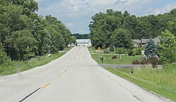 Looking east in Red Banks | |
 Red Banks  Red Banks | |
| Coordinates: 44°36′40″N87°51′47″W / 44.61111°N 87.86306°W | |
| Country | |
| State | |
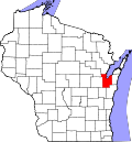
| County | Brown |
| Town | Scott |
| Elevation | 190 m (630 ft) |
| Time zone | UTC-6 (Central (CST)) |
| • Summer (DST) | UTC-5 (CDT) |
| Area code | 920 |
| GNIS feature ID | 1572129 [1] |

Red Banks is an unincorporated community located in the town of Scott, Brown County, Wisconsin, United States. [1]