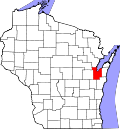
Wequiock, Wisconsin

Last updated
Wequiock, Wisconsin
USA Wisconsin location map.svg
Red pog.svg
Wequiock
Usa edcp location map.svg
Red pog.svg
Wequiock
Coordinates: 44°34′03″N87°52′52″W / 44.56750°N 87.88111°W / 44.56750; -87.88111
Country Flag of the United States.svg  United States
State Flag of Wisconsin.svg  Wisconsin
County Brown
Town Scott
Elevation
221 m (725 ft)
Time zone UTC-6 (Central (CST))
  Summer (DST) UTC-5 (CDT)
Area code 920
GNIS feature ID1576431 [1]

Wequiock is an unincorporated community located in the town of Scott, Brown County, Wisconsin, United States. [1]

Wequiock Falls, in a county park of the same name along Highway 57 Wequiock Falls Wisconsin (142732371).jpeg
Wequiock Falls, in a county park of the same name along Highway 57

Related Research Articles

<span class="mw-page-title-main">Brown County, Wisconsin</span> County in Wisconsin, United States

Brown County is a county in the U.S. state of Wisconsin. As of the 2020 census, the population was 268,740, making it the fourth-most populous county in Wisconsin. The county seat is Green Bay. Brown County is part of the Green Bay, WI Metropolitan Statistical Area.

<span class="mw-page-title-main">Scott, Brown County, Wisconsin</span> Town in Wisconsin, United States

Scott is a town in Brown County in the U.S. state of Wisconsin. As of the 2020 census, the population was 3,636.

<span class="mw-page-title-main">Sheboygan Falls, Wisconsin</span> City in United States, Town of Rochester

Sheboygan Falls is a city in Sheboygan County, Wisconsin, United States, along the Sheboygan River. The population was 8,210 at the 2020 census. It is part of the Sheboygan metropolitan area.

<span class="mw-page-title-main">Wisconsin Highway 29</span> Highway in Wisconsin

State Trunk Highway 29 is a state highway running east–west across central Wisconsin. It is a major east–west corridor connecting the Twin Cities and the Chippewa Valley with Wausau and Green Bay. A multi-year project to convert the corridor to a four-lane freeway or expressway from Elk Mound to Green Bay was completed in 2005. The remainder of WIS 29 is two-lane surface road or an urban multi-lane road.

<span class="mw-page-title-main">Interstate Park</span> United States historic place

Interstate Park comprises two adjacent state parks on the Minnesota–Wisconsin border, both named Interstate State Park. They straddle the Dalles of the St. Croix River, a deep basalt gorge with glacial potholes and other rock formations. The Wisconsin park is 1,330 acres (538 ha) and the Minnesota park is 298 acres (121 ha). The towns of Taylors Falls, Minnesota and St. Croix Falls, Wisconsin are adjacent to the park. Interstate Park is within the Saint Croix National Scenic Riverway and the Ice Age National Scientific Reserve. The western terminus of the Ice Age National Scenic Trail is on the Wisconsin side. On the Minnesota side, two areas contain National Park Service rustic style buildings and structures that are listed on the National Register of Historic Places.

<span class="mw-page-title-main">Tahquamenon Falls State Park</span> State park in Michigan, United States

The Tahquamenon Falls State Park is a 46,179-acre (186.88 km2) state park in the U.S. state of Michigan. It is the second largest of Michigan's state parks. Bordering on Lake Superior, most of the park is located within Whitefish Township in Chippewa County, with the western section of the park extending into McMillan Township in Luce County. The nearest town of any size is Paradise.

<span class="mw-page-title-main">Willow River State Park</span> State park in St. Croix County, Wisconsin

Willow River State Park is a 2,891-acre (1,170 ha) Wisconsin state park located five miles (8 km) north of Hudson. The centerpiece of the park is Willow Falls, a powerful cascade in a 200-foot (61 m) deep gorge. Another popular feature is Little Falls Lake, a shallow reservoir on the Willow River. Because of its proximity to Minneapolis-St. Paul it is one of the most visited state parks in Wisconsin. Trilobite fossils found in the lower layers of the gorge indicate the rock is around 600 million years old.

<span class="mw-page-title-main">Wisconsin Highway 57</span> State highway in Wisconsin, United States

Wisconsin Highway 57 is a 191.82-mile-long (308.70 km) state highway in Wisconsin, United States. It runs from its southern terminus at WIS 59 in Milwaukee to its northern terminus at WIS 42 in Sister Bay. Much of WIS 57 parallels Interstate 43 (I-43) and WIS 42, particularly from Saukville to its northern terminus in Sister Bay. The highway runs concurrently with I-43 for 12 miles (19 km) in Ozaukee County. Like most Wisconsin state highways, WIS 57 is maintained by the Wisconsin Department of Transportation (WisDOT).

<span class="mw-page-title-main">Wisconsin Highway 341</span> Former Highway in Wisconsin

State Trunk Highway 341, better known as Miller Park Way and currently Brewers Boulevard, refers to a former unsigned route designation of a segment of the oldest freeway in Milwaukee, Wisconsin, United States. It connects Interstate 94 (I-94) to WIS 59, with a single set of off-ramps to Canal Street and American Family Field's parking lots.

<span class="mw-page-title-main">Detroit Island</span> American island in Lake Michigan

Detroit Island is an island in Lake Michigan in the southern part of the town of Washington in Door County, Wisconsin, United States. The island has a land area of 2.578 km2, out of which 27.6% is open to the public. The northern end of the island borders the waters of Detroit Harbor.

<span class="mw-page-title-main">Whatcom Falls Park</span>

Whatcom Falls Park is a 241-acre (0.98 km2) park in Bellingham, Washington, United States. The falls are on Whatcom Creek, which leads from Lake Whatcom to Bellingham Bay. The park has four sets of waterfalls and several miles of well maintained walking trails.

<span class="mw-page-title-main">U.S. Route 12 in Wisconsin</span> Section of U.S. Highway in Wisconsin

U.S. Highway 12 in the U.S. state of Wisconsin runs east–west across the western to southeast portions of the state. It enters from Minnesota running concurrently with Interstate 94 (I-94) at Hudson, parallels the Interstate to Wisconsin Dells, and provides local access to cities such as Menomonie, Eau Claire, Black River Falls, Tomah, and Mauston. It then provides an alternative route for traffic between northwestern Wisconsin and Madison and is the anchor route for the Beltline Highway around Madison. Finally, it serves southeastern Wisconsin, connecting Madison with Fort Atkinson, Whitewater, Elkhorn, and Lake Geneva. The West Beltline Highway and the segment between Elkhorn and Genoa City are freeways, and the segment between Sauk City and Middleton is an expressway. The remainder of the road is a two-lane surface road or an urban multilane arterial. Between Hudson and west of Warrens, the road closely parallels the former main line of the Chicago, St. Paul, Minneapolis and Omaha Railway, now operated by Union Pacific Railroad.

<span class="mw-page-title-main">Falls Road station</span> Light Rail station in Towson, Maryland, US

Falls Road station is a Baltimore Light Rail station in the southwest corner of Towson, Maryland, located near the Mount Washington neighborhood of Baltimore and the Bare Hills Historic District in the Jones Falls Valley. It has two side platforms serving two tracks, one in each direction. A 0.3 mile boardwalk provides access from the parking lot to neighboring Lake Roland Park.

<span class="mw-page-title-main">Copper Falls State Park</span> State park in Ashland County, Wisconsin

Copper Falls State Park is a 3,068-acre (1,242 ha) state park in Wisconsin. The park contains a section of the Bad River and its tributary the Tylers Forks, which flow through a gorge and drop over several waterfalls. Old Copper Culture Indians and later European settlers mined copper in the area. The state park was created in 1929 and amenities were developed by the Civilian Conservation Corps and the Works Progress Administration. In 2005 the park was listed on the National Register of Historic Places as a site with 10 contributing properties.

<span class="mw-page-title-main">Rifle Falls State Park</span> State park in Garfield County, Colorado

Rifle Falls State Park is a Colorado State Park located in Garfield County northeast of Rifle, Colorado. The central feature of the 48-acre (0.19 km2) park is a triple 70-foot (21 m) waterfall flowing over a travertine dam on East Rifle Creek. Commonly seen wildlife includes mule deer, elk, coyote, and golden-mantled ground squirrel. Rainbow and brown trout can be caught in the creek. Limestone cliffs near the falls have a few small caves and three species of bats. Visitor facilities include campsites, picnic sites and 2.0 miles (3.2 km) of hiking trails.

The Masonic Hall in Wickenburg, Arizona, United States, was built around 1922. It served historically as a clubhouse.

<span class="mw-page-title-main">Goerke's Corners, Wisconsin</span> Former unincorporated community in Wisconsin, United States

Goerke's Corners is a former unincorporated community in the Town of Brookfield, in Waukesha County, Wisconsin, United States. It is now the location of a major highway intersection, and the site of a park-and-ride lot.

Meekers Grove is an unincorporated community located in the town of Elk Grove, Lafayette County, Wisconsin, United States. It consists of a grouping of 2 houses, a One-room school that caught fire and was demolished in 2000, and nearby farms.

<span class="mw-page-title-main">Gibraltar Rock State Natural Area</span>

Gibraltar Rock State Natural Area is a natural area in southern Wisconsin, United States, which is 68 acres (28 ha) in size, and is located along the 1,000-mile-long (1,600 km) Ice Age Trail.

Slob Historic District, near Christiansted, Virgin Islands, is a historic district which was listed on the National Register of Historic Places in 1987. The listing included nine contributing buildings, three contributing structures, and a contributing site on 9 acres (3.6 ha).

References

  1. 1 2 "Wequiock, Wisconsin". Geographic Names Information System . United States Geological Survey, United States Department of the Interior.
  2. Wequiock Falls, Brown County Parks Department