Scott, Brown County, Wisconsin

Last updated
Scott, Wisconsin
Wequiock Road (foreground) and Van Lieshout Road (background) in the town of Scott, Brown County, Wisconsin, July 29, 2005.jpg
Wequiock Road (foreground) and Van Lieshout Road (background) in the town of Scott
Brown County Wisconsin incorporated and unincorporated areas Scott highlighted.svg
Location in Brown County and the state of Wisconsin.
Coordinates: 44°34′55″N87°52′27″W / 44.58194°N 87.87417°W / 44.58194; -87.87417
Country Flag of the United States.svg  United States
State Flag of Wisconsin.svg  Wisconsin
County Brown
Area
  Total52.7 sq mi (136.5 km2)
  Land18.1 sq mi (47.0 km2)
  Water34.6 sq mi (89.5 km2)
Elevation
[1]
643 ft (196 m)
Population
 (2020)
  Total3,636
  Density195/sq mi (75.4/km2)
Time zone UTC-6 (Central (CST))
  Summer (DST) UTC-5 (CDT)
Area code 920
FIPS code 55-72200 [2]
GNIS feature ID1584113 [1]
Website www.townofscott.com

Scott is a town in Brown County in the U.S. state of Wisconsin. As of the 2020 census, the population was 3,636.

Contents

History

November, 1859 the Brown County Board of Supervisors voted to divide the Town of Green Bay into smaller townships, one of which was to become the present Town of Scott. Three names were proposed: Liberty, Pochequette, and Scott. This last name was a favorite of Robert Gibson (first town chairman), probably because it evoked memories of his homeland. Presumably it was in honor of Sir Walter Scott. [3]

Communities

Geography

Jean Nicolet statue near State Highway 57 in southeastern Scott. Statue of Jean Nicolet at Wequiock Falls County Park in Brown County, Wisconsin.jpg
Jean Nicolet statue near State Highway 57 in southeastern Scott.

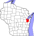
Scott is located in northeastern Brown County along the southeast shore of Green Bay, an arm of Lake Michigan. The city of Green Bay borders the town to the west and south. The town of Green Bay, a separate municipality, borders Scott to the east, and the town of Humboldt is to the south.

According to the United States Census Bureau, Scott has a total area of 52.7 square miles (136.5 km2), of which 18.1 square miles (47.0 km2) is land and 34.6 square miles (89.5 km2), or 65.58%, is water. [6]

The Hazen archeological site consists of remains left from a 19th-century farmstead located in the town. [7]

Demographics

Historical population
CensusPop.Note
2000 3,712
2010 3,545−4.5%
2020 3,6362.6%
U.S. Decennial Census [8]

As of the census [2] of 2000, there were 3,712 people, 1,145 households, and 906 families residing in the town. The population density was 188.5 people per square mile (72.8/km2). There were 1,234 housing units at an average density of 62.7 per square mile (24.2/km2). The racial makeup of the town was 96.12% White, 1.62% African American, 0.35% Native American, 0.65% Asian, 0.57% from other races, and 0.70% from two or more races. Hispanic or Latino of any race were 1.48% of the population.

There were 1,145 households, out of which 37.9% had children under the age of 18 living with them, 71.9% were married couples living together, 4.0% had a female householder with no husband present, and 20.8% were non-families. 14.7% of all households were made up of individuals, and 4.3% had someone living alone who was 65 years of age or older. The average household size was 2.73 and the average family size was 3.04.

In the town, the population was spread out, with 23.0% under the age of 18, 16.8% from 18 to 24, 30.7% from 25 to 44, 22.1% from 45 to 64, and 7.5% who were 65 years of age or older. The median age was 33 years. For every 100 females, there were 95.6 males. For every 100 females age 18 and over, there were 98.3 males.

The median income for a household in the town was $58,051, and the median income for a family was $62,138. Males had a median income of $41,996 versus $26,167 for females. The per capita income for the town was $21,992. About 0.6% of families and 2.0% of the population were below the poverty line, including 0.6% of those under age 18 and 0.6% of those age 65 or over.

Related Research Articles

<span class="mw-page-title-main">De Pere, Wisconsin</span> City in Wisconsin, United States

De Pere is a city in Brown County, Wisconsin, United States. The population was 25,410 at the 2020 census. De Pere is part of the Green Bay Metropolitan Statistical Area.

<span class="mw-page-title-main">Glenmore, Wisconsin</span> Town in Wisconsin, United States

Glenmore is a town in Brown County in the U.S. state of Wisconsin. The population was 1,135 at the 2010 census.

<span class="mw-page-title-main">Humboldt, Wisconsin</span> Town in Wisconsin, United States

Humboldt is a town in Brown County in the U.S. state of Wisconsin. The population was 1,311 at the 2010 census. The community name was chosen by Henry Fontaine.

<span class="mw-page-title-main">Ledgeview, Wisconsin</span> Town in Wisconsin, United States

Ledgeview is a town in Brown County in the U.S. state of Wisconsin. The population was 6,555 as of the 2010 census, up from 3,363 at the 2000 census.

<span class="mw-page-title-main">Morrison, Wisconsin</span> Town in Wisconsin, United States

Morrison is a town in Brown County in the U.S. state of Wisconsin. The population was 1,599 at the 2010 census.

<span class="mw-page-title-main">New Denmark, Wisconsin</span> Town in Wisconsin, United States

New Denmark is a town in Brown County in the U.S. state of Wisconsin. The population was 1,562 at the 2020 census. The town surrounds the village of Denmark but is separate from it. The unincorporated communities of Fontenoy and Langes Corners are located in the town. The unincorporated community of Buckman is also located partially in the town.

<span class="mw-page-title-main">Pittsfield, Wisconsin</span> Town in Wisconsin, United States

Pittsfield is a town in Brown County in the U.S. state of Wisconsin. The population was 2,608 at the 2010 census.

<span class="mw-page-title-main">Brussels, Wisconsin</span> Town in Wisconsin, United States

Brussels is a town in Door County, Wisconsin, United States. The population was 1,136 at the 2010 census. The unincorporated communities of Brussels and Kolberg are located in the town. The unincorporated community of Rosiere is also located partially in the town.

<span class="mw-page-title-main">Union, Door County, Wisconsin</span> Town in Wisconsin, United States

The Town of Union is located in Door County, Wisconsin, United States. The population was 880 at the 2000 census. The unincorporated communities of Shoemaker Point and Namur are located in the town.

<span class="mw-page-title-main">Calumet, Wisconsin</span> Town in Wisconsin, United States

Calumet is a town in Fond du Lac County, Wisconsin, United States. The population was 1,514 at the 2000 census. The unincorporated communities of Artesia Beach, Calumet Harbor, Garnet, Highland Park, Johnsburg, Laudolff Beach, Marytown, Pipe, Pukwana Beach, Winnebago Heights, and Winnebago Park are located within the town. The unincorporated community of Calumetville is located partially in the town.

<span class="mw-page-title-main">Franklin, Kewaunee County, Wisconsin</span> Town in Wisconsin, United States

Franklin is a town in Kewaunee County, Wisconsin, United States. The population was 993 at the 2010 census.

<span class="mw-page-title-main">Montpelier, Wisconsin</span> Town in Wisconsin, United States

Montpelier is a town in Kewaunee County, Wisconsin, United States. The population was 1,306 at the 2010 census.

<span class="mw-page-title-main">Red River, Wisconsin</span> Town in Wisconsin, United States

Red River is a town in Kewaunee County, Wisconsin, United States. The population was 1,393 at the 2010 census, down from 1,476 at the 2000 census. The unincorporated communities of Bay View, Duvall, Frog Station, Thiry Daems, and Tonet are located in the town. The census-designated place of Dyckesville is also located partially in the town.

<span class="mw-page-title-main">Franklin, Manitowoc County, Wisconsin</span> Town in Wisconsin, United States

Franklin is a town in Manitowoc County, Wisconsin, United States. The population was 1,293 at the 2000 census.

<span class="mw-page-title-main">Newton, Manitowoc County, Wisconsin</span> Town in Wisconsin, United States

Newton is a town in Manitowoc County, Wisconsin, United States. The population was 2,241 at the 2000 census.

<span class="mw-page-title-main">Freedom, Outagamie County, Wisconsin</span> Town in Wisconsin, United States

Freedom is a town in Outagamie County, Wisconsin, United States. The population was 6,200 at the 2020 census. The unincorporated communities of Freedom and Murphy Corner are located in the town and the unincorporated community of Five Corners is located partially within the town.

<span class="mw-page-title-main">Grand Chute, Wisconsin</span> Town in Wisconsin, United States

Grand Chute is a town in Outagamie County, Wisconsin, United States. The population was 23,831 at the 2020 census. The unincorporated community of Apple Creek is partially located in the town. It was the birthplace of U.S. Senator Joseph McCarthy.

<span class="mw-page-title-main">Green Bay (town), Wisconsin</span> Human settlement in Wisconsin, United States of America

Green Bay is a town in Brown County in the U.S. state of Wisconsin. The population was 2,035 at the 2010 census. The town is located several miles northeast of the city of Green Bay. The unincorporated community of Champion is located in the town, and the unincorporated communities of Dyckesville and New Franken are located partially in the town.

<span class="mw-page-title-main">Wrightstown (town), Wisconsin</span> Town in Brown County, Wisconsin

Wrightstown is a town in Brown County in the U.S. state of Wisconsin. The population was 2,221 at the 2010 census. The Village of Wrightstown is mostly surrounded by the town but is separate from it. The unincorporated community of Greenleaf is located in the town. The unincorporated community of Sniderville is also located partially with the town.

Hazel Green is a town in Grant County, Wisconsin, United States. The population was 1,043 at the 2000 census. The Village of Hazel Green is located partially within the town. The unincorporated community of Prairie Corners is located in the town. The unincorporated community of Sinsinawa, Wisconsin, is also located partially in the town.

References

  1. 1 2 "US Board on Geographic Names". United States Geological Survey. 2007-10-25. Retrieved 2008-01-31.
  2. 1 2 "U.S. Census website". United States Census Bureau . Retrieved 2008-01-31.
  3. "A Glimpse Into the Past: A History of The Town of Scott" by Pauline Lafrombois (1976) pg 44
  4. Jean Nicolet at Red Banks, Wisconsin
  5. Wequiock Falls, Brown County Parks Department
  6. "Geographic Identifiers: 2010 Demographic Profile Data (G001): Scott town, Brown County, Wisconsin". U.S. Census Bureau, American Factfinder. Archived from the original on February 12, 2020. Retrieved May 13, 2014.
  7. Final Report of Archeological Investigations at the State Highway 57/54 Interchange Improvement Project Brown County, Wisconsin, by Gathel M. Weston, Elizabeth D. Benchley, and Carrie A. Koster, Report Prepared for the Wisconsin Department of Transportation Project I.D. 1480-04-01 SHSW #94-5030, University of Wisconsin–Milwaukee Archeological Research Laboratory Report of Investigations, No. 127, February 1996, page 37 (pdf page 42)
  8. "Census of Population and Housing". Census.gov. Retrieved January 1, 2023.