Shirley, Wisconsin

Last updated

Shirley, Wisconsin
ShirleyWisconsinSign.jpg
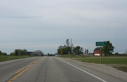
Looking north at Shirley
USA Wisconsin location map.svg
Red pog.svg
Shirley
Usa edcp location map.svg
Red pog.svg
Shirley
Coordinates: 44°21′25″N87°56′51″W / 44.35694°N 87.94750°W / 44.35694; -87.94750
Country Flag of the United States.svg  United States
State Flag of Wisconsin.svg  Wisconsin
County Brown
Town Glenmore
Elevation
287 m (942 ft)
Time zone UTC-6 (Central (CST))
  Summer (DST) UTC-5 (CDT)
Area code 920
GNIS feature ID1574057 [1]

Shirley is an unincorporated community in the town of Glenmore, Brown County, Wisconsin, United States. [1] It is located on Wisconsin Highway 96. [2]

Contents

History

The community was supposedly named after a paint brand sold at Zellner's General Store in Shirley. [3]

Economy

Shirley Wind, a wind farm, is located in the community. [4]

Notes

  1. 1 2 "Shirley". Geographic Names Information System . United States Geological Survey, United States Department of the Interior.
  2. Hometown Locator
  3. David Koenig. The Story of Glenmore [usurped] .
  4. Brown County Board hears from both sides on Shirley Wind Farm