Reliance, South Dakota

Last updated

Reliance, South Dakota
Reliance SD from I90.jpg
Panorama of Reliance
Lyman County South Dakota Incorporated and Unincorporated areas Reliance Highlighted.svg
Location in Lyman County and the state of South Dakota
Coordinates: 43°52′47″N99°36′06″W / 43.87972°N 99.60167°W / 43.87972; -99.60167
Country United States
State South Dakota
County Lyman
Incorporated1905 [1]
Area
[2]
  Total1.14 sq mi (2.96 km2)
  Land1.09 sq mi (2.81 km2)
  Water0.06 sq mi (0.14 km2)
Elevation
[3]
1,778 ft (542 m)
Population
 (2020) [4]
  Total128
  Density117.86/sq mi (45.52/km2)
Time zone UTC-6 (Central (CST))
  Summer (DST) UTC-5 (CDT)
ZIP code
57569
Area code 605
FIPS code 46-54020 [5]
GNIS feature ID1267549 [3]

Reliance is a town in Lyman County, South Dakota, United States. The population was 128 at the 2020 census. [6]

Contents

Reliance was laid out in 1905. [7]

Geography

According to the United States Census Bureau, the town has a total area of 1.15 square miles (2.98 km2), of which 1.09 square miles (2.82 km2) is land and 0.06 square miles (0.16 km2) is water. [8]

Medicine Butte is near Reliance. It rises about 200 feet above the prairie, and is sacred to the Brulé Sioux people, especially those who live on the nearby Lower Brule Indian Reservation. [9] [10]

Demographics

Historical population
CensusPop.Note
1910 192
1920 31765.1%
1930 287−9.5%
1940 219−23.7%
1950 215−1.8%
1960 201−6.5%
1970 2041.5%
1980 190−6.9%
1990 169−11.1%
2000 20621.9%
2010 191−7.3%
2020 128−33.0%
U.S. Decennial Census [11] [4]

2010 census

As of the census [12] of 2010, there were 191 people, 73 households, and 52 families residing in the town. The population density was 175.2 inhabitants per square mile (67.6/km2). There were 85 housing units at an average density of 78.0 per square mile (30.1/km2). The racial makeup of the town was 77.0% White, 0.5% African American, 17.8% Native American, 0.5% from other races, and 4.2% from two or more races. Hispanic or Latino of any race were 1.6% of the population.

There were 73 households, of which 34.2% had children under the age of 18 living with them, 58.9% were married couples living together, 6.8% had a female householder with no husband present, 5.5% had a male householder with no wife present, and 28.8% were non-families. 26.0% of all households were made up of individuals, and 12.3% had someone living alone who was 65 years of age or older. The average household size was 2.62 and the average family size was 2.96.

The median age in the town was 40.1 years. 30.9% of residents were under the age of 18; 3.1% were between the ages of 18 and 24; 22.5% were from 25 to 44; 26.2% were from 45 to 64; and 17.3% were 65 years of age or older. The gender makeup of the town was 48.2% male and 51.8% female.

2000 census

As of the census [5] of 2000, there were 206 people, 84 households, and 54 families residing in the town. The population density was 189.4 inhabitants per square mile (73.1/km2). There were 92 housing units at an average density of 84.6 per square mile (32.7/km2). The racial makeup of the town was 90.29% White, 5.34% Native American, and 4.37% from two or more races.

There were 84 households, out of which 35.7% had children under the age of 18 living with them, 47.6% were married couples living together, 10.7% had a female householder with no husband present, and 35.7% were non-families. 32.1% of all households were made up of individuals, and 11.9% had someone living alone who was 65 years of age or older. The average household size was 2.45 and the average family size was 3.11.

In the town, the population was spread out, with 28.6% under the age of 18, 9.2% from 18 to 24, 25.2% from 25 to 44, 25.2% from 45 to 64, and 11.7% who were 65 years of age or older. The median age was 37 years. For every 100 females, there were 100.0 males. For every 100 females age 18 and over, there were 101.4 males.

The median income for a household in the town was $30,833, and the median income for a family was $35,417. Males had a median income of $22,361 versus $21,875 for females. The per capita income for the town was $14,141. About 4.1% of families and 11.2% of the population were below the poverty line, including 9.2% of those under the age of eighteen and 24.0% of those 65 or over.

Related Research Articles

<span class="mw-page-title-main">Yale, South Dakota</span> Town in South Dakota, United States

Yale is an incorporated town in Beadle County, South Dakota, United States. The population was 112 at the 2020 census.

<span class="mw-page-title-main">Tabor, South Dakota</span> Town in South Dakota, United States

Tabor is a town in Bon Homme County, South Dakota, United States. The population was 407 at the 2020 census.

<span class="mw-page-title-main">Claremont, South Dakota</span> Town in South Dakota, United States

Claremont is a town in Brown County, South Dakota, United States. The population was 108 at the 2020 census.

<span class="mw-page-title-main">Stratford, South Dakota</span> Town in South Dakota, United States

Stratford is a town in southern Brown County, South Dakota, United States. The population was 57 at the 2020 census.

<span class="mw-page-title-main">Westport, South Dakota</span> Town in South Dakota, United States

Westport is a town in western Brown County, South Dakota, United States. The population was 88 at the 2020 census.

<span class="mw-page-title-main">Wagner, South Dakota</span> City in South Dakota, United States

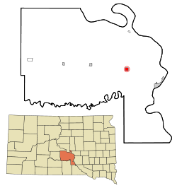
Wagner is a city in Charles Mix County, South Dakota, United States. The population was 1,490 at the 2020 census. The city is served by Wagner Municipal Airport as well as YST Transit buses.

<span class="mw-page-title-main">Bradley, South Dakota</span> Town in South Dakota, United States

Bradley is a town in Clark County, South Dakota, United States. The population was 65 at the 2020 census.

<span class="mw-page-title-main">Hermosa, South Dakota</span> Town in South Dakota, United States

Hermosa is a town near the northern edge of Custer County, South Dakota, United States. The population was 382 at the 2020 census.

<span class="mw-page-title-main">Andover, South Dakota</span> Town in South Dakota, United States

Andover is a town in northwestern Day County, South Dakota, United States. The population was 66 at the 2020 census.

<span class="mw-page-title-main">Pierpont, South Dakota</span> Town in South Dakota, United States

Pierpont is a town in northwestern Day County, South Dakota, United States. The population was 129 at the 2020 census.

<span class="mw-page-title-main">Onaka, South Dakota</span> Town in South Dakota, United States

Onaka is a town in Faulk County, South Dakota, United States. The population was 13 at the 2020 census.

<span class="mw-page-title-main">Orient, South Dakota</span> Town in South Dakota, United States

Orient is a town in Faulk County, South Dakota, United States. The population was 51 at the 2020 census.

<span class="mw-page-title-main">Revillo, South Dakota</span> Town in South Dakota, United States

Revillo is a town in southeastern Grant County, South Dakota, United States. The population was 99 at the 2020 census.

<span class="mw-page-title-main">Stockholm, South Dakota</span> Town in South Dakota, United States

Stockholm is a town in Grant County, South Dakota, United States. The population was 102 at the 2020 census.

<span class="mw-page-title-main">Belvidere, South Dakota</span> Town in South Dakota, United States

Belvidere is a town in Jackson County, South Dakota, United States. The population was 46 at the 2020 census.

<span class="mw-page-title-main">Wetonka, South Dakota</span> Town in South Dakota, United States

Wetonka is a town in McPherson County, South Dakota, United States. The population was 16 at the 2020 census.

<span class="mw-page-title-main">Corona, South Dakota</span> Town in South Dakota, United States

Corona is a town in Roberts County, South Dakota, United States. The population was 69 at the 2020 census.

<span class="mw-page-title-main">New Effington, South Dakota</span> Town in South Dakota, United States

New Effington is a town in Roberts County, South Dakota, United States. The population was 234 at the 2020 census.

<span class="mw-page-title-main">Rosholt, South Dakota</span> Town in South Dakota, United States

Rosholt is a town in Roberts County, South Dakota, United States. The population was 379 at the 2020 census.

<span class="mw-page-title-main">Tulare, South Dakota</span> Town in South Dakota, United States

Tulare is a town in Spink County, South Dakota, United States. The population was 211 at the 2020 census.

References

  1. "SD Towns" (PDF). South Dakota State Historical Society . Retrieved February 15, 2010.
  2. "ArcGIS REST Services Directory". United States Census Bureau. Retrieved October 15, 2022.
  3. 1 2 U.S. Geological Survey Geographic Names Information System: Reliance, South Dakota
  4. 1 2 "Census Population API". United States Census Bureau. Retrieved October 15, 2022.
  5. 1 2 "U.S. Census website". United States Census Bureau . Retrieved January 31, 2008.
  6. "U.S. Census Bureau: Reliance town, South Dakota". www.census.gov. United States Census Bureau. Retrieved December 28, 2021.
  7. Federal Writers' Project (1940). South Dakota place-names, v.1-3. University of South Dakota. p. 58.
  8. "US Gazetteer files 2010". United States Census Bureau. Archived from the original on February 20, 2011. Retrieved June 21, 2012.
  9. Tupper, Seth (February 24, 2010). "Tribe to KELO: find new tower site". Rapid City Journal via Mitchell Daily Republic . Retrieved December 12, 2014.
  10. Jorgensen, Dan (October 30, 2013). "Moving KPLO tower: the right thing to do". KELO-TV . Retrieved December 12, 2014.
  11. "Census of Population and Housing". Census.gov. Retrieved June 4, 2015.
  12. "U.S. Census website". United States Census Bureau . Retrieved June 21, 2012.