An editor has nominated this article for deletion. You are welcome to participate in the deletion discussion , which will decide whether or not to retain it. |
During 2024, tornadoes and tornado outbreaks were extensively researched by meteorologists and engineers across the world. Some research and publications included: the effects of "Tornado Brain", the detection of tornadic infrasound, several mobile radar observations of tornadoes, including the measurement of tornadic winds over 300 mph (480 km/h), the idea of tornado alley shifting eastward, and many other things.
In January 2024, researchers with Colorado State University’s Department of Atmospheric Science, published an analysis and database of 74 tornadoes which occurred in South America. According to the researchers, this was the first time tornadic environments was studied across South America. [1]
In February 2024, researchers with the University of Tennessee and University of Missouri published an academic study about how survivors from the 2011 Joplin tornado recover from "Tornado Brain", a new term for the PTSD of tornado survivors. [2]
During the same month, researchers with Auburn University (AU), Florida International University (FIU), Pennsylvania State University (Penn State), Louisiana State University (LSU), University of South Alabama, University of Illinois Urbana-Champaign (UIUC), University of Kentucky, and CoreLogic, published an academic case study on how hurricane-resistant houses performed during the 2022 Arabi–New Orleans EF3 tornado. [3] Researchers with the Tornado and Storm Research Organisation (TORRO), Met Office, and Jersey Met, also published a case study on the storm which produced an intense tornado and a hailstorm on the island nation of Jersey in November 2023. [4]
On February 8, meteorologist and storm chaser Reed Timmer, along with Mark Simpson, Sean Schofer, Curtis Brooks, published a paper about the design of and information about a new meteorological rocket probe which can be launched into tornadoes. The researchers launched one of these rocket probes into the 2019 Lawrence–Linwood EF4 tornado. The probe recorded winds of 85.1 m/s (190 mph; 306 km/h) during its first rotation around the tornado and also recorded a pressure drop of 113.5 hPa (113.5 mb) inside the tornado. The probe also recorded that the tornado's updraft was 65.0 m/s (145 mph; 234 km/h). The tornado threw the probe 32 mi (51 km), where the researchers were able to recover it. [5] [6]
In March 2024, Anthony W. Lyza, Matthew D. Flournoy, and A. Addison Alford, researchers with the National Severe Storms Laboratory, Storm Prediction Center, CIWRO, and the University of Oklahoma's School of Meteorology, published a paper where they stated, ">20% of supercell tornadoes may be capable of producing EF4–EF5 damage" and that "the legacy F-scale wind speed ranges may ultimately provide a better estimate of peak tornado wind speeds at 10–15 m AGL for strong–violent tornadoes and a better damage-based intensity rating for all tornadoes". In their conclusion, the researchers also posed the question: "Does a 0–5 ranking scale make sense given the current state of understanding of the low-level tornado wind profile and engineering of structures?" [7]
In April 2024, the European Severe Storms Laboratory and the Czech Hydrometeorological Institute, along with seven other European organizations, published a detailed damage survey and analysis on the 2021 South Moravia tornado using the International Fujita scale. [8] Also in April, Timothy A. Coleman, with the University of Alabama in Huntsville (UAH), Richard L. Thompson with the NOAA Storm Prediction Center, and Dr. Gregory S. Forbes, a retired meteorologist from The Weather Channel published an article to the Journal of Applied Meteorology and Climatology stating, "it is apparent that the perceived shift in tornado activity from the traditional tornado alley in the Great Plains to the eastern U.S. is indeed real". [9] [10] On April 26, a Doppler on Wheels (DOW) mobile radar truck measured 1-second wind speeds of approximately 224 mph (360 km/h) at a height of ~282 yards (258 m) as a tornado passed near Harlan, Iowa, causing widespread destruction. [11] [12] On April 30, strong tornado near Hollister, Oklahoma passed close to a NEXRAD radar. The radar measured a tornado vortex signature with a gate-to-gate of 260 miles per hour (420 km/h) about 600 feet (200 yd; 180 m) above the surface. [13] [14]
In mid-April, the National Severe Storms Laboratory along with Texas Tech University begin the Low-Level Internal Flows in Tornadoes (LIFT) Project, with the goal to collect data from the “damage layer” of tornadoes; from ground level to 20 m (22 yd) above the surface. The LIFT project deployed 11 times between April-June, gathering data from “numerous successful intercepts”. [15]
On April 30, the 118th United States House of Representatives passed the Weather Research and Forecasting Innovation Reauthorization Act of 2023, also known as the Weather Act Reauthorization Act of 2023, sending it to the United States Senate. The bill is set to provide authority for the Verification of the Origins of Rotation in Tornadoes Experiment (VORTEX-USA) by the National Oceanic and Atmospheric Administration. [16]
In May 2024, researchers with the University of Western Ontario's Northern Tornado Project and engineering department conducted a case study on the 2018 Alonsa EF4 tornado, the 2020 Scarth EF3 tornado, and the 2023 Didsbury EF4 tornado. In their case study, the researchers assessed extreme damage caused by the tornado which is ineligible for ratings on the Canadian Enhanced Fujita scale or the American Enhanced Fujita scale (EF-scale). In their analysis, it was determined all three tornadoes caused damage well-beyond their assigned EF-scale ratings, with all three tornadoes having EF5-intensity winds; Alonsa with 127 metres per second (280 mph; 460 km/h), Scarth with 110–119 metres per second (250–270 mph; 400–430 km/h), and Didsbury with 119 metres per second (270 mph; 430 km/h). At the end of the analysis, the researchers stated, "the lofting wind speeds given by this model are much higher than the rating based on the ground survey EF-scale assessment. This may be due to the current tendency to bias strong EF5 tornadoes lower than reality, or limitations in conventional EF-scale assessments". [17] Also during May, Timothy J. Dolney with Pennsylvania State University, published a new analysis of the 1985 United States–Canada tornado outbreak, specifically focusing on the state of Pennsylvania and Tornado Watch #211 issued by the National Weather Service for the tornado outbreak. [18]
Also in May, Doctor Bin Liang with the University of Mississippi published a paper on the results of a field research project on tornadoes. During the project, Liang was able to determine “that tornadoes emit dominant low-frequency infrasound between 0.5−1.2 Hertz”, after examining tornadic and non-tornadic supercells. [19]
On May 23, a Doppler on Wheels observed and recorded data of a large and long-lived EF2 tornado near Duke, Oklahoma. [20]
On May 21, a violent EF4 tornado struck the town of Greenfield, Iowa. As the tornado moved through the town, a Doppler on Wheels measured winds of at least >250 mph (400 km/h), "possibly as high as 290 mph (470 km/h)" at 48 yards (44 m) above the surface. [21] Pieter Groenemeijer, the director of the European Severe Storms Laboratory, noted that "on the IF-scale, 250 mph measured below 60 m above ground level is IF4 on the IF-scale, 290 mph is IF5." [22] The peak wind speed estimate was revised to between 309 mph (497 km/h) and 318 mph (512 km/h), a figure "among the highest wind speeds ever determined using DOW data", on June 22, 2024. [23]
A few weeks after the tornado, the National Oceanic and Atmospheric Administration released details about an experimental warning system which was tested before and during the tornado. This new warning system, named Warn-on-Forecast System (WoFS), was created by the Hazardous Weather Testbed housed in the National Weather Center in Norman, Oklahoma. During the experiment and test, the WoFS gave a high indication of “near-ground rotation” in and around the area of Greenfield, Iowa between 2-4 p.m. According to the press release, 75-minutes later, the violent EF4 tornado touched down. Scientists with the National Severe Storms Laboratory were able to give local National Weather Service forecasters a 75-minute lead time for the tornado. [24]
In June 2024, the first part of research from the PERiLS Project was published through the American Meteorological Society. [25] Also in June, researchers with the University of Miami’s CIMAS’s, the Atlantic Oceanographic and Meteorological Laboratory, the University of California, the Jet Propulsion Laboratory, and Mississippi State University published a paper regarding how a prolonged and unusual Pacific–North American pattern contributed to the formation of the tornado outbreak of December 10–11, 2021 and the infamous Quad-State Supercell. [26] Researchers with the University of Illinois also published a paper on various regional and seasonal trends of tornadoes across the United States. [27]
On June 3, a rare and intense EF3 tornado struck the town of oThongathi (Tongaat), in South Africa. The South African Weather Service conducted a nine-day case study on the tornado. [28]
In July 2024, scientists and historians from the University of Maryland, College Park, Storm Prediction Center, National Weather Service Norman, Oklahoma, Stanford University, and the University of Oklahoma's School of Meteorology, Center for Analysis and Prediction of Storms, and Advanced Radar Research Center, published information on a new database, called Tornado Archive, which contains information on more than 100,000 tornadoes. [29] Also in July, Jennifer M. First with the University of Missouri, published a paper examining the aftermath of the 2020 Nashville tornado, focusing on the mental health issues of survivors and the gender-based recovery difference. [30]
Later in the month, Engineers with Pennsylvania State University published a paper in the Journal of Structural Engineering to document how historic buildings in downtown Mayfield, Kentucky survived the 2021 Western Kentucky tornado, which caused EF4 damage throughout the city. [31]
On July 11, Independent United States Senator Kyrsten Sinema, along with other Democratic and Republican Senators, introduced the Border Weather Resiliency Act of 2024 to the United States Senate. [32] On July 22, United States Congressman Randy Feenstra along with three other congressman introduced a bill (H.R.9081) to the United States House of Representatives to provide tax relief to people affected by severe storms, flooding, and tornadoes. [33]
On July 19, the hit disaster-film Twisters released, which included accurate scientific theories on ways to potentially disrupt tornadoes. [34]
On July 30, Andrew Mercer, Kenneth Swan, and Adonte Knight with Mississippi State University published the first quantitative definition for how to define a tornado outbreak. The researchers also analyzed intensity and frequency trends of tornado outbreaks between 1960 and 2021. In their analysis, it was determined that between 1960-2021, the United States experienced 6,723 individual tornado outbreaks and that there is also a downward trend of 0.25 tornado outbreaks per year. [35]
In August 2024, Jordan Tweedie with the University of Oklahoma, published a paper on how the lower atmospheric boundary layer affected the supercell which produced the violent 2023 Rolling Fork–Silver City EF4 tornado. Tweedie stated the data collection for the research came from the PERiLS Project. [36] Later in the month, researchers with Central Michigan University, the University of Nebraska–Lincoln, the National Weather Service and the Polish Adam Mickiewicz University published an investigation into "230 significant tornadoes, 246 significant hail events, and 191 null cases across the United States" and how cell mergers, boundaries, other supercells, along with other meteorological phenomenon interact and what impacts do they have on tornadoes and significant hail. [37] On August 27, Sarah L. Horton with the Tornado and Storm Research Organisation published a case study on tornadoes which occurred during Storm Ciarán in 2023. [38] On August 30, meteorologist Trey Greenwood published a meteorological analysis on the 2024 Hollister, Oklahoma tornado. [39] Researchers with the University of Alabama also published a paper on how tornadoes devastated the tsuga canadensis, commonly known as eastern hemlock, in part of Alabama. [40]
On August 14, researchers with the Pressure Acoustics Research Inside Tornadoes EXperiment (PACRITEX) published research on some of the first pressure measurements and video observations inside three EF2 tornadoes taken by in-situ tornado probes. [41] [42]
In September 2024, researchers published a study with the American Meteorological Society regarding the various environmental conditions associated with long-track tornadoes (defined as a path length of at least 30 mi (48 km)), including, but not only, the 2021 Tri-State EF4 tornado, the 2021 Western Kentucky EF4 tornado, the 2021 Kenton–Dresden, Tennessee/Pembroke, Kentucky EF3 tornado, and the Barneveld–Black Earth F5 tornado. [43]
Later in the month, researchers with the ERATOSTHENES Centre of Excellence, the Cyprus University of Technology, the Harz University of Applied Studies, the Leibniz-Institut für Troposphärenforschung , and the Cyprus Department of Meteorology, published a case study on the 2024 Cyprus IF1.5 tornado on February 14, 2024. In their study, the researchers published about how the Atmospheric Remote Sensing Observatory (CARO), located 10 km (6.2 mi) away from the tornado in the city of Limassol, recorded a vertical wind speed of 10 m/s (22 mph) as well as an instantaneous rate of rain from the storm of 90 millimetres per hour (3.5 in/h). [44]
Official rating | Date | Location | Minimum peak wind speed | Maximum peak wind speed | Highest confirmed peak wind speed |
---|---|---|---|---|---|
EF3 | April 26, 2024 | Harlan, Iowa | — | — | 224 mph (360 km/h) |
A Doppler on Wheels recorded a wind gust of ~79 m/s (180 mph) about 258 m (846 ft) above the radar level. Peak ground level wind speed was estimated around 224 mph (360 km/h). [45] [46] [47] | |||||
EF2 | April 27, 2024 | Dexter, Kansas | — | — | — |
A Doppler on Wheels observed an EF2 tornado near Dexter, Kansas. [48] | |||||
EF1 | April 27, 2024 | Dexter, Kansas | — | — | — |
A Doppler on Wheels observed an EF1 tornado near Dexter, Kansas. [48] | |||||
EF2 | May 19, 2024 | Custer City, Oklahoma | — | — | 197 mph (317 km/h) |
A Ka-band mobile radar unit from Texas Tech University recorded a 0-second gust of 87.9 m/s. [49] | |||||
EF4 | May 21, 2024 | Greenfield, Iowa | 309 mph (497 km/h) | 318 mph (512 km/h) | ≥309 mph (497 km/h) |
A Doppler on Wheels recorded winds of 263–271 mph (423–436 km/h) approximately 30–50 m (98–164 ft) above the radar level. Following calculations to more accurately determine peak wind speeds, it was published that ground-relative winds of 309–318 mph (497–512 km/h) could be observed briefly to the immediate east of the main circulation. [50] | |||||
EF2 | May 22, 2024 | Temple, Texas | — | — | — |
A Doppler on Wheels observed an EF2 tornado near Temple, Texas. [51] | |||||
EF2 | May 23, 2024 | Duke, Oklahoma & Olustee, Oklahoma | — | — | 180 mph (290 km/h) |
Two Doppler on Wheels scanned a large and long-lived EF2 tornado near Duke, Oklahoma. [52] [53] [54] [55] A mobile radar from Texas Tech University recorded winds of 180 mph (290 km/h) less than 20 m (22 yd) above the surface. [56] | |||||
EFU | May 25, 2024 | Windthorst, Texas | — | — | — |
The University of Oklahoma’s RaXPol observed and documented a tornado near Windthorst, Texas. [57] [58] |
A tornado is a violently rotating column of air that is in contact with both the surface of the Earth and a cumulonimbus cloud or, in rare cases, the base of a cumulus cloud. It is often referred to as a twister, whirlwind or cyclone, although the word cyclone is used in meteorology to name a weather system with a low-pressure area in the center around which, from an observer looking down toward the surface of the Earth, winds blow counterclockwise in the Northern Hemisphere and clockwise in the Southern. Tornadoes come in many shapes and sizes, and they are often visible in the form of a condensation funnel originating from the base of a cumulonimbus cloud, with a cloud of rotating debris and dust beneath it. Most tornadoes have wind speeds less than 180 kilometers per hour, are about 80 meters across, and travel several kilometers before dissipating. The most extreme tornadoes can attain wind speeds of more than 480 kilometers per hour (300 mph), are more than 3 kilometers (2 mi) in diameter, and stay on the ground for more than 100 km (62 mi).
In meteorology, wind speed, or wind flow speed, is a fundamental atmospheric quantity caused by air moving from high to low pressure, usually due to changes in temperature. Wind speed is now commonly measured with an anemometer.
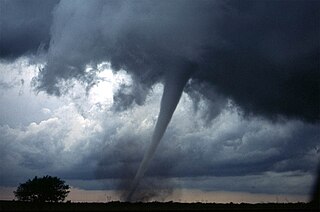
From May 2 to 8, 1999, a large tornado outbreak took place across much of the Central and parts of the Eastern United States, as well as southern Canada. During this week-long event, 152 tornadoes touched down in these areas. The most dramatic events unfolded during the afternoon of May 3 through the early morning hours of May 4 when more than half of these storms occurred. Oklahoma experienced its largest tornado outbreak on record, with 70 confirmed. The most notable of these was the F5 Bridge Creek–Moore tornado which devastated Oklahoma City and suburban communities. The tornado killed 36 people and injured 583 others; losses amounted to $1 billion, making it the first billion-dollar tornado in history. Overall, 50 people lost their lives during the outbreak and damage amounted to $1.4 billion. For these reasons, the outbreak is known in Oklahoma as the May 3rd outbreak or the Oklahoma tornado outbreak of 1999.
This article lists various tornado records. The most "extreme" tornado in recorded history was the Tri-State tornado, which spread through parts of Missouri, Illinois, and Indiana on March 18, 1925. It is considered an F5 on the Fujita Scale, holds records for longest path length at 219 miles (352 km) and longest duration at about 3+1⁄2 hours, and held the fastest forward speed for a significant tornado at 73 mph (117 km/h) anywhere on Earth until 2021. In addition, it is the deadliest single tornado in United States history with 695 fatalities. It was also the second costliest tornado in history at the time, and when costs are normalized for wealth and inflation, it still ranks third today.
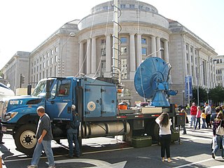
Doppler on Wheels is a fleet of X-band and C-band mobile and quickly-deployable truck-borne radars which are the core instrumentation of the Flexible Array of Radars and Mesonets affiliated with the University of Alabama Huntsville and led by Joshua Wurman, with the funding partially provided by the National Science Foundation (NSF), as part of the "Community Instruments and Facilities," (CIF) program. The DOW fleet and its associated Mobile Mesonets and deployable weather stations have been used throughout the United States since 1995, as well as occasionally in Europe and Southern America. The Doppler on Wheels network has deployed itself through hazardous and challenging weather to gather data and information that may be missed by conventional stationary radar systems.
Tornadoes are more common in the United States than in any other country or state. The United States receives more than 1,200 tornadoes annually—four times the amount seen in Europe. Violent tornadoes—those rated EF4 or EF5 on the Enhanced Fujita Scale—occur more often in the United States than in any other country.
The Verification of the Origins of Rotation in Tornadoes Experiment are field experiments that study tornadoes. VORTEX1 was the first time scientists completely researched the entire evolution of a tornado with an array of instrumentation, enabling a greater understanding of the processes involved with tornadogenesis. A violent tornado near Union City, Oklahoma was documented in its entirety by chasers of the Tornado Intercept Project (TIP) in 1973. Their visual observations led to advancement in understanding of tornado structure and life cycles.
The 1999 Bridge Creek–Moore tornado was a large, long-lived and exceptionally powerful F5 tornado in which the highest wind speeds ever measured globally was recorded at 321 miles per hour (517 km/h) by a Doppler on Wheels (DOW) radar. Considered the strongest tornado ever recorded to have affected the metropolitan area, the tornado devastated southern portions of Oklahoma City, Oklahoma, United States while near peak intensity, along with surrounding suburbs and towns to the south and southwest of the city during the early evening of Monday, May 3, 1999. Parts of Bridge Creek were rendered unrecognizable. The tornado covered 38 miles (61 km) during its 85-minute existence, destroying thousands of homes, killing 36 people, and leaving US$1 billion in damage, ranking it as the fifth-costliest on record not accounting for inflation. Its severity prompted the first-ever use of the tornado emergency statement by the National Weather Service.
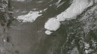
A prolonged and widespread tornado outbreak affected a large portion of the United States in late-May 2013 and early-June 2013. The outbreak was the result of a slow-moving but powerful storm system that produced several strong tornadoes across the Great Plains states, especially in Kansas and Oklahoma. Other strong tornadoes caused severe damage in Nebraska, Missouri, Illinois, and Michigan. The outbreak extended as far east as Upstate New York. 27 fatalities were reported in total, with nine resulting from tornadoes.
The 2013 El Reno tornado was an extremely large, powerful, and erratic tornado that occurred over rural areas of Central Oklahoma during the early evening of Friday, May 31, 2013. This rain-wrapped, multiple-vortex tornado was the widest tornado ever recorded and was part of a larger weather system that produced dozens of tornadoes over the preceding days. The tornado initially touched down at 6:03 p.m. Central Daylight Time (2303 UTC) about 8.3 miles (13.4 km) west-southwest of El Reno, rapidly growing in size and becoming more violent as it tracked through central portions of Canadian County. Remaining over mostly open terrain, the tornado did not impact many structures; however, measurements from mobile weather radars revealed extreme winds in excess of 313 mph (504 km/h) within the vortex. These are among the highest observed wind speeds on Earth, just slightly lower than the wind speeds of the 1999 Bridge Creek–Moore tornado. As it crossed U.S. 81, it had grown to a record-breaking width of 2.6 miles (4.2 km), beating the previous width record set in 2004. Turning northeastward, the tornado soon weakened. Upon crossing Interstate 40, the tornado dissipated around 6:43 p.m. CDT (2343 UTC), after tracking for 16.2 miles (26.1 km), it avoided affecting the more densely populated areas near and within the Oklahoma City metropolitan area.
The following is a glossary of tornado terms. It includes scientific as well as selected informal terminology.
The RapidX-bandPolarimetric Radar, commonly abbreviated as RaXPol, is a mobile research radar designed and operated by the University of Oklahoma, led by Howard Bluestein. RaXPol often collaborates with adjacent mobile radar projects, such as Doppler on Wheels and SMART-R. Unlike its counterparts, RaXPol typically places emphasis on temporal resolution, and as such is capable of surveilling the entire local atmosphere in three dimensions in as little as 20 seconds, or a single level in less than 3 seconds.
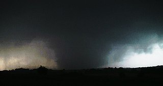
The 2011 El Reno–Piedmont tornado was a long-tracked and deadly EF5 tornado that struck central Oklahoma on the evening of May 24, 2011. The tornado impacted areas near or within the communities of El Reno, Piedmont, and Guthrie, killing nine and injuring 181. After producing incredible damage in several locations along a path of more than 60 miles (97 km), the El Reno–Piedmont tornado was given a rating of EF5, the highest category on the Enhanced Fujita scale, as well as being the highest rated tornado on the scale since its implementation in 2007, with estimated peak winds >210 mph (337 km/h). It was also the first tornado rated EF5 or F5 to strike Oklahoma since the 1999 Bridge Creek–Moore tornado. A mobile radar found that the tornado possessed possible wind speeds of up to 295 mph (475 km/h).
On the afternoon of May 21, 2024, a violent and destructive multi-vortex tornado struck the communities of Villisca, Nodaway, Brooks, Corning, and Greenfield in southwestern Iowa, killing five people and injuring 35 others. The tornado was the strongest of a large widespread tornado outbreak that occurred from May 19-27, 2024 in the central United States. The tornado reached peak intensity in the city of Greenfield, leading the National Weather Service in Des Moines, Iowa to assign a rating of mid-range EF4 on the Enhanced Fujita scale, with maximum wind speeds estimated at 185 mph (298 km/h). However, winds of 309–318 mph (497–512 km/h) were measured in a sub-vortex of the tornado by a DOW, placing it among the strongest tornadoes ever measured.
This is a timeline of scientific and technological advancements as well as notable academic or government publications in the area of atmospheric sciences and meteorology during the 21st century. Some historical weather events are included that mark time periods where advancements were made, or even that sparked policy change.
The history of tornado research spans back centuries, with the earliest documented tornado occurring in 200 and academic studies on them starting in the 18th century. This is a timeline of government or academic research into tornadoes.
Starting in the mid-1900s, mobile radar vehicles were being used for academic and military research. In the late 1900s, mobile doppler weather radars were designed and created with the goal to study atmospheric phenomena.
Winds of ~224 mph and diameter of max winds of ~2966 ft. Observations were taken as part of the @NSF -sponsored #BEST project led by @karen_kosiba and @JoshuaWurman
These data: Height ~258 m ARL (see 2) Gate 12m/beam 122m, gusts ~1sec
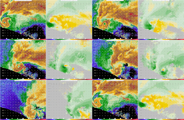
The gate velocities were over 260 miles per hour, a vortex hole like the eye of a hurricane and the swirl could be seen from 18,000 feet.
{{cite web}}
: CS1 maint: numeric names: authors list (link)Winds of ~224 mph and diameter of max winds of ~2966 ft. Observations were taken as part of the @NSF -sponsored #BEST project led by @karen_kosiba and @JoshuaWurman
These data: Height ~258 m ARL (see 2) Gate 12m/beam 122m, gusts ~1sec