
Lakewood is a neighborhood in East Dallas, Texas (USA). It is adjacent to White Rock Lake and Northeast of Downtown Dallas. Lakewood is bound by Mockingbird Lane to the north, Abrams Road to the west, Gaston Avenue to the south, and White Rock Lake to the east.
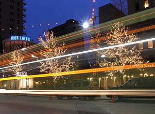
The Main Street District of downtown Dallas, Texas runs along Main Street and is bounded by Elm Street one block north, Commerce St. one block south, N. Lamar St. to the west, and US 75/I-45 (I-345) elevated highway to the east. The district is the spine of downtown Dallas, and connects many of the adjoining business and entertainment districts. It does not include Dealey Plaza or the John Fitzgerald Kennedy Memorial which are a few blocks west in the West End Historic District.

The Cedars is a district in Dallas, Texas (U.S.). It is adjacent to and south of downtown and Interstate 30, east of Austin Street, north of Corinth Street, and west of the 75 & 345 Overpasses just east of South Good Latimer Expy.

The Arts District is a performing and visual arts district in downtown Dallas, Texas.

The Farmers Market District is an area in southeastern downtown Dallas, Texas (USA). It lies south of the Main Street District, north of the Cedars, west of Deep Ellum, northeast of the Convention Center District, and southeast of the Government District.

Victory Park is a master planned development northwest of downtown Dallas, Texas (USA) and north of Spur 366. It is along Interstate 35E, part of the Stemmons Corridor and Uptown.
Casa Linda Estates, or simply Casa Linda is a neighborhood in east Dallas, Texas (USA). Situated to the south and east of White Rock Lake and to the south of Garland Road, it falls under Dallas Council District 9.

Bryan Place is a neighborhood in Old East Dallas, Texas (USA). It is east of the Arts District of downtown and the State Thomas neighborhood, north of Deep Ellum, south of Cityplace and west of Munger Place. Its boundaries are generally considered to be US-75 North Central Expressway on the west, Ross Avenue on the (north)west, N. Washington Street on the (north)east, and Live Oak Avenue on the (south)east.

The Government District is an area in south-central downtown Dallas, Texas (USA). It lies south of the Main Street District, southeast of the West End Historic District, north of the Convention Center District, west of the Farmers Market District, and east of the Reunion District.

The Convention Center District is an area in southern downtown Dallas, Texas (USA). It lies south of the Government District, north of the Cedars, west of the Farmers Market District, and east of the Reunion District. Visitdallas is contracted by the City to attract conventions, although an audit released in January 2019 cast doubts on its effectiveness.
The City Center District is an area in north-central downtown Dallas, Texas (USA). It lies south of the Arts District, north of the Main Street District, northwest of Deep Ellum, southwest of Bryan Place and east of the West End Historic District. The district contains a large concentration of downtown commercial space which prior to 1950 had been concentrated along Main Street. The district also contains remnants of Theatre Row, the historical entertainment area along Elm Street which contained theatres such as the Majestic Theatre.
West Kessler is a neighborhood named for George E. Kessler in Kessler, Dallas, Texas (USA).
L.O. Daniel is a neighborhood in northern Oak Cliff, Dallas, Texas (USA). It is named for Lark Owen Daniel.
The L Streets is a neighborhood in the Lake Highlands area of Dallas, Texas (USA). It is generally bounded by Ferndale Road on the west, Northwest Highway on the south, Plano Road on the east and Kingsley/Walnut Hill on the north. However, it excludes commercial property on its southwest and southeast corners, apartments along Northwest Highway and a church on its northeast corner.
Greenway Parks is a 150-acre residential neighborhood located approximately five miles north of downtown Dallas, Texas, bounded by the Dallas North Tollway on the east, Mockingbird Lane on the south, Inwood Road on the west, and University Boulevard on the north. It borders the city of Highland Park on the southeast and the city of University Park on the east.
Melshire Estates is a neighborhood in north Dallas, Texas (USA). It is generally bounded by Charlestown Drive on the north, Preston Road ( SH 289) on the east, Forest Lane on the south, and the Dallas North Tollway on the west. Small areas adjacent to Forest Lane, a shopping center on the northwestern corner of Preston Road and Forest Lane, and townhomes along Lindenshire Lane and Brookstone Drive are not considered part of the neighborhood.
Highland Hills is a neighborhood in the southern sector of Dallas, Texas. The neighborhood is centered on the intersection of Bonnie View and Simpson Stuart roads. Approximately 78% of the neighborhood is African American, 18% is Hispanic, 2% is white, and 2% are multiracial.
Alexander's village is a non-HOA neighborhood in the Lake Highlands area of Dallas, Texas (USA). The neighborhood is triangular in shape and is bounded by Abrams Road, Fair Oaks Avenue, and White Rock Creek. Walnut Hill Lane runs directly through the neighborhood.
Love Field is a neighborhood located in northwest Dallas, Texas (USA). It lies southwest of and is adjacent to Dallas Love Field Airport and is bounded by Denton Drive, Inwood Road, Harry Hines Boulevard, and Webb Chapel Extension. The neighborhood takes its name from Love Field Airport.
University Meadows is a residential neighborhood in eastern Dallas, Texas (USA). It is adjacent to several East Dallas neighborhoods including: Ridgewood Park and Caruth Terrace.


