Reunion District, Dallas

Last updated
Reunion District
Reunion tower dallas.jpg
Dallas, Texas map - Reunion District.svg
Location in Dallas
Country United States
State Texas
Counties Dallas
City Dallas
Area Downtown
Elevation
397 ft (121 m)
ZIP code
75202
Area code(s) 214, 469, 972

The Reunion district of downtown Dallas, Texas (USA) is an area in western downtown anchored by the Hyatt Regency Dallas and Reunion Tower
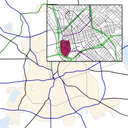
. The name "Reunion" originates from the mid-nineteenth century commune and current ghost town, La Reunion.

Contents

The district included Reunion Arena from 1980 to its demolition in 2009. The arena was originally intended to be an economic engine to drive redevelopment of the surrounding district. However, the real estate bust of the 1980s discouraged owner Ray Hunt and his Woodbine Development Corp. from investing beyond the Hyatt and the Tower, and no further building took place. With the Mavericks and Stars having relocated to American Airlines Center, plans indicated that the land would be put to other uses after demolition of the arena in November 2009, but as of mid-2013, no further use for the former arena site has been found.[ citation needed ][ needs update ].

Attractions

Transportation

Highways

Trains

Commuter

Light Rail

Regional

Education

The district is zoned to schools in the Dallas Independent School District.

Residents of the district are zoned to City Park Elementary School, Billy Earl Dade Middle School, and James Madison High School. [1]

Related Research Articles

<span class="mw-page-title-main">Downtown Houston</span> Neighborhood of Houston in Harris County, Texas, United States

Downtown is the largest central business district in the city of Houston and the largest in the state of Texas, located near the geographic center of the metropolitan area at the confluence of Interstate 10, Interstate 45, and Interstate 69. The 1.84-square-mile (4.8 km2) district, enclosed by the aforementioned highways, contains the original townsite of Houston at the confluence of Buffalo Bayou and White Oak Bayou, a point known as Allen's Landing. Downtown has been the city's preeminent commercial district since its founding in 1836.

<span class="mw-page-title-main">Hyatt</span> American multinational hospitality company

Hyatt Hotels Corporation, commonly known as Hyatt Hotels & Resorts, is an American multinational hospitality company headquartered in the Riverside Plaza area of Chicago that manages and franchises luxury and business hotels, resorts, and vacation properties. Hyatt Hotels & Resorts is one of the businesses managed by the Pritzker family.

<span class="mw-page-title-main">Dallas Union Station</span> Main railway station in Dallas, Texas, United States

Dallas Union Station, officially Eddie Bernice Johnson Union Station, also known as Dallas Union Terminal, is a large intermodal railroad station in Dallas, Texas. It is the third busiest Amtrak station in Texas, behind Fort Worth Central Station and San Antonio station. It serves DART Light Rail Blue and Red lines, Trinity Railway Express commuter rail and Amtrak intercity rail. It is located on Houston Street, between Wood and Young Streets, in the Reunion district of Downtown Dallas. The structure is a Dallas Landmark and is listed on the National Register of Historic Places.

<span class="mw-page-title-main">Reunion Tower</span> Observation tower in Dallas, Texas

Reunion Tower is a 561 ft (171 m) observation tower in Dallas, Texas, United States and one of the city's most recognizable landmarks. The tower is located at 300 Reunion Boulevard in the Reunion district of downtown Dallas, which is named after the mid-nineteenth century commune La Reunion. A free-standing structure until the construction of an addition to the Hyatt Regency Dallas and surrounding complex in 1998, the tower is the city's 15th tallest building. It was designed by architectural firm Welton Becket & Associates.

<span class="mw-page-title-main">Main Street District, Dallas</span> Neighborhood in Dallas, Texas

The Main Street District of downtown Dallas, Texas runs along Main Street and is bounded by Elm Street one block north, Commerce St. one block south, N. Lamar St. to the west, and US 75/I-45 (I-345) elevated highway to the east. The district is the spine of downtown Dallas, and connects many of the adjoining business and entertainment districts. It does not include Dealey Plaza or the John Fitzgerald Kennedy Memorial which are a few blocks west in the West End Historic District.

<span class="mw-page-title-main">West End Historic District (Dallas)</span> Neighborhood in Dallas, Texas

The West End Historic District of Dallas, Texas, is a historic district that includes a 67.5-acre (27.3 ha) area in northwest downtown, generally north of Commerce, east of I-35E, west of Lamar and south of the Woodall Rodgers Freeway. It is south of Victory Park, west of the Arts, City Center, and Main Street districts, and north of the Government and Reunion districts. A portion of the district is listed on the U.S. National Register of Historic Places as Westend Historic District. A smaller area is also a Dallas Landmark District. The far western part of the district belongs to the Dealey Plaza Historic District, a National Historic Landmark around structures and memorials associated with the assassination of John F. Kennedy.

<span class="mw-page-title-main">Cedars, Dallas</span> Place in Texas, United States

The Cedars is a district in Dallas, Texas (U.S.). It is adjacent to and south of downtown and Interstate 30, east of Austin Street, north of Corinth Street, and west of the 75 & 345 Overpasses just east of South Good Latimer Expy.

<span class="mw-page-title-main">Farmers Market District, Dallas</span> Neighborhood in Dallas, Texas

The Farmers Market District is an area in southeastern downtown Dallas, Texas (USA). It lies south of the Main Street District, north of the Cedars, west of Deep Ellum, northeast of the Convention Center District, and southeast of the Government District.

<span class="mw-page-title-main">Victory Park, Dallas</span> Place in Texas, United States

Victory Park is a master planned development northwest of downtown Dallas, Texas (USA) and north of Spur 366. It is along Interstate 35E, part of the Stemmons Corridor and Uptown.

Bryan Place is a neighborhood in Old East Dallas, Texas (USA). It is east of the Arts District of downtown and the State Thomas neighborhood, north of Deep Ellum, south of Cityplace and west of Munger Place. Its boundaries are generally considered to be US-75 North Central Expressway on the west, Ross Avenue on the (north)west, N. Washington Street on the (north)east, and Live Oak Avenue on the (south)east.

<span class="mw-page-title-main">Government District, Dallas</span> Neighborhood in Dallas, Texas

The Government District is an area in south-central downtown Dallas, Texas (USA). It lies south of the Main Street District, southeast of the West End Historic District, north of the Convention Center District, west of the Farmers Market District, and east of the Reunion District.

<span class="mw-page-title-main">Convention Center District, Dallas</span> Neighborhood in Dallas, Texas

The Convention Center District is an area in southern downtown Dallas, Texas (USA). It lies south of the Government District, north of the Cedars, west of the Farmers Market District, and east of the Reunion District. Visitdallas is contracted by the City to attract conventions, although an audit released in January 2019 cast doubts on its effectiveness.

<span class="mw-page-title-main">City Center District, Dallas</span> Neighborhood in Dallas, Texas

The City Center District is an area in north-central downtown Dallas, Texas (USA). It lies south of the Arts District, north of the Main Street District, northwest of Deep Ellum, southwest of Bryan Place and east of the West End Historic District. The district contains a large concentration of downtown commercial space which prior to 1950 had been concentrated along Main Street. The district also contains remnants of Theatre Row, the historical entertainment area along Elm Street which contained theatres such as the Majestic Theatre.

<span class="mw-page-title-main">Mercantile National Bank Building</span> Skyscraper in Dallas, Texas

The Mercantile National Bank Building is a 31-story, 159.4 m (523 ft) skyscraper at 1800 Main Street in the Main Street district of downtown Dallas, Texas. It is the former home of the Mercantile National Bank, which later became MCorp Bank. The design of the skyscraper features Moderne styling from the Art Deco era and was designed by Walter W. Ahlschlager. The building has a series of setbacks that is crowned by an ornamental four-sided clock along with a decorative weather spire. The Merc was the main element of a four-building complex that eventually spanned a full city block.

<span class="mw-page-title-main">Greater Downtown Miami</span> Neighborhood of Miami in Miami-Dade County, Florida, United States

Downtown Miami is the urban city center of Miami, Florida. The city's greater downtown region consists of the Central Business District, Brickell, the Historic District, Government Center, the Arts & Entertainment District, and Park West. It is divided by the Miami River and is bordered by Midtown Miami's Edgewater and Wynwood sections to its north, Biscayne Bay to its east, the Health District and Overtown to its west, and Coconut Grove to its south.

<span class="mw-page-title-main">Cityscape of Lexington, Kentucky</span>

The urban development patterns of Lexington, Kentucky, confined within an urban growth boundary that protects its famed horse farms, include greenbelts and expanses of land between it and the surrounding towns. This has been done to preserve the region's horse farms and the unique Bluegrass landscape, which bring millions of dollars to the city through the horse industry and tourism. Urban growth is also tightly restricted in the adjacent counties, with the exception of Jessamine County, with development only allowed inside existing city limits. In order to prevent rural subdivisions and large homes on expansive lots from consuming the Bluegrass landscape, Fayette and all surrounding counties have minimum lot size requirements, which range from 10 acres (40,000 m2) in Jessamine to fifty in Fayette.

<span class="mw-page-title-main">Downtown San Antonio</span> District of San Antonio

Downtown San Antonio is the central business district of San Antonio, Texas and the urban core of Greater San Antonio, a metropolitan area with nearly 2.5 million people.

<span class="mw-page-title-main">Hyatt Regency Dallas</span> Hotel in Dallas, Texas

The Hyatt Regency Dallas is a 28-story, 1,120-room hotel in the Reunion district of Dallas, Texas, United States The building is connected to Union Station and Reunion Tower, which is the city's landmark observation tower in downtown Dallas. The Y-shaped building has an atrium on the south side. In 1998, the hotel added a low-rise ballroom with an area of 32,000 square feet. The Hyatt Regency Dallas recently completed a $50 million renovation that features newly redone guest rooms, bathrooms, and corridors.

<span class="mw-page-title-main">Downtown Rochester</span> Neighborhood in Rochester, New York, United States

Downtown Rochester is the economic center of Rochester, New York, and the largest in Upstate New York, employing more than 50,000 people, and housing more than 6,000.

<span class="mw-page-title-main">Downtown Dallas</span> Place in Texas, United States

Downtown Dallas is the central business district (CBD) of Dallas, Texas, United States, located in the geographic center of the city. It is the second-largest business district in the state of Texas. The area termed "Downtown" has traditionally been defined as bounded by the downtown freeway loop, bounded on the east by I-345 (although known and signed as the northern terminus of I-45 and the southern terminus of US 75, on the west by I-35E, on the south by I-30, and on the north by Woodall Rodgers Freeway.

References

  1. Dallas ISD - 2006 School Feeder Patterns Archived 2007-04-09 at the Wayback Machine - James Madison High School Archived 2007-02-05 at the Wayback Machine . (Maps: ES: City Park Archived 2007-06-20 at the Wayback Machine ; MS: Dade Archived 2007-06-20 at the Wayback Machine ; HS: Madison Archived 2007-06-20 at the Wayback Machine .) Retrieved 31 December 2006.