Farmers Market District | |
|---|---|
 | |
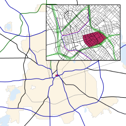 Location in Dallas | |
| Country | United States |
| State | Texas |
| Counties | Dallas |
| City | Dallas |
| Area | Downtown |
| Elevation | 136 m (446 ft) |
| ZIP code | 75201 |
| Area codes | 214, 469, 972 |

The Farmers Market District is an area in southeastern downtown Dallas, Texas (USA). It lies south of the Main Street District, north of the Cedars, west of Deep Ellum, northeast of the Convention Center District, and southeast of the Government District.


