
Cityplace/Uptown station is a DART light rail station located in Dallas, Texas. The station is located on the Red Line, Blue Line, Orange Line and serves the Cityplace and Uptown districts. It also serves as a transfer point to the M-Line Trolley.

The Cityplace Tower is a 42-story building located at 2711 North Haskell Avenue, at North Central Expressway, in the Cityplace district of Uptown Dallas, Texas (USA). The building is 560 feet (171 m) tall and has 1,400,000 square feet (130,000 m2) of office space. It is also the tallest building in Dallas outside of Downtown.

Oak Lawn is a neighborhood in Dallas, Texas, defined in Dallas City Ordinance 21859 as Planned Development District No. 193, the Oak Lawn Special Purpose DistrictArchived 2011-07-08 at the Wayback Machine. The unofficial boundaries are Turtle Creek Boulevard, Central Expressway, the City of Highland Park, Inwood Road, and Harry Hines Boulevard. It is over 12 square miles (31 km2) in area. Officially it is bounded by the City of Highland Park, the North Central Expressway, Stemmons Freeway, Woodall Rodgers Freeway, and other roads. The district is within the boundary defined by the City of Dallas law, excluding any existing planned development districts within.
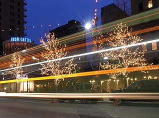
The Main Street District of downtown Dallas, Texas runs along Main Street and is bounded by Elm Street one block north, Commerce St. one block south, N. Lamar St. to the west, and US 75/I-45 (I-345) elevated highway to the east. The district is the spine of downtown Dallas, and connects many of the adjoining business and entertainment districts. It does not include Dealey Plaza or the John Fitzgerald Kennedy Memorial which are a few blocks west in the West End Historic District.

The Arts District is a performing and visual arts district in downtown Dallas, Texas.

Uptown Charlotte, also called Center City, is the central business district of Charlotte, North Carolina, United States. The area is split into four wards by the intersection of Trade and Tryon Streets, and bordered by Interstate 277 and Interstate 77. The area is managed and overseen by the Charlotte Central City Partners, which is one of the three Municipal Service Districts in Charlotte. Uptown Charlotte is the largest business district in Charlotte and the Carolinas.
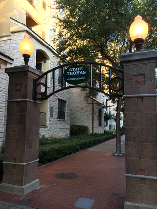
State Thomas is a Dallas Landmark District in the Uptown area of Dallas, Texas (USA). It borders downtown to the south at Woodall Rodgers Freeway, Bryan Place to the east at US 75, and LoMac to the north and west.

The M-Line Trolley is a heritage streetcar line in the Uptown neighborhood of Dallas, Texas. The trolley line, which has been in service since 1989, is notable for its use of restored historic streetcar vehicles, as opposed to modern replicas.

Cityplace is a TIF District and neighborhood in Old East Dallas, Texas (USA) - near the Uptown area of Dallas, adjacent to the intersection of Central Expressway and Haskell Avenue/Blackburn Street. East of Central Expressway, the neighborhood includes the tree-lined Haskell boulevard and travels past the 42-story Tower at Cityplace. At 42-stories, it is the tallest building in Dallas outside downtown. Also on the east is the newer Cityville high-end apartment complex. The west side Cityplace includes the new-urbanist West Village and the northern end of the Uptown neighborhood.
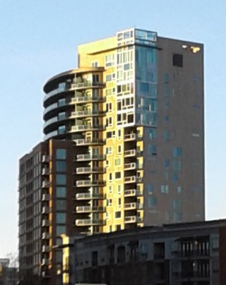
The Mondrian, designed by famed Dallas architect Thomas Brink, is a 20-story high-rise located at 3000 Blackburn Street in the Cityplace neighborhood of Oak Lawn, Dallas, Texas, United States. Construction started on the structure in 2003 and the building was completed in 2005,
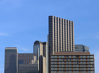
The City Center District is an area in north-central downtown Dallas, Texas (USA). It lies south of the Arts District, north of the Main Street District, northwest of Deep Ellum, southwest of Bryan Place and east of the West End Historic District. The district contains a large concentration of downtown commercial space which prior to 1950 had been concentrated along Main Street. The district also contains remnants of Theatre Row, the historical entertainment area along Elm Street which contained theatres such as the Majestic Theatre.

CityPlace is an upscale lifestyle center in downtown West Palm Beach, Florida, along South Rosemary Avenue. Considered a New Urbanist mixed-use development, CityPlace is architecturally composed of Mediterranean and Venetian elements. The 600,000-square-foot (56,000 m2)-center constitutes several city blocks and contains more than 60 restaurants and stores, as well as rental apartments, condos, and offices.
This article is about transportation systems in and around Dallas, Texas (USA).

Brickell City Centre is a large mixed-use complex consisting of two residential high-rise towers, two office buildings, a high-rise hotel, and an interconnected five-story shopping mall and lifestyle center covering 9 acres (36,000 m2) located in the Brickell district of Downtown Miami, Florida. Situated at the junction of Miami Avenue and Eighth Street, it spans up to five blocks to the west of Brickell Avenue and to the south of the Miami River. Contrary to the name, the development is not in the traditional downtown Miami city centre, but in the more recently redeveloped financial district of Brickell. The retail shopping and lifestyle center is operated by Simon Malls.

Downtown Fort Worth is the central business district of Fort Worth, Texas, United States. Most of Fort Worth's tallest buildings and skyscrapers are located downtown.

Downtown Markham is the main downtown of Markham, Ontario, Canada. Currently under development, it is located near the historic Unionville district and serves as the new heart of Markham. Businesses in the district are expected to employ up to 16,000 individuals, and it may house as many as 10,000 residents. The development plans will have a high density of residential, retail, commercial and mixed-use structures. The community is being developed, built and wholly financed by The Remington Group Inc.

Uptown is a PID and a dense neighborhood in Dallas, Texas. Uptown is north of and adjacent to downtown Dallas, and is bordered by US 75 on the east, N Haskell Avenue on the northeast, the Katy Trail on the northwest, Bookhout Street and Cedar Springs Road on the west, N Akard Street on the southwest and Spur 366 on the south.

Downtown Dallas is the central business district (CBD) of Dallas, Texas, United States, located in the geographic center of the city. It is the second-largest business district in the state of Texas. The area termed "Downtown" has traditionally been defined as bounded by the downtown freeway loop, bounded on the east by I-345 (although known and signed as the northern terminus of I-45 and the southern terminus of US 75, on the west by I-35E, on the south by I-30, and on the north by Woodall Rodgers Freeway.
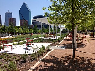
Klyde Warren Park is a 5.2-acre (2.1 ha) public park in Downtown Dallas, Texas. The park is over the Woodall Rodgers Freeway, and opened in 2012. It is named for Klyde Warren, the young son of billionaire Kelcy Warren who donated $10 million to the development of the park.


