River Bend, North Carolina

Last updated

River Bend, North Carolina
River Bend, NC Town Flag.gif
River Bend, NC Town Seal.png
NCMap-doton-RiverBend.PNG
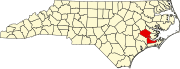
Location of River Bend, North Carolina
Coordinates: 35°04′18″N77°09′01″W / 35.07167°N 77.15028°W / 35.07167; -77.15028
Country United States
State North Carolina
County Craven
Area
[1]
  Total2.87 sq mi (7.43 km2)
  Land2.51 sq mi (6.51 km2)
  Water0.35 sq mi (0.92 km2)
Elevation
[2]
7 ft (2 m)
Population
 (2020)
  Total2,902
  Density1,154.80/sq mi (445.89/km2)
Time zone UTC-5 (Eastern (EST))
  Summer (DST) UTC-4 (EDT)
FIPS code 37-56710 [3]
GNIS feature ID2407222 [2]
Website riverbendnc.org

River Bend is a town in Craven County, North Carolina, United States. The population was 3,119 as of the 2010 census. [4] It is part of the New Bern, North Carolina Metropolitan Statistical Area.

Contents

Geography

According to the United States Census Bureau, the town has a total area of 2.8 square miles (7.3 km2), of which 2.5 square miles (6.5 km2) is land and 0.2 square miles (0.52 km2) (7.27%) is water.

Demographics

Historical population
CensusPop.Note
1990 2,408
2000 2,92321.4%
2010 3,1196.7%
2020 2,902−7.0%
U.S. Decennial Census [5]

2020 census

River Bend racial composition [6]
RaceNumberPercentage
White (non-Hispanic)2,44984.39%
Black or African American (non-Hispanic)2317.96%
Native American 40.14%
Asian 210.72%
Pacific Islander 40.14%
Other/Mixed 1073.69%
Hispanic or Latino 862.96%

As of the 2020 United States census, there were 2,902 people, 1,376 households, and 957 families residing in the town.

2000 census

As of the census [3] of 2000, there were 2,923 people, 1,343 households, and 988 families residing in the town. The population density was 1,147.1 inhabitants per square mile (442.9/km2). There were 1,477 housing units at an average density of 579.6 per square mile (223.8/km2). The racial makeup of the town was 93.29% White, 5.71% African American, 0.10% Native American, 0.38% Asian, 0.07% Pacific Islander, 0.03% from other races, and 0.41% from two or more races. Hispanic or Latino of any race were 1.03% of the population.

There were 1,343 households, out of which 15.0% had children under the age of 18 living with them, 68.3% were married couples living together, 4.6% had a female householder with no husband present, and 26.4% were non-families. 23.2% of all households were made up of individuals, and 12.2% had someone living alone who was 65 years of age or older. The average household size was 2.08 and the average family size was 2.40.

In the town, the population was spread out, with 14.0% under the age of 18, 3.6% from 18 to 24, 18.4% from 25 to 44, 27.1% from 45 to 64, and 36.9% who were 65 years of age or older. The median age was 57 years. For every 100 females, there were 92.4 males. For every 100 females age 18 and over, there were 89.8 males.

The median income for a household in the town was $49,851, and the median income for a family was $54,316. Males had a median income of $44,602 versus $37,500 for females. The per capita income for the town was $27,990. About 0.4% of families and 2.3% of the population were below the poverty line, including 4.0% of those under age 18 and 1.0% of those age 65 or over.

Related Research Articles

<span class="mw-page-title-main">Higganum, Connecticut</span> Census-designated place in Connecticut, United States

Higganum is a village and census-designated place (CDP) in the town of Haddam, a part of Middlesex County, Connecticut, United States. The population was 2,089 at the 2020 census.

<span class="mw-page-title-main">Montgomery, Indiana</span> Town in Indiana, United States

Montgomery is a town in Barr Township, Daviess County, Indiana, United States. The population was 343 at the 2010 census.

<span class="mw-page-title-main">Mount Ayr, Indiana</span> Town in Indiana, United States

Mount Ayr is a town in Jackson Township, Newton County, in the U.S. state of Indiana. The population was 122 at the 2010 census.

<span class="mw-page-title-main">Strong, Maine</span> Town in Maine, United States

Strong is a town in Franklin County, Maine, United States. The population was 1,122 at the 2020 census. Strong is home to the annual Sandy River Festival.

<span class="mw-page-title-main">Des Arc, Missouri</span> City in Missouri, United States

Des Arc is a city in Iron County, Missouri, United States. The population was 131 at the 2020 census.

Great Bend is a hamlet and census-designated place (CDP) in Jefferson County, New York, United States. The population was 843 at the 2010 census.

<span class="mw-page-title-main">Biltmore Forest, North Carolina</span> Town in North Carolina, United States

Biltmore Forest is a town in Buncombe County, North Carolina, United States. The population was 1,343 in 2010. It is part of the Asheville Metropolitan Statistical Area. Biltmore Forest is the second-wealthiest town in North Carolina by per capita income at $85,044.

Magnolia is a town in Duplin County, North Carolina, United States. The population was 939 at the 2010 census.

<span class="mw-page-title-main">Grimesland, North Carolina</span> Town in North Carolina, United States

Grimesland is a town in Pitt County, North Carolina, United States. The population was 441 at the 2010 Census. The town is a part of the Greenville Metropolitan Area located in North Carolina's Inner Banks.

<span class="mw-page-title-main">Boonville, North Carolina</span> Town in North Carolina, United States

Boonville is a town in Yadkin County, North Carolina, United States. The population was 1,222 at the 2010 census.

<span class="mw-page-title-main">Taloga, Oklahoma</span> Town in Oklahoma, United States

Taloga is a town in Dewey County, Oklahoma, United States. The population was 299 at the 2010 census. It is the county seat of Dewey County. The town lies near the southern bank of a bend of the Canadian River, along U.S. Route 183, approximately thirty-seven miles north of Clinton. According to the Encyclopedia of Oklahoma History and Culture, the name is of Indian origin and means either "beautiful valley" or "rocking water".

<span class="mw-page-title-main">Elko, South Carolina</span> Town in South Carolina, United States

Elko is a town in Barnwell County, South Carolina, United States. According to the 2010 census the population was 193.

<span class="mw-page-title-main">Hilda, South Carolina</span> Town in South Carolina, United States

Hilda is a town in Barnwell County, South Carolina, United States. The population was 447 at the 2010 census.

<span class="mw-page-title-main">Snelling, South Carolina</span> Town in South Carolina, United States

Snelling is a town in Barnwell County, South Carolina, United States. The population was 274 at the 2010 census.

<span class="mw-page-title-main">Great Falls, South Carolina</span> Town in South Carolina, United States

Great Falls is a town in Chester County, South Carolina, United States and is located fourteen miles southwest of Lancaster, South Carolina. The population was 1,951 at the 2020 census.

<span class="mw-page-title-main">Kershaw, South Carolina</span> Town in South Carolina, United States

Kershaw is a town in Lancaster County, South Carolina, United States. It was incorporated in 1888. As of the 2010 census, the population was 1,803, and as of 2019 the estimated population was 2,321. The Haile Gold Mine, where gold was discovered in 1825, is 3 miles (5 km) from town and was at one time the largest single producer of gold in the Appalachian region.

Seven Oaks is a census-designated place (CDP) in Lexington County, South Carolina, United States, 8 miles (13 km) northwest of downtown Columbia, the state capital. The population of the CDP was 15,144 at the 2010 census. It is part of the Columbia Metropolitan Statistical Area.

<span class="mw-page-title-main">Cairo, West Virginia</span> Town in West Virginia, United States

Cairo is a town in Ritchie County, West Virginia, United States, along West Virginia Route 31, the North Fork of the Hughes River, and the North Bend Rail Trail. The population was 174 at the 2020 census.

<span class="mw-page-title-main">Tobaccoville, North Carolina</span> Village in North Carolina, United States

Tobaccoville is a village in Forsyth and Stokes counties in the U.S. state of North Carolina. The population was 2,209 at the 2020 census. While a Tobaccoville post office was established in 1887, the village was not incorporated until 1991, as a defense against forced annexation of the area by the nearby city of King.

Orono is a census-designated place (CDP) consisting of the eastern portion of the town of Orono in Penobscot County, Maine, United States. The population of the CDP was 9,474 at the 2010 census.

References

  1. "ArcGIS REST Services Directory". United States Census Bureau. Retrieved September 20, 2022.
  2. 1 2 U.S. Geological Survey Geographic Names Information System: River Bend, North Carolina
  3. 1 2 "U.S. Census website". United States Census Bureau . Retrieved January 31, 2008.
  4. "River Bend, North Carolina (NC 28562)". City-data.com. Retrieved December 31, 2013.
  5. "Census of Population and Housing". Census.gov. Retrieved June 4, 2015.
  6. "Explore Census Data". data.census.gov. Retrieved December 24, 2021.