Vanceboro is a town in Washington County, Maine, United States. The town was named after landowner William Vance. The main village in town is located at the eastern terminus of Maine State Route 6. Vanceboro is across the St. Croix River from St. Croix, New Brunswick, Canada, to which it is connected by the Saint Croix–Vanceboro Bridge. Vanceboro is also connected to St. Croix by the Saint Croix–Vanceboro Railway Bridge, which is used by the New Brunswick Southern Railway.

Elon is a town in Alamance County, North Carolina, United States. It is part of the Burlington metropolitan statistical area. The population as of the 2020 census was 11,324. The town of Elon is home to Elon University.

Bridgeton is a town in Craven County, North Carolina, United States. The population was 454 at the 2010 census. It is part of the New Bern, North Carolina Micropolitan Statistical Area.

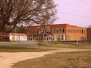
Cove City is a town in Craven County, North Carolina, United States. The population was 378 at the 2020 U.S. census. It is part of the New Bern, North Carolina Micropolitan Statistical Area.

Havelock is a city in Craven County, North Carolina, United States. The population was 20,735 at the 2010 census. The city is home to Marine Corps Air Station Cherry Point, the world's largest Marine Corps air station, and home to the 2nd Marine Aircraft Wing.

River Bend is a town in Craven County, North Carolina, United States. The population was 3,119 as of the 2010 census. It is part of the New Bern, North Carolina Metropolitan Statistical Area.

Stanley is a town in Gaston County, North Carolina, United States. The population was 3,556 at the 2010 census.

Wilson's Mills is a town in Johnston County, North Carolina, United States. In 2010, the population was 2,277, up from 1,291 in 2000. As of 2018, the estimated population was 2,689.

Gaston is a town in Northampton County, North Carolina, United States. The population was 1,152 at the 2010 census. It is part of the Roanoke Rapids, North Carolina Micropolitan Statistical Area.

Jackson is a town in Northampton County, North Carolina, United States. The population was 513 at the 2010 census. It is the county seat of Northampton County.

Richlands is a town in Onslow County, North Carolina, United States. In the 2020 U.S. census, the population was 2,287. It is included in the Jacksonville, North Carolina Metropolitan Statistical Area. Incorporated on March 29, 1880, it was the first town in Onslow County to have its own library and museum. Richlands was also the first town in Onslow County to have a female mayor, Annette Hargett.

Swansboro is a town in Onslow County, North Carolina, United States, located along the Crystal Coast. In 2020, the population was 3,744.

Winterville is a town in Pitt County, North Carolina, United States. The population was 10,591 as of the 2020 census. The town is a part of the Greenville Metropolitan Area.

Randleman is a city in Randolph County, North Carolina, United States. The population was 4,113 at the 2010 census. It is the home of NASCAR's Petty family, the Victory Junction Gang Camp and was the location of the Richard Petty Museum from 2003 to 2014.
Parkton is a town in Robeson County, North Carolina, Lumberton metro area, United States. The town was so named because it was a place where farmers tied up their horses while waiting for the train. As of the 2020 census, the town population was 504.
Glenburn is a census-designated place (CDP) in Glenburn Township, Lackawanna County, Pennsylvania, United States. The population was 953 at the 2010 census. It is approximately 10 miles (16 km) north of downtown Scranton, in the growing suburban area known as the "Abingtons". Glenburn is located north of Clarks Summit and south of Dalton.
Williamston is a town in Anderson County, South Carolina. The population was 4,043 at the 2020 census.

Gaston is a town in Lexington County, South Carolina, United States. The population was 1,645 at the 2010 census. It is part of the Columbia, South Carolina Metropolitan Statistical Area.

Swansea is a town in Lexington County, South Carolina, United States. The population was 827 at the 2010 census. It is part of the Columbia, South Carolina Metropolitan Statistical Area.

Tobaccoville is a village in Forsyth and Stokes counties in the U.S. state of North Carolina. The population was 2,209 at the 2020 census. While a Tobaccoville post office was established in 1879, the village was not incorporated until 1991, as a defense against forced annexation of the area by the nearby city of King.