
Repentigny is an off-island suburb of Montreal, Quebec, Canada. It is located north of the city on the lower end of the L'Assomption River, and on the Saint Lawrence River. Repentigny and Charlemagne were the first towns off the eastern tip of the Island of Montreal. Repentigny is part of the Lanaudière region.

Mascouche is an off-island suburb of Montreal, in southern Quebec, Canada. The city is located on the Mascouche River within the Les Moulins Regional County Municipality and has a population of 51,183, ranking 20th among Quebec municipalities.
Grande-Digue is a community in Kent County, New Brunswick, Canada, near Shediac.
Dalhousie was a town in Restigouche County, New Brunswick from 1905 to 2023. It was amalgamated with Charlo to form the town of Heron Bay. The name Dalhousie is still retained for address purposes. Heron Bay is the northernmost municipality in New Brunswick.
Plamondon is a hamlet in northern Alberta, Canada within Lac La Biche County. It is located on Highway 858, approximately 3.0 km (1.9 mi) north of Highway 55, and has an elevation of 555 m (1,821 ft).
Pointe-Verte is a community in the town of Belle-Baie in Gloucester County, New Brunswick. It was a village from 1966 to 2023, when it was amalgamated with surrounding municipalities to form the town of Belle-Baie.
Saint-Isidore is a former village in Gloucester County, New Brunswick, Canada. It held village status prior to 2023 and is now part of the town of Hautes-Terres. It is adjacent to the communities of Pont-Landry, Hacheyville, Bois-Gagnon and Tilley Road. The community is situated on the Acadian Peninsula.

Saint-Léonard is a former town in Madawaska County, New Brunswick, Canada. It held town status prior to 2023 and is now part of the town of Vallée-des-Rivières.
Lavaltrie is a city located within the D'Autray Regional County Municipality in the southern part of the region of Lanaudière, Quebec, Canada, northeast of Montreal outside the suburban sprawl of the North Shore. The population was 14,425 as of the Canada 2021 Census within a land surface area of about 70 square kilometres, with the majority of the territory being used for agricultural activities..

Notre-Dame-de-l'Île-Perrot is the largest of four municipalities located on Île Perrot, west of the island of Montreal, Quebec. The population as of the Canada 2016 Census was 10,654. It hosts the island's first church built in 1740 originally situated at Pointe-du-Moulin which was reconstituted as the Chapelle du Souvenir in 1953 beside the church of Sainte-Jeanne-de-Chantal across from the town hall.
Dunlop is a Canadian rural community and former local service district (LSD) in Gloucester County, New Brunswick. Most of the LSD was in Beresford Parish, with the southern extremity in Bathurst Parish.

Pokemouche was a Canadian local service district in Gloucester County, in the northeast of New Brunswick, in the Acadian peninsula; it included the communities of Cowans Creek, Pokemouche, and Upper Pokemouche. It is now part of the town of Caraquet.

Saint-Colomban is a city in the regional county municipality of La Rivière-du-Nord in Québec, Canada. It is situated in the Laurentides region of Québec and was named in honour of Saint Columbanus.
Vaudreuil-sur-le-Lac is a village municipality in Vaudreuil-Soulanges Regional County Municipality in the Montérégie region of Quebec, Canada. It is located on the western portion of the Vaudreuil Peninsula, which projects into Lake of Two Mountains. The population as of the Canada 2016 Census was 1,341.

Bathurst is a geographic parish in Gloucester County, New Brunswick, Canada.
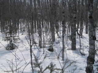
North Tetagouche is a local service district in New Brunswick, Canada. It is situated 7 km Western the centre of Bathurst. It is located to the North of Tetagouche river, it is nearly rectangular and borders Dunlop on the Northwest. The most part of its territory is a forest and a residential neighbourhood by the river which links to Route 322.

Saint-Simon is a settlement in Gloucester County, New Brunswick, Canada. It is located in the Acadian Peninsula.

Caraquet is a town in Gloucester County, New Brunswick, Canada.

Oromocto is a Canadian town in Sunbury County, New Brunswick.

The Regional Municipality of Tracadie is the first and only regional municipality in the province of New Brunswick, Canada.
