Maricopa County is in the south-central part of the U.S. state of Arizona. As of the 2020 census the population was 4,420,568, or about 62% of the state's total, making it the fourth-most populous county in the United States and the most populous county in Arizona, and making Arizona one of the nation's most centralized states. The county seat is Phoenix, the state capital and fifth-most populous city in the United States.

Pinal County is in the central part of the U.S. state of Arizona. According to the 2020 census, the population of the county was 425,264, making it Arizona's third-most populous county. The county seat is Florence. The county was founded in 1875.

Pima is a town in Graham County, Arizona, United States. As of the 2010 census, the population of the town was 2,387, up from 1,989 in 2000. The estimated population in 2018 was 2,512. Pima is part of the Safford Micropolitan Statistical Area.

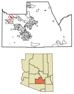
Gila Bend, founded in 1872, is a town in Maricopa County, Arizona, United States. The town is named for an approximately 90-degree bend in the Gila River, which is near the community's current location. As of the 2020 census, the population of the town was 1,892.

Maricopa is a city in the Gila River Valley in Pinal County, Arizona, United States. With 66,290 residents as of 2022, Maricopa is the largest incorporated municipality in Pinal County.

Sacaton is a census-designated place (CDP) in Pinal County, Arizona, United States. The population was 3,254 at the 2020 census. It is the capital of the Gila River Indian Community.

The Gila River Indian Community (GRIC) is an Indian reservation in the U.S. state of Arizona, lying adjacent to the south side of the city of Chandler, within the Phoenix Metropolitan Area in Pinal and Maricopa counties. The Gila River Indian Community was established in 1859, and the Gila River Indian Community was formally established by Congress in 1939. The community is home for members of both the Akimel O’odham (Pima) and the Pee-Posh (Maricopa) tribes.

Theba is an unincorporated community and census-designated place (CDP) in Maricopa County, Arizona, United States. Its elevation is 728 feet (222 m). Theba is located along Interstate 8 and is served by Exit 106. As of the 2020 census, it had a population of 111, down from 158 in 2010.

Kaka is a census-designated place (CDP) in Maricopa County, Arizona, United States, located in the Tohono O'odham Nation. The population was 83 at the 2020 census, down from 141 at the 2010 census.

Casa Blanca is a census-designated place (CDP) in Pinal County, Arizona, United States, located in the Gila River Indian Community. The population was 1,388 at the 2010 census.

Pima Villages, sometimes mistakenly called the Pimos Villages in the 19th century, were the Akimel O’odham (Pima) and Pee-Posh (Maricopa) villages in what is now the Gila River Indian Community in Pinal County, Arizona. First, recorded by Spanish explorers in the late 17th century as living on the south side of the Gila River, they were included in the Viceroyalty of New Spain, then in Provincias of Sonora, Ostimuri y Sinaloa or New Navarre to 1823. Then from 1824 to 1830, they were part of the Estado de Occidente of Mexico and from September 1830 they were part of the state of Sonora. These were the Pima villages encountered by American fur trappers, traders, soldiers and travelers along the middle Gila River from 1830s into the later 19th century. The Mexican Cession following the Mexican American War left them part of Mexico. The 1853 Gadsden Purchase made their lands part of the United States, Territory of New Mexico. During the American Civil War, they became part of the Territory of Arizona.
Sacaton or Socatoon was a village of the Maricopa people, established above the Pima Villages, after the June 1, 1857, in the Battle of Pima Butte where it appears a few months later in the 1857 Chapman Census. Sacaton village lay on the Gila River, 3.75 miles west of modern Sacaton.

Socatoon Station, was a stagecoach station of the Butterfield Overland Mail between 1858 and 1861. It was located four miles (6.4 km) east of Sacaton at a Maricopa village from which it took its name. This station was located 22 miles (35 km) east of Maricopa Wells Station, 11 miles (18 km) east of Casa Blanca Station and 13 miles (21 km) north of Oneida Station.
Arenal, "sandy place" in Spanish, also known as Aranca No.1 in the 1857 census, was one of the 19th century Pima Villages, located along the Gila River, in what is now the Gila River Indian Community in Pinal County, Arizona.
Hueso Parado, Spanish for “Standing Bone” or El Juez Tarado Spanish for "The Judge Tarado", was the largest village of the Maricopa people in the 19th century, in what is now the Gila River Indian Community in Pinal County, Arizona.
Agua Raiz, Spanish for "Water root" as named in the 1860 Census, it was one of the 19th century Pima Villages, located along the Gila River, near the modern site of Sacate Village, Arizona in what is now the Gila River Indian Community in Pinal County, Arizona.

Ak Chin, is a rural native village and a census-designated place on the Tohono Oʼodham Reservation, in Pima County, Arizona, United States. It had a population of 30 as of the 2010 U.S. Census and an estimated population of 31 as of July 1, 2015. Ak Chin has an estimated elevation of 1,854 feet (565 m) above sea level.

San Miguel is a census-designated place in Pima County, in the U.S. state of Arizona. The population was 207 as of the 2020 census. San Miguel is located near the border with Mexico on the Tohono O'odham Nation reservation.

Sacate is a populated place in the Middle Gila River Valley area, within Pinal County, Arizona, United States. Located 8 mi (13 km) north of Maricopa on the south side of the Gila River near Pima Butte, Sacate was an Pima village, a railroad station of the Southern Pacific Railroad, and a Catholic mission. It had originally been called Sacaton Station but the name was shortened to its current version in 1904.
Cachanillo, a derivative of Cachanilla in Spanish, being an arrowweed or Pluchea sericea, was one of the 19th century Pima Villages, located along the Gila River, in what is now the Gila River Indian Community in Pinal County, Arizona.


