San Marco (Jacksonville)

Last updated

San Marco
Jacksonville San Marco Square.JPG
Lion statues in San Marco Square
Jacksonville Urban Core.png
Red pog.svg
San Marco
Location within Central Jacksonville
Coordinates: 30°18′14″N81°39′15″W / 30.30389°N 81.65417°W / 30.30389; -81.65417
Government
   City Council Lori N. Boyer
Warren Jones
   Florida House Reggie Fullwood
Charles McBurney
   Florida Senate Aaron Bean
Audrey Gibson
   U.S. House John Rutherford (R)
ZIP Code
32207
Area code(s) 904

San Marco is a neighborhood of Jacksonville, Florida, south of Downtown across the St. Johns River. The neighborhood was formerly the independent city of South Jacksonville until it was annexed by Jacksonville in 1932. The neighborhood is primarily residential, with an integrated commercial sector known as San Marco Square.

Contents

The South Jacksonville community emerged after the American Civil War and incorporated in 1907. It saw its greatest growth after the Acosta Bridge was completed in 1921, connecting the neighborhood to Downtown Jacksonville. This period included the construction of the original San Marco development, which eventually gave its name to the area as a whole. Since the 1990s, the neighborhood has seen several historic preservation and redevelopment projects. It is home to fourteen city parks, several schools and other amenities.

Geography

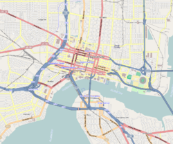
"San Marco" originally designated only one development within South Jacksonville, but the name is now used for much of the former city's territory, south and east of the St. Johns River across from downtown Jacksonville. [1] The place name "South Jacksonville" or Southside has similarly evolved, and now signifies a much larger area of southeastern Duval County. [2] The neighborhood's borders are not official and have changed over time. The boundaries used by the San Marco Preservation Society are Interstate 95 to the north, Philips Highway to the east, Greenridge Road to the south, and the St. Johns River to the west. [3] The area along the riverbank north of I-95, known as the Southbank, was historically part of the community but was designated part of the downtown Jacksonville business district in the 1980s. [4] [5] Notable neighborhoods within San Marco include Colonial Manor and South Riverside. [6] [7] [8] The St. Nicholas neighborhood is immediately to the east of San Marco. [9]

History

Early history

The Red Bank Plantation House, now a private residence in San Marco Jax FL Red Bank Plantation03.jpg
The Red Bank Plantation House, now a private residence in San Marco

Permanent habitation on this part of the St. Johns River came only during Florida's British period, when officials established a ferry crossing at the Cow Ford in 1760. The ferry docked on the river's southern bank, which was thus populated continuously long before what is now downtown Jacksonville. [10] When the Spanish resumed control of Florida in 1783 they built Fort San Nicolas beside the ferry landing in present-day St. Nicholas. [11] In 1793 the Spanish government issued a land grant for a slave plantation, which was eventually taken over by Isaac Hendricks. By 1850, Hendricks had married Elizabeth Hudnall, who owned a large adjacent tract, and his daughter Margaret married Albert Gallatin Philips, owner of the nearby Red Bank Plantation; as a result much of the area was owned by families connected to each other by marriage. [12]

Martha Reed Mitchell MARTHA REED MITCHELL A woman of the century (page 520 crop).jpg
Martha Reed Mitchell

After the American Civil War, the plantations were broken up for residential developments. In 1873, Elizabeth Hendricks sold the eastern part of the Hendricks-Hudnall tract to retiring Florida governor Harrison Reed, who moved there and established the original South Jacksonville development. In 1882, Hendricks developed the western portion of her land as "Oklahoma". South of Oklahoma, Harrison Reed's sister, Martha Reed Mitchell, and her husband Alexander established the vast estate of Alexandria as a winter home. [12] Martha Mitchell became a prominent fixture in Jacksonville society, involved in a number of charities and causes. [13] By 1900, the developments had grown into a community generally known as "South Jacksonville". [12]

South Jacksonville

The former South Jacksonville Grammar School, now converted to lofts Jax FL South Jacksonville Grammar School05.jpg
The former South Jacksonville Grammar School, now converted to lofts
John Fletcher White, Jr., the first Mayor of South Jacksonville John Fletcher White Jnr..jpg
John Fletcher White, Jr., the first Mayor of South Jacksonville

Promoters marketed South Jacksonville as a suburb of Jacksonville, though access to the city across the river was limited to ferries. [12] Following the completion of the FEC Railway Bridge in 1890, several railways serviced South Jacksonville, contributing to its growth. [14] By 1907, South Jacksonville was a regional transit hub with a population of around 600, though it still lacked paved streets, sidewalks, and electric lights. Led by businessman John Fletcher White and the Hendricks and Philips families, residents voted to incorporate the town. S. M. Scruggs was appointed its first mayor; White defeated him in the inaugural election six months after. [6]

Growth came rapidly over the next few years as the town saw the construction of a bank, a public school, a city hall, several sizable industries and a series of amusement parks at present-day Treaty Oak Park. [15] In 1910, Atlantic Boulevard opened between South Jacksonville and the Jacksonville Beaches, further cementing South Jacksonville's place as a hub for car and ferry traffic. [6] By 1917, the town's population was ten times what it had been when it was incorporated, so local leaders planned the original Acosta Bridge, connecting Jacksonville and South Jacksonville by road for the first time. [16]

Jacksonville Journal cover celebrating the opening of the Acosta Bridge St Johns River Bridge Opening - Front page of The Florida Metropolis 30 June 1921.jpg
Jacksonville Journal cover celebrating the opening of the Acosta Bridge

The bridge opened in 1921 and spurred a new wave of development in South Jacksonville. New subdivisions were platted in Oklahoma and Villa Alexandria, including South Shores, Alexandria Place, River Oaks, and the original San Marco development, while the old Red Bank plantation became South Riverside and Colonial Manor. [6] In 1857, the Red Bank Plantation House became a residence in the Colonial Manor neighborhood that grew around it; it is Jacksonville's second oldest residential building still in use. [17] The bridge triggered economic development in South Jacksonville as well, though it greatly reduced the ferry business, which disappeared entirely within twenty years. [6]

San Marco development

San Marco Theatre Cine San Marco.JPG
San Marco Theatre

San Marco, which eventually gave its name to the former area of South Jacksonville, broke ground in 1925 as the city's most ambitious development. It was constructed over 80 acres of the former Villa Alexandria estate, which had deteriorated after Martha Reed Mitchell's death in 1902. [18] The developer was Telfair Stockton, who had previously established the exclusive Avondale neighborhood on the other side of the river. [19] San Marco, designed as a fashionable, upscale development in keeping with Villa Alexandria's reputation, comprised 250 lots and a commercial district. It was remarkably successful from the beginning; apparently driven by land speculation, San Marco shattered local records by selling every lot within three hours of putting them up for sale, even though very little work had begun. [20]

Construction on the first buildings started in 1926. San Marco was originally planned in the Italian Renaissance revival style, which influenced the name of the development and several of its streets. The commercial district was called "San Marco Square" after Venice's Piazza San Marco, and featured several Mediterranean buildings and a fountain. Ultimately, however, few of the homes built there kept to the style, which was falling out of favor at the time. Instead, a diverse mix of contemporary architectural styles appeared in the development in the late 1920s. A former clay pit was landscaped into an artificial lake, Lake Marco. [21]

Unlike most of Jacksonville's neighborhoods, San Marco's momentum and profusion of desirable properties carried it through the collapse of the 1920s Florida land boom and the onset of the Great Depression. While other neighborhoods faltered in the downturn, in 1929, Telfair Stockton formed a company to purchase and develop the remainder of the former Villa Alexandria property as the "First Addition to San Marco". San Marco grew steadily through the 1930s, with new lots selling into the 1940s. [21]

Annexation and later history

By 1931, many Duval County residents were warming to the idea of merging municipal and county governments to reduce bureaucracy, corruption and weak management. As a result, in 1932, citizens of both cities voted for the annexation of South Jacksonville into Jacksonville. [4] [22] While full city-county consolidation was voted down, the efforts of the 1930s set the stage for further attempts, ultimately resulting in the 1968 Jacksonville Consolidation. [23]

In 1937, Jacksonville annexed the neighborhoods on the old Red Bank property. [4] [24] As development continued to spread south of the city limits, much of the former city of South Jacksonville came to be called "San Marco". [1] The area was increasingly integrated into Jacksonville's urban fabric, and in the 1980s the area along the St. Johns River, known as the Southbank, was designated part of the Downtown Jacksonville central business district and was developed primarily for commercial office uses. [4] [5] Meanwhile, the neighborhood began to decline under the pressure of suburban sprawl. In 1975, the San Marco Preservation Society (SMPS) was formed to encourage historic preservation and to revitalize the commercial district. Subsequently, the society and the City of Jacksonville undertook a series of urban renewal projects, including renovating San Marco Square, building a new branch library and park complex, and converting the former South Jacksonville City Hall as the SMPS headquarters. [3] [25]

San Marco Square

Gazebo in San Marco Square Jax FL San Marco gazebo01.jpg
Gazebo in San Marco Square

San Marco Square is the neighborhood's major commercial district. The triangular district is located at the three-way juncture of Atlantic Boulevard, Hendricks Avenue and San Marco Boulevard; a tiered fountain at the center of the square originally marked the convergence of these streets. [21] The San Marco Building, a Mediterranean Revival structure completed in 1927, was the district's first commercial building and set its architectural tone. [26] Other features of the square include the San Marco Theatre, an art deco single-screen movie theater first opened in 1938; [27] and the Little Theatre, home to Theatre Jacksonville, one of the country's oldest community theater troupes. [28]

Designed as the commercial heart of San Marco, the square had declined seriously by the 1970s, with many businesses closing. The original, compass-themed fountain was demolished. In the 1990s, the City of Jacksonville undertook a major renovation and streetscaping project, which included restoring the fountain with three lion statues inspired by the Piazza San Marco. [3] [25] Since then, the square has become a popular commercial destination with many shops, restaurants and bars. In 2013, the square underwent another renovation project that rerouted the streets and expanded the small park in the center, named Balis Park, into a larger pedestrian green space. [29] [30]

Features

San Marco has a number of parks of various sizes and purposes; the San Marco Preservation Society lists fourteen within its boundaries. [31] [32] There are two more in the Southbank: Treaty Oak Park, home of one of Jacksonville's oldest live oaks, [33] and Friendship Fountain Park. [34] Other amenities on the Southbank include the Museum of Science and History (MOSH) and the Southbank Riverwalk. San Marco is served by an elementary school, a middle school, and the Southside Branch Public Library. [31] Two major projects of the San Marco Preservation Society have been the restoration of the former South Jacksonville City Hall as the society's headquarters and the conversion of the former St. Paul's Episcopal Church building into Preservation Hall, a reservable banquet hall. [35] [36]

Notes

  1. 1 2 Wood, p. 260.
  2. McEwen, pp. 59–68.
  3. 1 2 3 Newman, Jennifer (2003). "San Marco History Includes Magnificent Mansions and a Business District Reminiscent of Venice, Italy". jaxhistory.com. Jacksonville Historical Society . Retrieved April 13, 2013.
  4. 1 2 3 4 Wood, p. 252.
  5. 1 2 "Celebrating the River: A Plan for Downtown Jacksonville" (PDF). www.coj.net. City of Jacksonville. 2000. pp. 34–35. Retrieved March 4, 2014.
  6. 1 2 3 4 5 Wood, p. 251.
  7. Davis, Ennis (March 18, 2010). "Urban Neighborhoods: Miramar". Metro Jacksonville . Retrieved April 13, 2013.
  8. Davis, Ennis (August 3, 2010). "Neighborhoods: South Riverside". Metro Jacksonville . Retrieved April 13, 2013.
  9. Wood, pp. 229–231.
  10. Wood, p. 22.
  11. Wood, p. 229.
  12. 1 2 3 4 Wood, p. 250.
  13. Wood, pp. 260–261.
  14. Wood, pp. 250–251.
  15. Wood, pp. 251, 253, 256.
  16. Wood, pp. 85, 251.
  17. Wood, p. 257.
  18. Wood, p. 261.
  19. Wood, pp. 260, 261.
  20. Wood, pp. 261-262.
  21. 1 2 3 Wood, p. 262.
  22. Ward, p. 226.
  23. Ward, pp. 226–237.
  24. Ward, p. 227.
  25. 1 2 Walker, Katherine (February 3, 2002). "Old Jax District is Reborn". Star-Banner . Retrieved April 13, 2013.
  26. Wood, pp. 262, 268.
  27. Wood, p. 268.
  28. Wood, p. 269.
  29. Davis, Ennis (November 9, 2012). "A Public Square for San Marco". Metro Jacksonville . Retrieved April 13, 2013.
  30. Davis, Ennis (August 21, 2013). "Before & After: San Marco Square's Balis Park". Metro Jacksonville . Retrieved September 20, 2013.
  31. 1 2 "Parks". smpsjax.com. San Marco Preservation Society. 2013. Retrieved April 13, 2013.
  32. Davis, Ennis (September 13, 2010). "The 14 Parks of San Marco". Metro Jacksonville . Retrieved April 13, 2013.
  33. Wood, p. 255.
  34. Charlie Patton (June 16, 2011). "Renovated Friendship Fountain will reopen Saturday". The Florida Times-Union. Retrieved April 13, 2013.
  35. "South Jax City Hall". smpsjax.com. San Marco Preservation Society. 2013. Retrieved April 13, 2013.
  36. "Preservation Hall". smpsjax.com. San Marco Preservation Society. 2013. Retrieved April 13, 2013.

Related Research Articles

Jacksonville, Florida Largest city in Florida, United States, located in Duval County

Jacksonville is a city located on the Atlantic coast of Florida, the most populous city in the state, and is the largest city by area in the contiguous United States as of 2020. It is the seat of Duval County, with which the city government consolidated in 1968. Consolidation gave Jacksonville its great size and placed most of its metropolitan population within the city limits. As of 2020, Jacksonville's population is 949,611, making it the 12th most populous city in the U.S., the most populous city in the Southeast, and the most populous city in the South outside of the state of Texas. With a population of 1,733,937, the Jacksonville metropolitan area ranks as Florida's fourth-largest metropolitan region.

Jacksonville Skyway People mover in Jacksonville, Florida, United States

The Jacksonville Skyway is an automated people mover in Jacksonville, Florida, United States, operated by the Jacksonville Transportation Authority (JTA). Opening in 1989 with three stations in Downtown Jacksonville, the Skyway was extended in 1996 following a conversion from its original technology to Bombardier Transportation equipment. It was expanded again in 1998 and 2000. The system currently comprises two routes across 2.5 miles (4.0 km) of track, serving eight stations, and crosses the St. Johns River on the Acosta Bridge. There is currently no fare to ride the Skyway, which had 1.2 million passengers in 2014.

San Marco station Jacksonville Skyway monorail station in Florida, United States

San Marco station is a Jacksonville Skyway people mover station in Jacksonville, Florida. It is located at the corner of San Marco Boulevard and Mary Street in the Southbank area of Downtown Jacksonville. Nearby points of interest include the Museum of Science and History and Friendship Fountain Park.

Riverplace station Jacksonville Skyway monorail station in Florida, United States

Riverplace station is a station of the Jacksonville Skyway in Jacksonville, Florida. It is located at the corner of Mary Street and Flagler Avenue in the Southbank area of Downtown Jacksonville. It is near Riverplace Tower.

Downtown Jacksonville Neighborhood of Jacksonville, Florida

Downtown Jacksonville is the historic core and central business district (CBD) of Jacksonville, Florida USA. It comprises the earliest area of the city to be developed and is located in its geographic center along the narrowing point of the St. Johns River. There are various definitions of what constitutes Jacksonville's downtown; the one used by the city government and other entities defines it as including eight districts: the Central Core, the Southbank, LaVilla, Brooklyn, the Working Waterfront, the Cathedral, the Church, and the Entertainment & Sports District. The area features offices for major corporations such as CSX Corporation, Fidelity National Financial, TIAA Bank, Black Knight Financial, One Call Care Management, Suddath, Interline Brands Haskell, FIS, and Stein Mart.

Neighborhoods of Jacksonville

There are more than 500 neighborhoods within the area of Jacksonville, Florida, the largest city in the contiguous United States by area. These include Downtown Jacksonville and surrounding neighborhoods. Additionally, greater Jacksonville is traditionally divided into several major sections with amorphous boundaries: Northside, Westside, Southside, and Arlington, as well as the Jacksonville Beaches.

Fountain Square, Indianapolis Indianapolis Cultural District in the United States

Fountain Square is one of seven designated cultural districts in Indianapolis, Indiana. Located just outside the city's downtown district, Fountain Square is home to three designated national historic districts, the Laurel and Prospect, the State and Prospect, and the Virginia Avenue districts, all of which were listed on the National Register of Historic Places in 1983. The neighborhood derives its name from the successive fountains that have been prominently featured at the intersection of Virginia Avenue, East Prospect Street, and Shelby Street.

The Bates–Hendricks neighborhood is situated just south and east of the downtown commercial district of Indianapolis, Indiana. The Fountain Square business district is just to the east.

Jacksonville Riverwalks

The Jacksonville Riverwalks are a network of multi-use trails and open space developments along both the north and south banks of the St. Johns River in Jacksonville, Florida. The roughly 2-mile (3.2 km) Downtown Northbank portion travels alongside the Hyatt Regency Jacksonville, Jacksonville Landing, Times-Union Center for the Performing Arts, CSX Transportation Building, and extends into the Brooklyn district. The 1.25-mile (2.01 km) Southbank portion of the trail connects local landmarks such as Friendship Fountain, Museum of Science and History and Riverplace Tower.

Friendship Fountain

Friendship Fountain is a large fountain in Jacksonville, Florida. It is in St. Johns River Park at the west end of Downtown Jacksonville's Southbank Riverwalk attraction. The world's largest and tallest fountain when it opened, it has been one of Jacksonville's most recognizable and popular attractions.

Transportation in Jacksonville, Florida Overview of transportation in Jacksonville, Florida

The Jacksonville transportation network includes ground, air, and sea options for passenger and freight transit. The Jacksonville Port Authority (Jaxport) operates the Port of Jacksonville, which includes container shipping facilities at Blount Island Marine Terminal, the Talleyrand Marine Terminal and the Dames Point Marine Terminal. Jacksonville Aviation Authority managers Jacksonville International Airport in Northside, as well as several smaller airports. The Jacksonville Transportation Authority (JTA) operates bus, people mover, and park-n-ride services throughout the city and region. A major bus terminal at the intermodal Rosa Parks Transit Station serves as JTA's main transit hub. Various intercity bus companies terminate near Central Station. Amtrak operates passenger rail service to and from major cities throughout North America. The city is bisected by major highways, I-95 and I-10, I-295 creates a full beltway around the city.

Riverside and Avondale Neighborhood of Jacksonville, Florida

Riverside and Avondale are two adjacent and closely associated neighborhoods, alternatively considered one continuous neighborhood, of Jacksonville, Florida. The area is primarily residential, but includes some commercial districts, including Five Points, the King Street District, and the Shoppes of Avondale.

Arlington (Jacksonville) Region of Jacksonville in Florida

Arlington is a large region of Jacksonville, Florida, and is generally understood as a counterpart to the city's other large regions, the Urban Core, Northside, Southside, Westside, and the Beaches. It borders the Southside area at its southern end, and has several bridge connections to nearby beaches, the Northside and Downtown. The expansive neighborhood was incorporated into the city in 1968 as a result the Jacksonville Consolidation, a city-county consolidation of the governments of the City of Jacksonville and Duval County. Arlington is known for its mid-century modern architecture, and contains several architectural significant homes designed by local architects Robert C. Broward, Taylor Hardwick, and William Morgan.

Brooklyn (Jacksonville) Neighborhood of Jacksonville, Florida

Brooklyn is a neighborhood of Jacksonville, Florida, considered part of the downtown area. Originally a residential suburb, commercial uses became prominent during the 20th century, particularly along the St. Johns River and Riverside Avenue, and the area became included in Jacksonville's central business district. In the 21st century, it has become the site of mixed-use developments.

Southbank (Jacksonville) Neighborhood of Jacksonville, Florida

The Southbank is a neighborhood of Jacksonville, Florida, considered part of the Urban Core.

Northside (Jacksonville) Region of Jacksonville, Florida, US

The Northside is a large region of Jacksonville, Florida, and is generally understood as a counterpart to the city's other large regions, the Urban Core, Arlington, Southside, Westside, and the Beaches. The expansive area consists of historic communities, cultural landmarks, protected ecosystems and vital transportation and logistics facilities, all fundamental to the history and development of Jacksonville.

Architecture of Jacksonville

The architecture of Jacksonville is a combination of historic and modern styles reflecting the city's early position as a regional center of business. According to the National Trust for Historic Preservation, there are more buildings built before 1967 in Jacksonville than any other city in Florida, but it is also important to note that few structures in the city center predate the Great Fire of 1901. Numerous buildings in the city have held state height records, dating as far back as 1902, and last holding a record in 1981.

The First Coast Flyer is a bus rapid transit (BRT) system in Jacksonville, Florida, owned and operated by the Jacksonville Transportation Authority (JTA). It currently consists of four radial routes running north, southwest, southeast, and east from the Jacksonville Regional Transportation Center in Downtown Jacksonville, where it connects to the Jacksonville Skyway. The first phase, including stations in Downtown Jacksonville and the northbound Green Line, opened in December 2015, with the southbound Blue Line opening in 2016. Additional phases, including the eastbound Red Line and southwestern Orange Line opened in 2018 and 2021, respectively.

The cape of Point La Vista is a bluff in Duval County, located on the eastern bank of the St. Johns River, three miles south of downtown Jacksonville, Florida. It is also the name of one of the subdivisions on the cape. This residential community of single-family homes was created during suburban expansion from the mid-1920's through the 1980s on one of the city's most geographically distinct riverfront locations. The historical boundaries of the cape of Point La Vista date from land grants of the Second Spanish Era (1783-1821). The modern half-loop road of San Jose Blvd. splits off of Hendricks Avenue just after River Oaks Park, the old Oriental Gardens, at Southside United Methodist Church and hugs the pedestrian-friendly contours of the cape for nearly two miles, ending at the Miramar Center, a shopping plaza. The portion of the cape within the old Jacksonville city limits of 1937 overlaps the traditional southern boundary of the San Marco neighborhood. Many places in Duval County are named for families who once owned property at the cape, such as Bowden Road, Shad Road, Sanchez Road, Hendricks Avenue, Philips Highway, and the Hart Bridge.

References