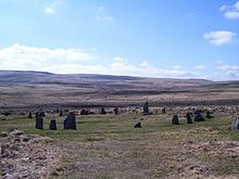
Childe's Tomb is a granite cross on Dartmoor, Devon, England. Although not in its original form, it is more elaborate than most of the crosses on Dartmoor, being raised upon a constructed base, and it is known that a kistvaen is underneath.

The River Teign is a river in the county of Devon, England. It is 31 mi (50 km) long and rises on Dartmoor, becomes an estuary just below Newton Abbot and reaches the English Channel at Teignmouth.
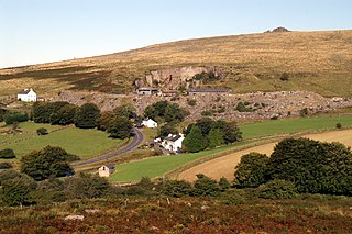
Merrivale is a locality in western Dartmoor, in the West Devon district of Devon, England. It is best known for the nearby series of Bronze Age megalithic monuments to the south and a former granite quarry.
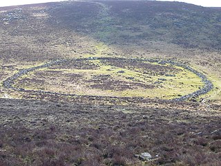
Grimspound is a late Bronze Age settlement, situated on Dartmoor in Devon, England. It consists of a set of 24 hut circles surrounded by a low stone wall. The name was first recorded by the Reverend Richard Polwhele in 1797; it was probably derived from the Anglo-Saxon god of war, Grim.

Bowerman's Nose is a stack of weathered granite on Dartmoor, Devon, England. It is situated on the northern slopes of Hayne Down, about a mile from Hound Tor and close to the village of Manaton at grid reference SX742805. It is about 21.5 feet (6.6 m) high and is the hard granite core of a former tor, standing above a 'clitter' of the blocks that have eroded and fallen from it.
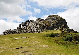
Haytor, also known as Haytor Rocks, Hay Tor, or occasionally Hey Tor, is a granite tor on the eastern edge of Dartmoor in the English county of Devon.
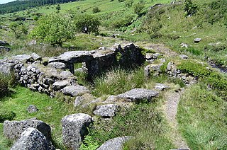
A blowing house or blowing mill was a building used for smelting tin in Cornwall and on Dartmoor in Devon, in South West England. Blowing houses contained a furnace and a pair of bellows that were powered by an adjacent water wheel, and they were in use from the early 14th century until they were gradually replaced by reverberatory furnaces in the 18th century. The remains of over 40 blowing houses have been identified on Dartmoor.
The South Devon Railway Company built and operated the railway from Exeter to Plymouth and Torquay in Devon, England. It was a 7 ft 1⁄4 in broad gauge railway built by Isambard Kingdom Brunel.
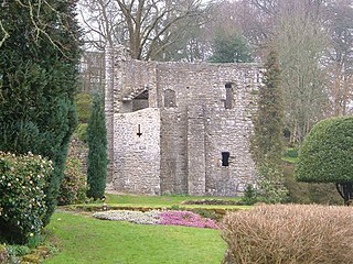
Gidleigh Castle was the manor house of the manor of Gidleigh on the north-eastern edge of Dartmoor, about two miles (3.2 km) north-west of the town of Chagford, Devon, England.
A rock-cut basin is a natural cylindrical depression cut into stream or river beds, often filled with water. Such plucked-bedrock pits are created by kolks; powerful vortices within the water currents which spin small boulders around, eroding out these rock basins by their abrasive action. These basins are frequently found in streams and rivers with a relatively soft rock substrates such as limestones and sandstones. The rather unusual and man-made appearance of such depressions has led to various folk-tales becoming associated with them, such as their identification as petrosomatoglyphs, including knee prints, elbow prints, etc. of saints, heroes, kings or supernatural beings.
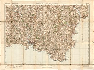
South Devon is the southern part of Devon, England. Because Devon has its major population centres on its two coasts, the county is divided informally into North Devon and South Devon. In a narrower sense "South Devon" is used to refer to the part of Devon south of Exeter and Dartmoor, including Plymouth, Torbay and the districts of South Hams, West Devon and Teignbridge.

North Bovey is a village and civil parish situated on the south-eastern side of Dartmoor National Park, Teignbridge, Devon, England, about 11 miles WSW of the city of Exeter and 1.5 miles SSW of Moretonhampstead. The village lies above the eastern bank of the River Bovey from which it takes its name. In 2001 the population of the parish was 274, compared to 418 in 1901 and 519 in 1801.

The Nine Stones, also known as the Devil's Nine Stones, the Nine Ladies, or Lady Williams and her Dog, is a stone circle located near to the village of Winterbourne Abbas in the southwestern English county of Dorset. Archaeologists believe that it was likely erected during the Bronze Age.

Kingston Russell Stone Circle, also known as the Gorwell Circle, is a stone circle located between the villages of Abbotsbury and Littlebredy in the south-western English county of Dorset. Archaeologists believe that it was likely erected during the Bronze Age. The Kingston Russell ring is part of a tradition of stone circle construction that spread throughout much of Britain, Ireland, and Brittany during the Late Neolithic and Early Bronze Age, over a period between 3,300 and 900 BCE. The purpose of such monuments is unknown, although archaeologists speculate that they were likely religious sites, with the stones perhaps having supernatural associations for those who built the circles.

Cosdon Hill, also called Cosdon Beacon, or Cawsand Beacon, is one of the highest hills on Dartmoor, in Devon, England. It has numerous traces of prehistoric occupation.

Withypool Stone Circle, also known as Withypool Hill Stone Circle, is a stone circle located on the Exmoor moorland, near the village of Withypool in the southwestern English county of Somerset. The ring is part of a tradition of stone circle construction that spread throughout much of Britain, Ireland, and Brittany during the Late Neolithic and Early Bronze Age, over a period between 3300 and 900 BCE. The purpose of such monuments is unknown, although archaeologists speculate that the stones represented supernatural entities for the circle's builders.
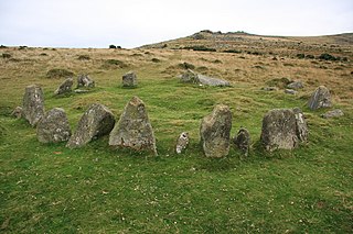
The Nine Maidens, also known as the Seventeen Brothers, is a Bronze Age stone circle located near the village of Belstone on Dartmoor in Devon, England. The stone circle functioned as a burial chamber, although the cairn has since been robbed and the cist, known locally as a kistvaen, destroyed.
Richard Hansford Worth of Plymouth, Devon was a civil engineer, geologist, archaeologist and writer on Dartmoor. He was the author of numerous papers published by the Devonshire Association some of which became the basis of the book Worth’s Dartmoor published posthumously.
