Great Dolmen of Zambujeiro is a megalithic monument located in Nossa Senhora da Tourega, near Valverde, in the municipality of Évora, considered one of the biggest such structures in the Iberian Peninsula.

Loures is a city and a municipality in the central Portuguese Grande Lisboa Subregion. It is situated 13 km to the north of Lisbon. It was created on 26 July 1886 by a royal decree. The population in 2011 was 199,494, in an area of 167.24 km². It borders the municipalities of Odivelas, Sintra, Mafra, Arruda dos Vinhos, Vila Franca de Xira and Lisbon. The municipality is basically divided in three areas: the rustic one, to the north, the urban one, to the south and the urban-industrial, to the east. Portela de Sacavém is the site of Portugal's largest airport.

The Dolmen of Cunha Baixa is a dolmen in the civil parish of Cunha Baixa, in the municipality of Mangualde. It is located in a valley area of the Rio Castelo, between the villages of Cunha Baixa and Espinho.
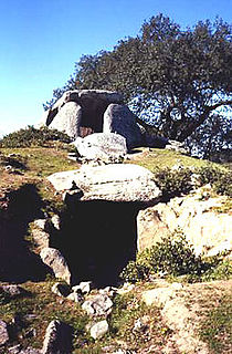
The Great Dolmen of Comenda da Igreja is a megalithic funerary site in the civil parish of Nossa Senhora do Bispo, in the municipality of Montemor-o-Novo, in the central Alentejo region of continental Portugal.
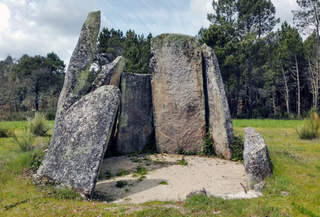
Dolmen of Carapito I is a megalithic monument located in the civil parish of Carapito, in the municipality of Aguiar da Beira in the Guarda District of Portugal.

Anta is the Portuguese name for about 5,000 megaliths built during the Neolithic period in the area of Portugal. The Anta das Pedras Grandes is a late-Neolithic site located in Casal Nova in the parish of Caneças, in the Odivelas municipality, in the Lisbon District of Portugal. It was classified as a National Monument in 1944. Excavations in the early 21st century suggest that it was originally built as a dolmen or single-chamber megalithic tomb, consisting of a polygonal long chamber with eight supporting stones about 3 metres tall, and a short access corridor. There are traces of a tumulus, and human bones have been discovered. Excavations in the surrounding area also identified many flint chippings, suggesting that the area was used for the production of flint items.

The Anta do Monte Abraão was a megalithic dolmen located in the parish of Monte Abraão, in Queluz, Sintra Municipality, Lisbon District, Portugal. The dolmen was first identified in 1876, by Carlos Ribeiro, who carried out excavations until 1878 and published his results in 1880. Excavations suggest that it served as a tomb for about 80 individuals and that it dates back to the middle to end of the Neolithic period. The Anta do Monte Abraão and the nearby Anta da Pedra dos Mouros and Anta da Estria are collectively known as the Antas de Belas.
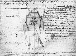
The Anta da Estria is a megalithic dolmen situated between Belas and Queluz in the Lisbon District of Portugal. Based on datings of human remains, it is believed to date back to the late-Neolithic and early-Chalcolithic eras. The Anta da Estria, the Anta do Monte Abraão and the Anta da Pedra dos Mouros are collectively known as the Antas de Belas, and were first identified in the 1870s by Carlos Ribeiro (1813-1882), who is regarded as the "father" of Portuguese prehistoric archaeology.

The Anta da Pedra dos Mouros, also known as the Anta do Senhor da Serra, is a megalithic dolmen situated near Belas and Queluz in the Lisbon District of Portugal. It is believed to date back to the late-Neolithic and early-Chalcolithic eras. The Anta da Pedra dos Mouros, the Anta da Estria, and the Anta do Monte Abraão are a short distance from each other and are collectively known as the Antas de Belas. The Anta da Pedra dos Mouros was first identified in the 1850s by Carlos Ribeiro. Despite being registered and protected as a national monument in 1910, the dolmen has recently suffered significant damage.

The Anta de Agualva, also known as the Anta do Carrascal, is a megalithic dolmen situated in an urban area of Agualva-Cacém in the municipality of Sintra, in the Lisbon District of Portugal. First identified by Carlos Ribeiro in 1875, the dolmen has recently been restored and can be easily visited.
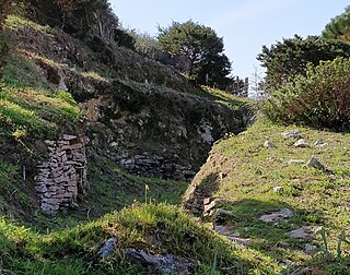
The Praia das Maçãs Prehistoric Monument, also known as the Tholos of Outeiro das Mós, consists of an artificial Neolithic cave and a Chalcolithic domed or beehive tomb. It is situated close to the Praia das Maçãs beach, near the town of Colares in Sintra municipality, in the Lisbon District of Portugal. The area was discovered in 1927. As an important prehistoric sepulchral site, it was classified as a national monument in 1974. Surrounded by housing, the location has been designated as a special zone of protection, and construction is forbidden. Plans by Sintra and the Directorate-General for Cultural Heritage to turn the complex into a museum area, first discussed in 2001, have not yet been implemented. For purposes of protection the site has been covered by sand and there is little presently visible.

The Anta de Carcavelos, located close to the village of Carcavelos near the town of Lousa in the municipality of Loures in the Lisbon District of Portugal, is a stone age dolmen or megalithic monument from the Chalcolithic period. It is one of many such tombs that have been identified in Portugal.
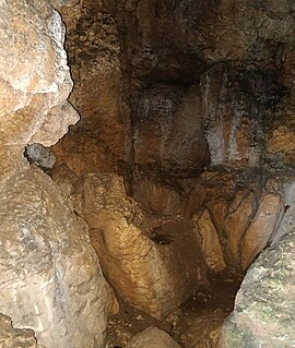
The Cave of Salemas is located close to the village of Lousa in the municipality of Loures in the Lisbon District of Portugal. Discovered by archaeologists during the 1950s, the cave appears to have been occupied by humans as a temporary refuge during the Upper Paleolithic and used as a tomb during the Neolithic.

The four Artificial caves of Casal do Pardo, also known as the Caves of Quinta do Anjo, were neolithic tombs. They are situated in Palmela municipality in the Setúbal District, of Portugal, about 25 km (16 mi) south of the capital of Lisbon. These caves were classified as a National Monument of Portugal in 1934.

The Necropolis of Carenque is an archaeological site consisting of three well-preserved late Neolithic collective sepulchres or tombs, dating back to about 3000 BCE, which are dug into smooth limestone outcrops. It is situated in the municipality of Amadora in the Lisbon District of Portugal.
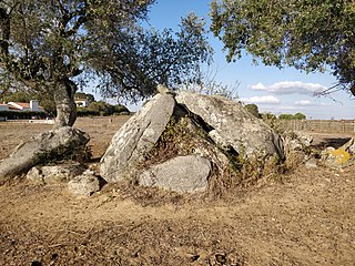
The Antas da Valeira are two Chalcolithic dolmen, or burial chambers, about 100 metres apart, close to the village of Nossa Senhora da Graça do Divor in the Évora district of the Alentejo region of Portugal. Situated in a farm field about one kilometer from the Vale Maria do Meio Cromlech and ten kilometers from the notable megalithic complex of the Almendres Cromlech, these dolmen are among numerous megalithic sites identified in the Évora area. These two monuments have yet to be studied by archaeologists and are in a poor condition.

The Vale Maria do Meio Cromlech is a megalithic stone circle situated in Évora district in the Alentejo region of Portugal. It is believed to date back to the fifth millennium BCE or earlier, and is classified as a National Monument.

The Antas do Olival da Pêga are located near the village of Telheiro, in the municipality of Reguengos de Monsaraz, in the Évora district of the Alentejo region of Portugal. Anta is the Portuguese name for a dolmen, a single-chamber megalithic tomb. These two neolithic dolmens were used over a long period, from the late neolithic to the chalcolithic. The tombs were originally identified by the German archaeologists, Georg and Vera Leisner, who excavated Anta 1, with Anta 2 being subsequently excavated from the 1990s by Victor Gonçalves and Ana Catarina Sousa of the Centre of Archaeology of the University of Lisbon (UNIARQ). In addition to the visible stones at the two sites, which are about 300 meters apart, many items have been found as a result of excavations. Over one hundred people were buried in each tomb. The proximity of the two tombs gives rise to the conclusion that both were part of the same megalithic complex.

The Anta da Vidigueira is a megalithic dolmen or burial chamber located southwest of the village of Freixo, in Redondo municipality in the Évora district of the Alentejo region of Portugal. The dolmen was probably constructed between the Neolithic and the Chalcolithic. It has been classified as a National Monument since 1910.

Georg and Vera Leisner were married German prehistorians and archaeologists who, after becoming a Lt Colonel and a nurse, spent many years studying fourth and third millennia BCE megalithic sites in Iberia. The work of the Leisners is widely acknowledged as one of the most important contributions to the study of the megalithic phenomenon in Iberia. They produced numerous publications on this topic, almost all published jointly, which remain the classic reference works on the Portuguese and Spanish megalithic. They developed a systematic method of research based on direct observation, drawings and photographs, coupled with the discussion of available sources. Over several decades, they visited, studied and described hundreds of megalithic monuments throughout Spain and Portugal. Vera Leisner was born in New York on 4 February 1885 and died in Hamburg on 31 May 1972. Her husband, who was fifteen years older, was born in Kiel on 2 September 1870 and died in Stuttgart on 20 September 1957.


