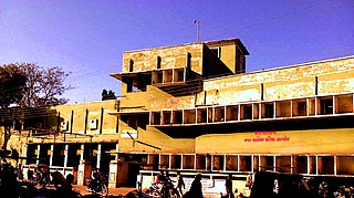
Barwani is a town and a municipality in Barwani district in the state of Madhya Pradesh, India. The town is situated near the left bank of the Narmada River, and is the administrative headquarters of Barwani District. It has served as the capital of the former princely state of Barwani. It can be reached by road only. Bawangaja, a Jain pilgrimage place, is 8 km from Barwani.

Bhind District is a district in the Chambal division of the Indian state of Madhya Pradesh. The town of Bhind is the district headquarters. Bhind District is situated in Chambal region in the northwest of the state. The geographical coordinates of the district are latitude 26°36' N and longitude 78°46' E. It is bounded by Agra, Etawah, Jalaun and Jhansi districts of Uttar Pradesh state to the north and the east, and the Madhya Pradesh districts of Datia to the south, Gwalior to the southwest, and Morena to the west. The geography of the district is characterised by uneven ravines, plain fertile fields and scanty forests. The total area of the district is 4,459 km2.

Khargone district, formerly known as West Nimar district, is a district of Madhya Pradesh state in central India. The district lies in Nimar region, and is part of Indore Division. Under indore Khargone town is the headquarters of this district.
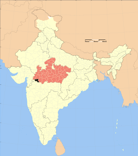
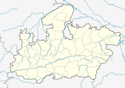
Barwani district is one of the districts of Madhya Pradesh state of India. The administrative headquarters of the district is at Barwani. Barwani district has an area of 5,427 km² and a population 1,385,881. The district lies in the southwestern corner of Madhya Pradesh; the Narmada River forms its northern boundary. The Satpura Range lies to its south. The district is bordered by Maharashtra state to the south, Gujarat state to the west, Dhar District to the north and Khargone District to the east.
Khargone is a city in Madhya Pradesh state of in India. It is the administrative headquarters of the Khargone district. Several major administrative offices of the Khargone District, including the collectorate, police, telecom and various other government organizations are located in the city. The city is situated at the bank of Kunda river and is known for its cotton and chilly production. It is also known for Navgraha Mandir, a temple devoted to the nav grahas. Khargone topped the nation in municipality and received a national award for 'India's Fastest Moving City' under a population of two lakh. City ranked the 15th cleanest city in India in Swachh Survekshan 2018 and ranked 17th cleanest city in India in Swachh Survekshan 2017. Khargone is the 23rd biggest city in the state of Madhya Pradesh.
Shajapur is a town in Malwa region of Madhya Pradesh state in west-central India. It is the head quarters of Shajapur district.
Kasrawad is a subdistrict (tehsil) and nagar panchayat in Khargone district in the Indian state of Madhya Pradesh.
Kukshi is a town in Dhar district of Madhya Pradesh state, India. Kukshi has population of around 37,482 and as it is a tehsil place. Kukshi is famous for the business of cotton, mirchi, gold and silver, and ready made garments.
Manawar is a town with tehsil in Dhar district in the Indian state of Madhya Pradesh. The name Manawar came from name of river Mān that flows at southern edge of the town. Pin code of Manawar is 454446.
Sanawad is an Indian town on the banks of the Bakud River in Khargone district in the Indian state of Madhya Pradesh. It is a popular center for the trade of cotton and chili peppers. Nearby cities include Khargone, Khandwa and Indore.
Sendhwa is a city with a municipal government in Barwani district in the Indian state of Madhya Pradesh. It is the headquarters for Sendhwa Tehsil, and, as of 2011, was the largest town in the district. The name Sendhwa was derived after the rulers Sendhaw (सेंधव) at period of holkars.
Deori " kalan "
is a historical city is situated on the banks of river " Aas " Sukhchain, on the Narsinghpur Sagar road. Deori kalan is a 15k old municipality under Sagar district damoh contituncy in the state of Madhya Pradesh, India.
Thikri is a town and a tehsil in Barwani District, Madhya Pradesh, India. Known in the area for historical, racial and religious 'Gada Khichai' programme on 'Holi', which has been running since 12th century AD.
Borawan is a village in Khargone district in the Indian state of Madhya Pradesh.
Warla is a village in Barwani district in the Indian state of Madhya Pradesh. It is the headquarters of Warla tehsil.
Bhagwanpura, Madhya Pradesh is a village & Tehsil in Khargone district in the Indian state of Madhya Pradesh.
Jhirnya, Madhya Pradesh is a village & tehsil in Khargone district in the Indian state of Madhya Pradesh.
Khedi Khurd is a village in the Khargone district of Madhya Pradesh, India. It is located in the Gogawaa tehsil.
Toksar is a village in Barwah tehsil in Khargone district of Madhya Pradesh, India. It belongs to the Indore division and is located on the south bank of the Narmada river, about 10 km west of Sanawad and 75 km south of Indore. In 2001, its population was 1,473 inhabitants with 758 males and 715 females.
Kenud is a village situated in Madhya Pradesh state of India. It is situated in Khandwa district's Punasa sub-division (tehsil). Joraji Singh Badal (Badaliya-Panwar) founded Kenud village around 1500 AD, It is 120 km (75 mi) from Indore, the commercial capital of the state and 228 km from Bhopal the administrative capital of the state.