Selliampatti, Dharmapuri

Last updated
Selliampatti
செல்லியம்பட்டி
Selliyampatti
Village
India Tamil Nadu location map.svg
Red pog.svg
Selliampatti
Coordinates: 12°10′54″N78°07′27″E / 12.1818°N 78.1241°E / 12.1818; 78.1241
CountryFlag of India.svg  India
State Tamil Nadu
Region Kongu Nadu
District Dharmapuri
Thaluk Palacode
Block Palacode
Panchayat Selliyampatti [1]
Population
 (2011)
  Total4,434
Languages
  Official Tamil
Time zone UTC+5:30 (IST)
PIN
636809
Post Office
Telephone code91-4348
Vehicle registration TN-29
Lok Sabha Constituency Dharmapuri
Lok Sabha Member S. Senthilkumar
Assembly Constituency Pennagaram
Assembly Member G. K. Mani

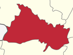
Selliampatti, also spelled as Selliyampatti, is a Grama Panchayath village located in Dharmapuri District, Tamil Nadu, India. [2] It is located ten kilometers northwest of its district capital, Dharmapuri, and thirteen kilometers south of its Thaluk capital, Palacode. [3]

Contents

Demography

According to the 2011 census, the village has a total population of 1,054 with a total population of 4,434. This includes 2301 males and 2138 females. Literacy rate in the village is 61.5%, which is less than Tamil Nadu's average literacy rate of 80.09%. [4]

See also

Related Research Articles

<span class="mw-page-title-main">Dharmapuri</span> City in Tamil Nadu, India

Dharmapuri is a city in the north western part of Tamil Nadu, India. It serves as the administrative headquarters of Dharmapuri district which is the first district created in Tamil Nadu after the independence of India by splitting it from then Salem district on 2 October 1965. The city is located 50 km from Krishnagiri, 69 km from Salem, 60 km from Tirupattur, 90 km from Hosur, 117 km from Thiruvannamalai, 126 km from Bangalore and Erode, 181 km from Tiruppur, 200 km from Coimbatore and Tiruchirappalli, 300 km from Madurai and the state capital Chennai. It is located between latitudes N 11 47’ and 12 33’ and longitudes E 77 02’ and 78 40’. It is one of the major leading cultivators and producers of mangoes in the state along with Krishnagiri, and is often referred as Mango Capital of India.

<span class="mw-page-title-main">Dharmapuri district</span> Place in India

Dharmapuri is one of the 38 districts in the state of Tamil-Nadu, India. It is the first district created in Tamil Nadu after the independence of India by splitting it from then-Salem district on 2 October 1965. Dharmapuri District is one of the major producers of mango in the state, fine quality granite is found in the district. It is also one of the main sericulture belts in the state. Around 30 percent of the district's area is under forest cover. Kaveri enters Tamil Nadu through this district. Dharmapuri district had the lowest literacy rate of 74.23% in Tamilnadu during the 2011 census.

Chengam is an important market town and a taluk headquarter in the Foot hills of Eastern ghats in Tiruvannamalai district of Tamil Nadu, India. Chengam is the gateway to the Chengam pass in the Eastern ghats between Javvadhu hills to the north and Chennakesava hills to the south. The town is also the centre for various industrial activities which includes Sathanur dam hydro-electric project, Aavin milk processing plant and Periya Kolappadi SIDCO estate.

Harur is a Second grade municipality in the Dharmapuri district of Tamil Nadu, India. It is one of two revenue blocks in the district.

<span class="mw-page-title-main">Jayankondam</span> First Grade Municipality in Tamil Nadu, India

Jayankondam is a First Grade Municipality in Ariyalur district of Tamil Nadu in India. As of 2023, the town had a population of 46,000.

<span class="mw-page-title-main">Palakkodu</span> Town panchayat in Tamil Nadu, India

Palacode is a panchayat town in Dharmapuri district in the Indian state of Tamil Nadu.

Papparapatti is a panchayat town in Dharmapuri district in the Indian state of Tamil Nadu. The original name of this town was Pallur Pettai, later it was officially renamed as Papparapatti by the local government.

Pennagaram is a town in Dharmapuri district in the Indian state of Tamil Nadu. It is the headquarters of Pennagaram taluk (sub-district).

Mylaudy is one of the town panchayats in Kanniyakumari district in the Indian state of Tamil Nadu. It is a municipality rich in fields, mountains, rivers and natural resources. Before 1950, Mylaudy was part of South Travancore. Now it is in Kanniyakumari district of Tamil Nadu.

Palacode taluk is a taluk in the Dharmapuri district of the Indian state of Tamil Nadu. The headquarters of the taluk is the town of Palacode. Part of Cauvery North Wildlife Sanctuary is located in this taluk.

Kothamangalam is a panchayat town in the Sivaganga district, in the state of Tamil Nadu, India. Kothamangalam Pin code is 630105 and postal head office is Kothamangalam (Sivaganga).

Appanur is a village in the Kadaladi Taluk of Ramanathapuram District in Tamil Nadu, India. It is located between Mudukulathur and Sayalgudi, on the State Highway 29 (SH29).

Gettupatti is a village in Dharmapuri District of Tamil Nadu State, India.
It comes under Dokkubothanahalli Panchayath and its south regions is covered by thoppur forest.
It is located 20 km towards South from Dharmapuri and 308 km from State capital Chennai.

Endiyur is a village panchayat located in Tindivanam, in the Villupuram district of Tamil-Nadu, India. The native language of the village is Tamil. The village is connected to nearby places through SH-134. The nearest railway station is Tindivanam which is 5 km from the village. Puducherry is 32.8 km from Endiyur. The village has a Draupadi Amman temple.

Varagur is a village in Senthamangalam Taluk, Namakkal district of Tamil Nadu state. Erumaipatti is 7 kilometers and Thathaiyangarpet is 9 kilometers away from the village. The Varagur village is located in the state Tamil Nadu having state code 33 and having the village code 634663. The Namakkal is the district of this village with district code 609. The total geographical area in which this village is expanded in 1,140 hectares. The village is known for the Varagur Venkatesa Perumal Koil, one of the 108 Abhimana Kshethra temples.

Pochampalli is a small town in the Krishnagiri District of Tamil Nadu State, India. It also acts as the headquarters of Pochampalli taluk. Pochampalli is located 27 kilometers south from the district headquarters Krishnagiri, 30 kilometers from Dharmapuri, 30 kilometers from Tirupattur, and 256 kilometers from the state capital Chennai. It is located on SH-60.

Kethanahalli is a small village in Karimangalam block in Dharmapuri District of Tamil Nadu State, India. It comes under Kethanahalli Panchayath. This is situated between Palacode and Karimangalam and also it is located next to Hanumanthapuram Village. This is located 18 km towards North from District headquarters Dharmapuri. Locals and nearest villagers used to called this village has Kethampatti.

Kadagathur is a village panchayath under Dharmapuri Block and in Dharmapuri district in the state of Tamil Nadu, India. This village is located 6 km away from District Capital Dharamapuri. One of the Famous Kadagathur Lake in this village around 800 acres and Siva Temple 1000 years old in beginning of Lake. Village mainly focus Pongal Festival once in a year and Manjuvirattu is famous Celebration during the Festival.

<span class="mw-page-title-main">B. Pallipatti</span> Village panchayat in Tamil Nadu, India

B. Pallipatti is a village in the Dharmapuri district of the Indian state of Tamil Nadu. The village code is 643526, and it is under the jurisdiction of B. Pallipatti Grama panchayath.

Kethureddipatti is a Village Panchayat in Dharmapuri district of Tamil Nadu, India. It is located at 30 km (19 mi) from Dharmapuri town. It comes under Pappireddipatti taluk and Kadathur Block. It belongs to Pappireddipatti State Legislative Assembly Constituency and Dharmapuri Loksabha Constituency. It consists of nine panchayat wards. As per the 2011 Census, the total population of this village is 4,808.

References

  1. "Selliampatty Village in Dharmapuri". eTamilNadu.org. Retrieved 2023-06-17.
  2. "SELLIAMPATTI Pin Code - 636809, Palakkodu All Post Office Areas PIN Codes, Search DHARMAPURI Post Office Address". news.abplive.com. Retrieved 2023-06-17.
  3. "Selliampatti Pin Code | Postal Code (Zip Code) of Selliampatti, Dharmapuri, Tamil Nadu, India". www.indiatvnews.com. Retrieved 2023-06-17.
  4. "Selliyampatti Village Population - Palakkodu - Dharmapuri, Tamil Nadu". www.census2011.co.in. Retrieved 2023-06-17.