
Clay County is a county located in the southwestern part of the U.S. state of Georgia. As of the 2020 census, the population was 2,848, making it the fourth-least populous county in Georgia. The county seat is Fort Gaines.
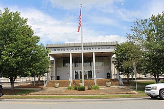
White County is a county in the Northeast region of the U.S. state of Georgia. As of the 2020 census, the population was 28,003. The county seat is Cleveland. The county was created on December 22, 1857, formerly a part of Habersham County and most likely was named for Newton County Representative David T. White, who helped a Habersham representative successfully attain passage of an act creating the new county.
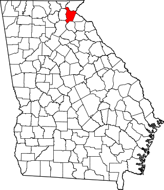
Habersham County is a county in the Northeast region of the U.S. state of Georgia. As of the 2020 census, the population was 46,031. The county seat is Clarkesville. The county was created on December 15, 1818, and named for Colonel Joseph Habersham of the Continental Army in the Revolutionary War.

Barrow County is a county located in the East Central portion of the U.S. state of Georgia. As of the 2020 census, its population was 83,505. Its county seat is Winder. Barrow County is included in the Atlanta–Sandy Springs–Roswell metropolitan statistical area.

Decatur is a city, in Benton County, Arkansas, United States. The population was 1,773 at the 2020 census. It is part of the Northwest Arkansas region. This town is named after Commodore Stephen Decatur, Jr.

Horseshoe Beach is a town in southern Dixie County, Florida, United States. The town is part of Big Bend and the Nature Coast in North Florida, along the Gulf of Mexico. The population was 165 at the 2020 census.

Jennings is a town in Hamilton County, Florida, United States. The population was 749 at the 2020 census, down from 878 at the 2010 census.
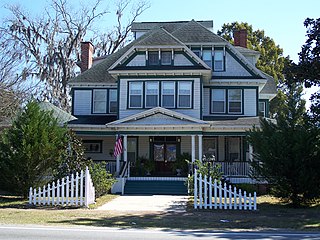
Greenville is a town in Madison County, Florida, United States. The population was 746 at the 2020 census, down from 843 at the 2010 census.
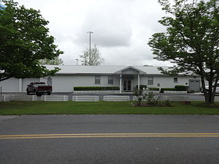
Lee is a town in Madison County, Florida, United States. The Town of Lee is part of the Florida Panhandle in North Florida. The population was 375 at the 2020 census.

Princeton is a census-designated place (CDP) and unincorporated community in Miami-Dade County, Florida, United States. It is part of the Miami metropolitan area of South Florida. The population was 39,208 at the 2020 census, up from 22,038 at the 2010 census.

Vinings is an unincorporated community and census-designated place (CDP) in Cobb County, Georgia, United States that runs along the Chattahoochee River bank across from Buckhead. As of the 2020 census, the CDP had a total population of 12,581. Located next to the affluent Paces section of Buckhead in northwest Atlanta, Vinings is known for its historic sites, shopping districts, proximity to local freeways and The Battery, and nearby nature areas. The United States Postal Service assigns "Atlanta" to the ZIP Code (30339) that includes Vinings.

Morganton is a city in Fannin County, Georgia, United States. The population was 285 at the 2020 census.

Union Point is a city in Greene County, Georgia, United States. As of the 2020 census, the city population was 1,597.

White Plains is a city in Greene County, Georgia, United States. The population was 284 at the 2010 census.
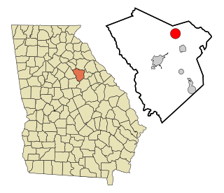
Woodville is a city in Greene County, Georgia, United States. The population was 321 at the 2010 census, down from 400 at the 2000 census.

Hoschton is a city in Jackson County, Georgia, United States. The population was 1,377 at the 2010 census. As of 2018 the estimated population was 1,916.

Talmo is a town in Jackson County, Georgia, United States. The population was 257 at the 2020 census.

Plains is a city in Sumter County, Georgia, United States. The population was 573 at the 2020 census and it is a part of the Americus Micropolitan Statistical Area. It is the birthplace and deathplace of Jimmy Carter and his wife Rosalynn, who were the president and first lady of the United States from 1977 to 1981. They lived in Plains both before and after their time in the White House.

Sidon is a town in Leflore County, Mississippi, United States. The population was 509 at the 2010 census. It is part of the Greenwood, Mississippi micropolitan area.

State Line is a town in Greene and Wayne counties, Mississippi, in the United States. The population was 452 at the 2020 census.


