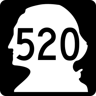
State Route 520 (SR 520) is a state highway and freeway in the Seattle metropolitan area, part of the U.S. state of Washington. It runs 13 miles (21 km) from Seattle in the west to Redmond in the east. The freeway connects Seattle to the Eastside region of King County via the Evergreen Point Floating Bridge on Lake Washington. SR 520 intersects several state highways, including Interstate 5 (I-5) in Seattle, I-405 in Bellevue, and SR 202 in Redmond.

The Evergreen Point Floating Bridge, officially the Governor Albert D. Rosellini Bridge, and commonly called the SR 520 Bridge or 520 Bridge, was a floating bridge in the U.S. state of Washington that carried State Route 520 across Lake Washington, connecting Medina with the Montlake neighborhood of Seattle.

State Route 99 (SR 99), also known as the Pacific Highway, is a state highway in the Seattle metropolitan area, part of the U.S. state of Washington. It runs 49 miles (79 km) from Fife to Everett, passing through the cities of Federal Way, SeaTac, Seattle, Shoreline, and Lynnwood. The route primarily follows arterial streets, including Aurora Avenue, and has several freeway segments, including the tolled SR 99 Tunnel in Downtown Seattle. SR 99 was officially named the William P. Stewart Memorial Highway by the state legislature in 2016, after a campaign to replace an unofficial moniker honoring Confederate president Jefferson Davis.
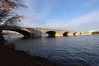
The Arlington Memorial Bridge, often shortened to Memorial Bridge, is a Neoclassical masonry, steel, and stone arch bridge with a central bascule that crosses the Potomac River in Washington, D.C., the capital of the United States. First proposed in 1886, the bridge went unbuilt for decades thanks to political quarrels over whether the bridge should be a memorial, and to whom or what. Traffic problems associated with the dedication of the Tomb of the Unknown Soldier in November 1921 and the desire to build a bridge in time for the bicentennial of the birth of George Washington led to its construction in 1932.

The Salmon Bay Bridge, also known as Bridge 6.3 on the BNSF railroad, formerly Bridge No. 4 on the Great Northern Railroad, is a Strauss Heel-trunnion single-leaf bascule bridge spanning Salmon Bay and connecting Magnolia/Interbay to Ballard in Seattle, Washington. The bridge is located just west of Commodore Park. It carries the main line of the BNSF Railway, the Scenic Subdivision, on its way north to Everett and south to King Street Station and Seattle's Industrial District.

The Fremont Bridge is a double-leaf bascule bridge that spans the Fremont Cut in Seattle, Washington. The bridge, which connects Fremont Avenue North and 4th Avenue North, connects the neighborhoods of Fremont and Queen Anne.

The Montlake Bridge is a double-leaf bascule bridge that carries State Route 513 over Seattle's Montlake Cut—part of the Lake Washington Ship Canal—connecting Montlake and the University District.

The Broadway Bridge is a Rall-type bascule bridge spanning the Willamette River in Portland, Oregon, United States, built in 1913. It was Portland's first bascule bridge, and it continues to hold the distinction of being the longest span of its bascule design type in the world. It was added to the National Register of Historic Places in November 2012.

The Interstate Bridge is a pair of nearly identical steel vertical-lift, Parker through-truss bridges that carry Interstate 5 traffic over the Columbia River between Vancouver, Washington and Portland, Oregon in the United States.
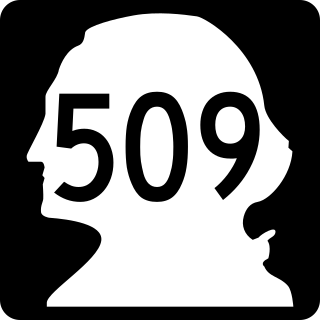
State Route 509 (SR 509) is a 35.17-mile-long (56.60 km) state highway in the U.S. state of Washington, connecting Tacoma in Pierce County to Seattle in King County. The highway travels north from Interstate 705 (I-705) in Tacoma to SR 99 south of downtown Seattle. It serves cities along the Puget Sound and west of Seattle–Tacoma International Airport in south King County, including Federal Way, Des Moines, and Burien. SR 509 is part of the National Highway System and is a limited-access highway near the Port of Tacoma and from Burien to its northern terminus in Seattle.

The West Seattle Bridge, officially the Jeanette Williams Memorial Bridge, is a cantilevered segmental bridge that serves as the primary connection between West Seattle and important highways such as State Route 99, the Spokane Street Viaduct, and Interstate 5. It was built between 1981 and 1984 after the previous bascule bridge was deemed inoperable as a result of being struck by the freighter Antonio Chavez in 1978.

South Park is a neighborhood in Seattle, Washington. It is located just south of Georgetown across the Duwamish River, and just north of the city of Tukwila. Its main thoroughfares are West Marginal Way S., S. Cloverdale Street and 14th Ave. S (north-and-south). South Park connects to Georgetown by two bridges at 1st Ave S. at the northmost end of the neighborhood, and the South Park Bridge at the north end of 14th Ave. South.
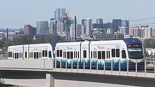
The 2 Line, also known as the East Link Extension, is a light rail line serving the Eastside region of the Seattle metropolitan area in the U.S. state of Washington. It is part of Sound Transit's Link light rail system and runs for 6.6 miles (10.6 km) in the cities of Bellevue and Redmond. The initial segment serves eight stations between South Bellevue and Redmond Technology stations and opened on April 27, 2024. The full line is scheduled to open in 2025 and is planned to include 18 miles (29 km) from west to east and serve twelve stations in Downtown Seattle, Mercer Island, Bellevue, and Redmond. The 2 Line will continue through the Downtown Seattle Transit Tunnel and share stations with the 1 Line through to Lynnwood City Center station.

Northgate is a light rail and bus station in the Northgate neighborhood of Seattle, Washington, United States, and part of 1 Line on Sound Transit's Link light rail system. The transit center, located adjacent to the Northgate Mall, has four bus bays served by 22 routes. The station also has parking for 1,475 vehicles.

The Amtrak Old Saybrook–Old Lyme Bridge is a railroad bridge that carries the Northeast Corridor over the Connecticut River between Old Saybrook and Old Lyme, Connecticut. It is the southernmost crossing of the river before it reaches Long Island Sound. The bridge is a truss bridge with a bascule span, allowing boat traffic to pass through. The bridge is owned by Amtrak; it is used by Amtrak Northeast Regional and Acela intercity trains, Shore Line East local trains, and Providence and Worcester Railroad freight trains. A $1.3 billion replacement bridge began construction in 2024 with completion scheduled for 2031.

Rebuilding American Infrastructure with Sustainability and Equity (RAISE) is an American federal government program administered by the United States Department of Transportation. Originally known as Transportation Investment Generating Economic Recovery (TIGER), it began as supplementary discretionary grant program included in the American Recovery and Reinvestment Act of 2009. Initial legislation provided $1.5 billion for a National Surface Transportation System through September 30, 2011, "to be awarded on a competitive basis for capital investments in surface transportation projects". The program has been extended several times, and was renamed as Better Utilizing Investments to Leverage Development (BUILD) in 2018 before taking its current name in 2021.
The Congress Street Bridge was a movable deck-girder Scherzer rolling-lift bridge in Bridgeport, Connecticut, United States. In 1909, the City of Bridgeport tasked a special commission to oversee the construction of a bridge at Congress Street. The original construction was completed in 1911 for $300,000. The bridge served as a street car, vehicle and pedestrian bridge throughout its service life. In 1997, the bridge was closed after the Connecticut Department of Transportation found the substructure to be moving. The bridge was demolished in 2010 and $40 million funding for a new bridge has since been secured. The Congress Street bridge was on the Connecticut Historical Commission's list of bridges.

The West Spokane Street Bridge was a pair of bascule bridges that crossed the west fork of the Duwamish River in Seattle, Washington, United States. The bridges connected the SoDo and West Seattle neighborhoods over the river. The original bridge opened to traffic in 1924; a second bridge carrying eastbound traffic was opened in 1930, with the 1924 bridge reconfigured to carry westbound traffic.

Redmond Technology station, formerly Overlake Transit Center, is a bus and light rail station in Redmond, Washington, United States. The bus station opened in 2002 adjacent to State Route 520 on the headquarters campus of Microsoft. It was served by Sound Transit Express and King County Metro, as well as Microsoft's private shuttle buses. The light rail station is the eastern terminus of the 2 Line, part of Sound Transit's Link light rail system, and opened on April 27, 2024.


