South Wallins, Kentucky

Last updated

South Wallins, Kentucky
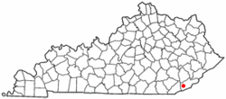
KYMap-doton-SouthWallins.PNG
Location of South Wallins, Kentucky
Coordinates: 36°48′59″N83°24′41″W / 36.81639°N 83.41139°W / 36.81639; -83.41139
Country United States
State Kentucky
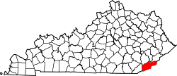
County Harlan
Area
[1]
  Total6.34 sq mi (16.42 km2)
  Land6.31 sq mi (16.35 km2)
  Water0.03 sq mi (0.07 km2)
Elevation
1,142 ft (348 m)
Population
 (2020)
  Total838
  Density132.74/sq mi (51.25/km2)
Time zone UTC-5 (Eastern (EST))
  Summer (DST) UTC-4 (EDT)
FIPS code 21-72255
GNIS feature ID0503985

South Wallins is an unincorporated community and census-designated place (CDP) in Harlan County, Kentucky, United States. The population was 859 at the 2010 census, [2] down from 996 at the 2000 census.

Contents

Geography

South Wallins is located in western Harlan County at 36°48′59″N83°24′41″W / 36.81639°N 83.41139°W / 36.81639; -83.41139 (36.816469, -83.411475), [3] in the valley of Wallins Creek, a north-flowing tributary of the Cumberland River. The CDP is bordered to the north by the community of Wallins Creek. Kentucky Route 219 is the main road through the community, leading north (downstream) 1.5 miles (2.4 km) to U.S. Route 119 at Wallins Creek and south 3.5 miles (5.6 km) to its dead-end in Creech.

According to the United States Census Bureau, the South Wallins CDP has a total area of 6.3 square miles (16.4 km2), of which 0.03 square miles (0.08 km2), or 0.49%, are water. [2]

Demographics

Historical population
CensusPop.Note
2020 838
U.S. Decennial Census [4]

As of the census [5] of 2000, there were 996 people, 405 households, and 287 families residing in the CDP. The population density was 158.4 inhabitants per square mile (61.2/km2). There were 448 housing units at an average density of 71.2 per square mile (27.5/km2). The racial makeup of the CDP was 97.29% White, 0.20% Native American, and 2.51% from two or more races. Hispanic or Latino of any race were 1.20% of the population.

There were 405 households, out of which 33.6% had children under the age of 18 living with them, 55.3% were married couples living together, 13.8% had a female householder with no husband present, and 28.9% were non-families. 26.7% of all households were made up of individuals, and 14.3% had someone living alone who was 65 years of age or older. The average household size was 2.46 and the average family size was 2.98.

In the CDP, the population was spread out, with 26.1% under the age of 18, 7.4% from 18 to 24, 27.4% from 25 to 44, 24.1% from 45 to 64, and 15.0% who were 65 years of age or older. The median age was 38 years. For every 100 females, there were 88.3 males. For every 100 females age 18 and over, there were 81.3 males.

The median income for a household in the CDP was $19,650, and the median income for a family was $23,083. Males had a median income of $30,417 versus $18,906 for females. The per capita income for the CDP was $9,357. About 32.6% of families and 36.7% of the population were below the poverty line, including 44.3% of those under age 18 and 15.5% of those age 65 or over.

Related Research Articles

<span class="mw-page-title-main">Central Heights-Midland City, Arizona</span> CDP in Gila County, Arizona

Central Heights-Midland City is an unincorporated community and census-designated place (CDP) in Gila County, Arizona, United States. The area is home to the Pinal Cemetery which serves the community in gereneral but also contains Croatian and Serbian dedicated sections. The Gila County Health and Human Services offices are located within the region. One of the communities few nurseries is located along Golden Hill Road, a notable road in the Central Heights-Midland City area. The population was 2,534 at the 2010 census.

<span class="mw-page-title-main">Benham, Kentucky</span> City in Kentucky, United States

Benham is a home rule-class city in Harlan County, Kentucky, in the United States. The city was formally incorporated by the General Assembly in 1961. The population was 512 at the 2020 census, up from 500 at the 2010 census.

<span class="mw-page-title-main">Cumberland, Kentucky</span> City in Kentucky, United States

Cumberland is a home rule-class city in Harlan County, Kentucky, in the United States. The population according to the 2010 Census was 2,237, down from 2,611 at the 2000 census.

<span class="mw-page-title-main">Evarts, Kentucky</span> City in Kentucky, United States

Evarts is a home rule-class city in Harlan County, Kentucky, in the United States. The post office was opened on February 9, 1855, and named for one of the area's pioneer families. The city was formally incorporated by the state assembly in 1921. The population was 962 at the 2010 census.

<span class="mw-page-title-main">Harlan, Kentucky</span> City in Kentucky, United States

Harlan is a home rule-class city in and the county seat of Harlan County, Kentucky, United States. The population was 1,745 at the 2010 census, down from 2,081 at the 2000 census.

<span class="mw-page-title-main">Loyall, Kentucky</span> City in Kentucky, United States

Loyall is a home rule-class city in Harlan County, Kentucky, in the United States. The population was 1,461 as of the 2010 census, up from 766 at the time of the 2000 census.

<span class="mw-page-title-main">Lynch, Kentucky</span> City in Kentucky, United States

Lynch is a home rule-class city in Harlan County, Kentucky, United States. In the 2020 census the city population was 658, down from 747 in 2010.

<span class="mw-page-title-main">Wallins Creek, Kentucky</span> Census-designated place in Kentucky, United States

Wallins Creek is an unincorporated community and census-designated place (CDP) in Harlan County, Kentucky, United States. The population was 156 at the 2010 census, when it was still a city, having dropped from 257 at the 2000 census.

<span class="mw-page-title-main">Pine Knot, Kentucky</span> Census-designated place in Kentucky, United States

Pine Knot is an unincorporated community and census-designated place (CDP) in McCreary County, Kentucky, United States. The population was 1,380 at the 2020 census, down from 1,621 in 2010.

<span class="mw-page-title-main">Stearns, Kentucky</span> Census-designated place in Kentucky, United States

Stearns is an unincorporated community and census-designated place (CDP) in McCreary County, Kentucky, United States. The population was 1,365 at the 2020 census. It was founded by Justus Smith Stearns.

<span class="mw-page-title-main">Whitley City, Kentucky</span> Census-designated place in Kentucky, United States

Whitley City is an unincorporated community and census-designated place (CDP) in McCreary County, Kentucky, United States. The population was 968 at the 2020 census, down from 1,170 in 2010. It is the county seat of McCreary County. Whitley City is one of two unincorporated county seats in Kentucky.

<span class="mw-page-title-main">Bloomingdale, Ohio</span> Village in Ohio, United States

Bloomingdale is a village in central Jefferson County, Ohio, United States. The population was 145 at the 2020 census. It is part of the Weirton–Steubenville metropolitan area.

Cloud Creek is an unincorporated community and census-designated place (CDP) in Delaware County, Oklahoma, United States. The population was 121 at the 2010 census, a 40.7 percent increase over the figure of 86 recorded in 2000 census.

Mount Gretna Heights is an unincorporated community and census-designated place (CDP) in Lebanon County, Pennsylvania, United States, adjacent to the borough of Mount Gretna. The population was 323 at the 2010 census.

<span class="mw-page-title-main">Dentsville, South Carolina</span> Census-designated place in South Carolina, United States

Dentsville is a census-designated place (CDP) in Richland County, South Carolina, United States. The population was 14,062 at the 2010 census. It is part of the Columbia, South Carolina, Metropolitan Statistical Area.

<span class="mw-page-title-main">Scenic Oaks, Texas</span> Census-designated place in Texas, United States

Scenic Oaks is a census-designated place (CDP) in Bexar County, Texas, United States. It is part of the San Antonio Metropolitan Statistical Area. The population was 10,458 at the 2010 census, up from 4,957 at the 2010 census.

<span class="mw-page-title-main">Ewing, Virginia</span> Census-designated place in Virginia, United States

Ewing is an unincorporated community and census-designated place (CDP) in Lee County, Virginia. The population was 439 at the 2010 U.S. Census. Ewing is one of the westernmost settlements in the Commonwealth of Virginia, before reaching the Cumberland Gap and the borders with Kentucky and Tennessee.

<span class="mw-page-title-main">Keokee, Virginia</span> Census-designated place in Virginia, United States

Keokee is an unincorporated community and census-designated place (CDP) in Lee County, Virginia, United States. The population was 416 at the 2010 census.

<span class="mw-page-title-main">Rose Hill, Lee County, Virginia</span> Census-designated place in Virginia, United States

Rose Hill is an unincorporated community and census-designated place (CDP) in Lee County, Virginia, United States. The population was 799 at the 2010 census, up from 714 at the 2000 census.

<span class="mw-page-title-main">North Corbin, Kentucky</span> Census-designated place in Kentucky, United States

North Corbin is a census-designated place (CDP) in Laurel and Knox counties in the U.S. state of Kentucky. The population was 1,727 at the 2020 census down from 1,773 at the 2010 census. The census bureau also lists the Laurel County portion of North Corbin as a CCD with a population of 10,729.

References

  1. "2020 U.S. Gazetteer Files". United States Census Bureau. Retrieved March 18, 2022.
  2. 1 2 "Geographic Identifiers: 2010 Demographic Profile Data (G001): South Wallins CDP, Kentucky". American Factfinder. U.S. Census Bureau. Retrieved June 29, 2017.[ dead link ]
  3. "US Gazetteer files: 2010, 2000, and 1990". United States Census Bureau. February 12, 2011. Retrieved April 23, 2011.
  4. "Census of Population and Housing". Census.gov. Retrieved June 4, 2016.
  5. "U.S. Census website". United States Census Bureau . Retrieved January 31, 2008.