Staffordsville, Kentucky | |
---|---|
Coordinates: 37°49′47″N82°50′32″W / 37.82972°N 82.84222°W Coordinates: 37°49′47″N82°50′32″W / 37.82972°N 82.84222°W | |
Country | United States |
State | Kentucky |
County | Johnson |
Elevation | 669 ft (204 m) |
Population (2000) | |
• Total | 2,403 |
Time zone | UTC-5 (Eastern (EST)) |
• Summer (DST) | UTC-4 (EDT) |
ZIP codes | 41256 |
GNIS feature ID | 504227 |
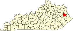
Staffordsville is an unincorporated community in Johnson County, Kentucky, United States. The community was originally named Frew and the first post office was established on July 14, 1882, with Millard F. Rule as postmaster but in 1893, postmistress Jessie Stafford changed the post office's name to "Staffordsville" in order to honor her family. [1] Staffordsville's ZIP code is 41256.
Staffordsville has an elevation of 669 feet. [2]
As of the census of 2000, [3] there were 2,403 people, 938 households, and 745 families residing in the ZIP Code Tabulation Area (ZCTA). The racial makeup of the ZCTA was 98.7% White, 0.0% African American 0.1% Native American, and 0.7% Asian.
There were 938 households, out of which 35.1% had children under the age of 18, 65.1% were married couples living together, 10.6% had a female householder with no husband present, and 20.6% were non-families. 19.0% of all households were made up of individuals, and 18.8% had someone living alone who was 65 years of age or older. The average household size was 2.56 and the average family size was 2.90.
The median income for a household in the ZCTA was $30,865, and the median income for a family was $34,878. Males had a median income of $26,938 versus $21,250 for females. The per capita income was $17,954. About 14.6% of the families in the ZCTA were below the poverty line.
Staffordsville is the hometown of country singer Chris Stapleton.
Most students living in Staffordsville attend: [4]
Martin Township is a civil township of Allegan County in the U.S. state of Michigan. The population was 2,629 at the 2010 census.
Colfax Township is a civil township of Mecosta County in the U.S. state of Michigan. The population was 1,975 at the 2000 census.
Morton Township is a civil township of Mecosta County in the U.S. state of Michigan. The population was 3,597 at the 2000 census.
Day Township is a civil township of Montcalm County in the U.S. state of Michigan. As of the 2000 census, the township population was 1,282.
Robinson Township is a civil township of Ottawa County in the U.S. state of Michigan. The population was 5,588 at the 2000 census.
Bridgeport is an unincorporated community in Bridgeport Charter Township, Saginaw County in the U.S. state of Michigan. It is also a census-designated place (CDP) for statistical purposes. The population was 7,849 at the 2000 census. Bridgeport is also the name of a post office with ZIP code 48722. The area served by the ZIP code includes the southeast portion of the CDP and includes southeastern portions of Bridgeport Charter Township outside of the CDP as well as portions of southwest Frankenmuth Township and a small area of northeastern Birch Run Township. The remainder of the CDP area is served by the Saginaw ZIP code 48601.
Custer Township is a civil township of Sanilac County in the U.S. state of Michigan. The population was 1,036 at the 2000 census.
Elk Township is a civil township of Sanilac County in the U.S. state of Michigan. The population was 1,584 at the 2000 census.
Almer Charter Township is a charter township of Tuscola County in the U.S. state of Michigan. The population was 3,101 at the 2010 census. It is the only charter township in the Upper Thumb region of Michigan.
Gilford Township is a civil township of Tuscola County in the U.S. state of Michigan. The population was 741 at the 2010 Census.
Tuscola Township is a civil township of Tuscola County in the U.S. state of Michigan. The population was 2,082 at the 2010 Census.
Deepwater is an unincorporated community located within Pennsville Township, in Salem County, New Jersey, United States. The community is located at the east end of the Delaware Memorial Bridge. Deepwater is the location of the United States Postal Service area covering ZIP code 08023. At the 2000 census, the ZCTA had a population of 345.
Van Lear is an unincorporated community and coal town in Johnson County, Kentucky, United States.
Hager Hill (also Hagerhill) is an unincorporated community in Johnson County, Kentucky, United States. Hager Hill is located approximately four miles south of Paintsville, the county seat of Johnson County.
Oil Springs is an unincorporated community in Johnson County, Kentucky, United States. It lies along Route 40 west of the city of Paintsville, the county seat of Johnson County. It has a post office with the ZIP code 41238.
Tutor Key is an unincorporated community in Johnson County, Kentucky, United States about 4.5 miles northeast of Paintsville. Tutor Key was originally known as Mingo.
Flat Gap is an unincorporated community in Johnson County, Kentucky, United States. The community was named after the "flat gap" formed at the divide between the Lower Laurel and Mudlick Creeks. Flat Gap's first post office was established on February 26, 1873, with Henry Jayne as postmaster. Its ZIP code is 41219.
Wittensville is an unincorporated community in Johnson County, Kentucky, United States. Wittensville's ZIP code is 41274. It has a United States Postal Service, which stands besides a Dollar General which was constructed in June 2019. It also has an East Kentucky Realty estate agency.
Wheatland Township is a civil township of Mecosta County in the U.S. state of Michigan. The population was 1,474 at the 2000 census.
Richland Township is a civil township of Montcalm County in the U.S. state of Michigan. The population was 2,868 at the 2000 census.
{{cite web}}
: Missing or empty |title=
(help)