The Steinway Street station is a local station on the IND Queens Boulevard Line of the New York City Subway. Located under Steinway Street between Broadway and 34th Avenue, it is served by the M train on weekdays, the R train at all times except nights, and the E and F trains at night.
History
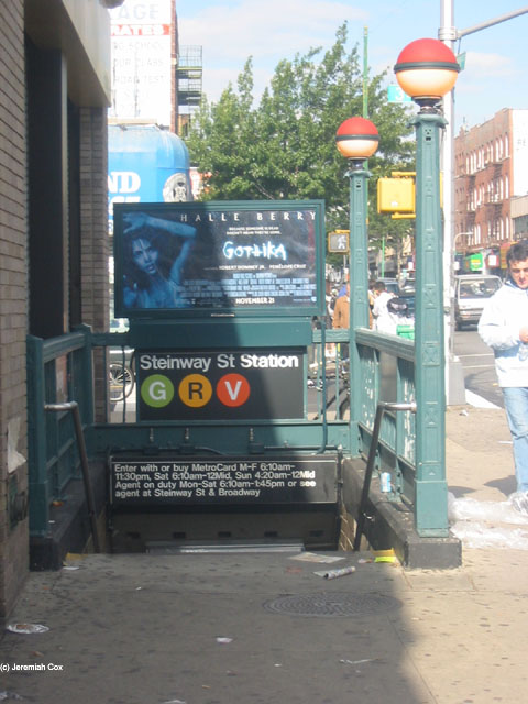
Entrance at the southwestern corner of 34th Avenue and Steinway Street
In 2019, as part of an initiative to increase the accessibility of the New York City Subway system, the MTA announced that it would install elevators at the Steinway Street station as part of the MTA's 2020–2024 Capital Program.[14] In November 2022, the MTA announced that it would award a $965 million contract for the installation of 21 elevators across eight stations,[15] including Steinway Street.[16][17]:81 A joint venture of ASTM and Halmar International would construct the elevators under a public-private partnership.[16][17]:80
This underground station has two tracks and two side platforms. The E and F trains serve the station at night,[18][19] the M train serves the station on weekdays during the day,[20] and the R train serves the station at all times except late nights.[21] The station is between 36th Street to the west and 46th Street to the east.[22]
Both platform walls have a purple tile band with a black border and mosaic name tablets reading "STEINWAY ST." in white sans-serif lettering on a black background and purple border. Small tile captions reading "STEINWAY" in white on black run below the tile band, and directional signs in the same style are present under some of the name tablets.[citation needed] The tile band was part of a color-coded tile system used throughout the IND.[23] The tile colors were designed to facilitate navigation for travelers going away from Lower Manhattan. As such, the purple tiles used at the Steinway Street station were originally also used at Queens Plaza, the next express station to the west, while a different tile color is used at Jackson Heights–Roosevelt Avenue, the next express station to the east. Purple tiles are similarly used at the other local stations between Queens Plaza and Roosevelt Avenue.[24][25]
Royal purple I-beam columns run along both platforms at regular intervals, alternating ones having the standard black station name plate with white lettering.[citation needed] The I-beam piers are located every 15 feet (4.6m) and support girders above the platforms. The roof girders are also connected to columns in the platform walls.[26]:3 The tunnel is covered by a U-shaped trough that contains utility pipes and wires. The outer walls of this trough are composed of columns, spaced approximately every 5 feet (1.5m) with concrete infill between them. There is a 1-inch (25mm) gap between the tunnel wall and the platform wall, which is made of 4-inch (100mm)-thick brick covered over by a tiled finish. The columns between the tracks are also spaced every 5 feet (1.5m), with no infill.[26]:3
South of this station, the express tracks rejoin the local tracks and the line becomes four tracks again.
Exits
Southern station mezzanine
There are two separate mezzanines, one at each end of the station, and crossover is allowed on both of them. The side on Steinway Street near Broadway has two street stairs and has a token booth; this used to be the only full-time fare control area. This mezzanine has two small staircases to the southbound side and a single platform-wide staircase on the northbound side. The former part-time fare control area at 34th Avenue and Steinway Street—since converted to a secondary full-time fare control area—currently has no booth (it had been completely dismantled for asbestos abatement), and is HEET turnstile access at all times. This side has two stairs to the street to the northeast and southwest corners, and one to each platform.[27]
In 2003, the hours for this token booth were 6:10a.m. to 1:45p.m. Mondays through Saturdays. The entrances on this side, at the time, were only open 6:10a.m. to 11:30a.m. Mondays through Fridays, 6:10a.m. to 12:00a.m. Saturdays, and 4:20a.m. to 12:00a.m. Sundays.[28] In 2009, the MTA proposed closing the part-time booth, which was then open 6:10a.m. to 1:30p.m. Mondays through Saturdays. Access to this entrance has been added through HEET access between 2003 and 2009.[29]
12"New York MPS Elmhurst Avenue Subway Station (IND)". Records of the National Park Service, 1785 - 2006, Series: National Register of Historic Places and National Historic Landmarks Program Records, 2013 - 2017, Box: National Register of Historic Places and National Historic Landmarks Program Records: New York, ID: 05000672. National Archives.
Note: Service variations, station closures, and reroutes are not reflected here. Stations with asterisks have no regular peak, reverse peak, or midday service on that route. See linked articles for more information.
Stations and line segments in italics are closed, demolished, or planned (temporary closures are marked with asterisks). Track connections to other lines' terminals are displayed in brackets. Struck through passenger track connections are closed or unused in regular service.
This page is based on this Wikipedia article Text is available under the CC BY-SA 4.0 license; additional terms may apply. Images, videos and audio are available under their respective licenses.


