Sutphin Boulevard station (IND Queens Boulevard Line)

Last updated

 Sutphin Blvd
  NYCS-bull-trans-F-Std.svg NYCS-bull-trans-Fd-Std.svg
MTA NYC logo.svg New York City Subway station (rapid transit)
IND Queens Boulevard Sutphin Boulevard Northbound Platform.jpg
Northbound platform
Station statistics
Address Sutphin Boulevard & Hillside Avenue
Queens, NY 11435
Borough Queens
Locale Jamaica
Coordinates 40°42′21″N73°48′35″W / 40.705726°N 73.809714°W / 40.705726; -73.809714
Division B (IND) [1]
Line IND Queens Boulevard Line
Services    F   NYCS-SSI-alltimes.svg (all times) <F> NYCS-SSI-rushpeak.svg  (two rush hour trains, peak direction)
TransitAiga bus trans.svg NYCT Bus: Q20A, Q20B, Q43, Q44 SBS, X68
Aiga bus trans.svg MTA Bus: Q40
StructureUnderground
Platforms2 side platforms
Tracks4
Other information
OpenedApril 24, 1937(87 years ago) (1937-04-24) [2]
Opposite-
direction
transfer
Yes
Traffic
20235,941,974 [3] Increase2.svg 24.6%
Rank35 out of 423 [3]
Services
Preceding station MTA NYC logo.svg New York City Subway Following station
Briarwood
F   NYCS-SSI-alltimes.svg <F> NYCS-SSI-rushpeak.svg
NYCS-bull-trans-F-Std.svg NYCS-bull-trans-Fd-Std.svg
Local
Parsons Boulevard
F   NYCS-SSI-alltimes.svg <F> NYCS-SSI-rushpeak.svg
Location
NYCS map blank.svg
Map pointer.svg
USA New York City location map.svg
Map pointer.svg
USA New York location map.svg
Map pointer.svg
Track layout

Contents

BSicon MFADEg.svg
BSicon uvSTR.svg
BSicon MFADEg.svg
BSicon uvSTR.svg
BSicon udSTRf.svg
BSicon uvSTR.svg
BSicon udSTRg.svg
BSicon dBSl.svg
BSicon uvSTR.svg
BSicon uvSTR.svg
BSicon dBSr.svg
BSicon dBSl.svg
BSicon uvSTR.svg
BSicon uvSTR.svg
BSicon dBSr.svg
BSicon numN285.svg
BSicon dBSl.svg
BSicon uvSTR.svg
BSicon uvSTR.svg
BSicon dBSr.svg
BSicon dBSl.svg
BSicon uvSTR.svg
BSicon uvSTR.svg
BSicon dBSr.svg
BSicon udSTRf.svg
BSicon uvSTR.svg
BSicon udSTRg.svg
BSicon MFADEf.svg
BSicon uvSTR.svg
BSicon MFADEf.svg
BSicon uvSTR.svg
Street map

Sutphin Boulevard station (IND Queens Boulevard Line)

Station service legend
SymbolDescription
NYCS-SSI-alltimes.svg Stops all times
NYCS-SSI-rushpeak.svg Stops rush hours in the peak direction only (limited service)

The Sutphin Boulevard station is a local station on the IND Queens Boulevard Line of the New York City Subway. Located at Sutphin Boulevard and Hillside Avenue in Jamaica, Queens, it is served by the F train at all times, the <F> train during rush hours in the reverse peak direction, and a few rush-hour E trains to Jamaica–179th Street during p.m. rush hours. [4]

A red-painted arrow at the station directing riders to the Long Island Rail Road Sutphin Blvd; LIRR Red Arrow.jpg
A red-painted arrow at the station directing riders to the Long Island Rail Road

This station opened on April 24, 1937 as part of an extension of the Independent Subway System's Queens Boulevard Line. In 1953, the platforms at the station were extended to accommodate 11-car trains. Ridership at this station decreased sharply after the opening of the Archer Avenue lines in 1988. This had been the closest subway station to the Long Island Rail Road's Jamaica station after the removal of a portion of the Jamaica Elevated in 1977.

History

Construction

The Queens Boulevard Line was one of the first built by the city-owned Independent Subway System (IND), and was planned to stretch between the IND Eighth Avenue Line in Manhattan and 178th Street and Hillside Avenue in Jamaica, Queens. [5] [6] The line was first proposed in 1925. [7] Construction of the line was approved by the New York City Board of Estimate on October 4, 1928. [8] On December 23, 1930, the contract for the construction of the section between 137th Street (now the Van Wyck Expressway) and 178th Street—Route 108, Section 11—was let. This section included the stations at 169th Street, Parsons Boulevard, Sutphin Boulevard, and Briarwood. [9] As planned, Parsons Boulevard was to be an express stop, while the other three stations, including Sutphin Boulevard, would be local stops. [10] The contract for this section was awarded to Triest Contracting Corporation. [11] The line was constructed using the cut-and-cover tunneling method, and to allow pedestrians to cross, temporary bridges were built over the trenches. [12]

The first section of the line opened on August 19, 1933 from the connection to the Eighth Avenue Line at 50th Street to Roosevelt Avenue in Jackson Heights. [13] Later that year, a $23 million loan was approved to finance the remainder of the line, along with other IND lines. [14] The remainder of the line was built by the Public Works Administration. [15] In summer 1933 work on this station and 169th Street were completed, far ahead of schedule. [11] In 1934 and 1935, construction of the extension to Jamaica was suspended for 15 months and was halted by strikes. [16] Construction was further delayed due to a strike in 1935, instigated by electricians opposing wages paid by the General Railway Signal Company. [17]

In August 1936, tracks were installed all the way to 178th Street, and the stations to Union Turnpike were completed. The stops to the east, including Sutphin Boulevard, still needed to be tiled and did not have stairways, turnstiles and lighting installed. [16] Two additional contracts remained to be put up for bid, both the results of last minute changes; one such contract involved moving the eastern terminal from 178th to 169th Street. [18] In addition, a new tunnel roof and new side supports had to be constructed. [19] A 3.5-mile (5.6 km) extension from Roosevelt Avenue to Kew Gardens opened on December 31, 1936. [20] In March 1937, the extension to 169th Street was expected to be opened on May 1, requiring work to be finished by April 3, and fully approved and tested by April 20. As of this point, minor station work remained, including the installation of light bulbs, with the only major work left to be completed being the final 200 feet (61 m) of track in the 169th Street terminal. [19]

Opening

On April 9, 1937, Mayor Fiorello La Guardia announced that the operation of the $14.4 million extension to Jamaica and express service would begin on April 24. [21] [22] The extension to Hillside Avenue and 178th Street, with a terminal station at 169th Street, opened as planned on April 24, 1937. [23] [2] [24] Service was initially provided by E trains, which began making express stops from 71st–Continental Avenues to Queens Plaza during rush hours on the same date, and by EE local trains during non-rush hours. The express service operated between approximately 6:30 and 10:30 a.m. and from 3:00 p.m. to 7:00 p.m., [15] [25] and ran every three to five minutes. [26] This extension was celebrated with a ribbon-cutting ceremony at the Parsons Boulevard station and with a parade along Hillside Avenue. [27] On December 15, 1940, F trains began running via the newly opened IND Sixth Avenue Line and along the Queens Boulevard Line's express tracks; they skipped the Sutphin Boulevard station. [28]

Changes

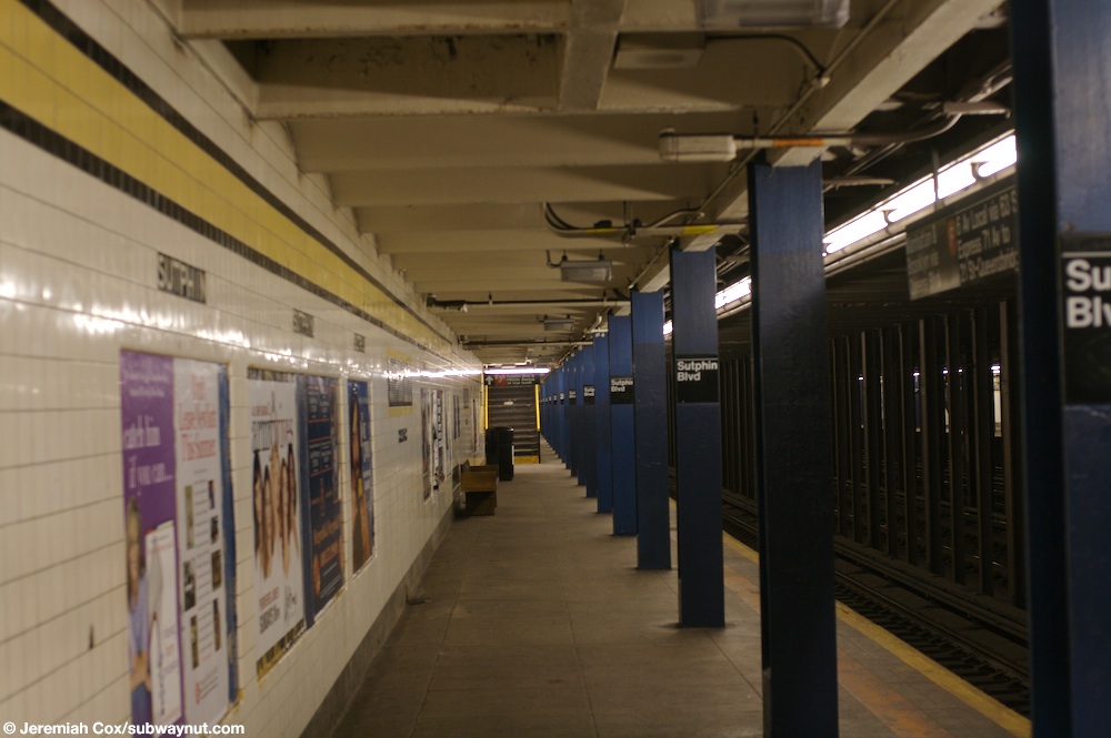
In 1953, the platforms at six Queens Boulevard Line stations, including Sutphin Boulevard, were lengthened to allow eleven-car trains. Originally, service was provided with ten-car trains. [lower-alpha 1] [30] The New York City Board of Transportation had announced plans in November 1949 to spend $325,000 extending platforms at several IND stations, including 75th Avenue, to accommodate 11-car trains; [31] [32] the bid for the project went out in 1951. [33] The project was estimated to be completed in 18 months. [34] The lengthened trains began running during rush hour on September 8, 1953. Eleven-car trains would only operate on weekdays. [35] :37–38 The extra car increased the total carrying capacity by 4,000 passengers. The lengthening project cost $400,000. [30] The operation of eleven-car trains ended in 1958 because of operational difficulties. The signal blocks, especially in Manhattan, were too short to accommodate the longer trains, and the motormen had a very small margin of error to properly platform the train. It was found that operating ten-car trains allowed for two additional trains per hour to be scheduled. [36]

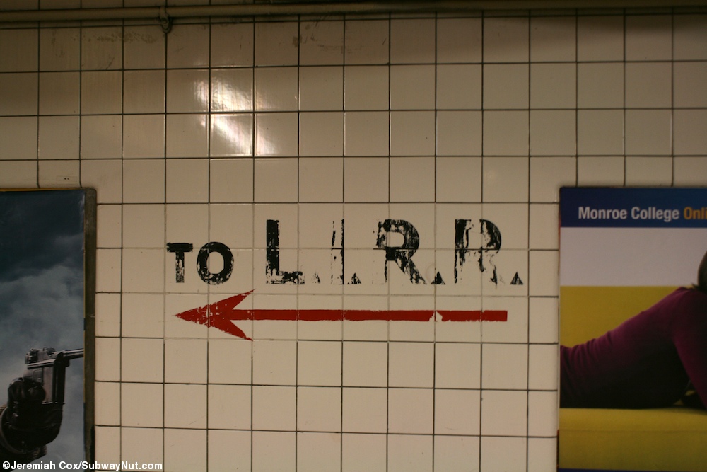
Until the opening of the Sutphin Boulevard–Archer Avenue station on the Archer Avenue lines on December 11, 1988, [37] this was the closest subway station to the Long Island Rail Road's Jamaica station. [38] The opening of the Archer Avenue lines was expected to severely lessen congestion at the Sutphin Boulevard, Parsons Boulevard, and 169th Street stations. Ridership checks conducted before and after the opening of the new line showed that ridership at this station, between 5 and 10 a.m. on weekdays, decreased from 7,282 riders to 2,610 riders, a 64% decrease. [39]

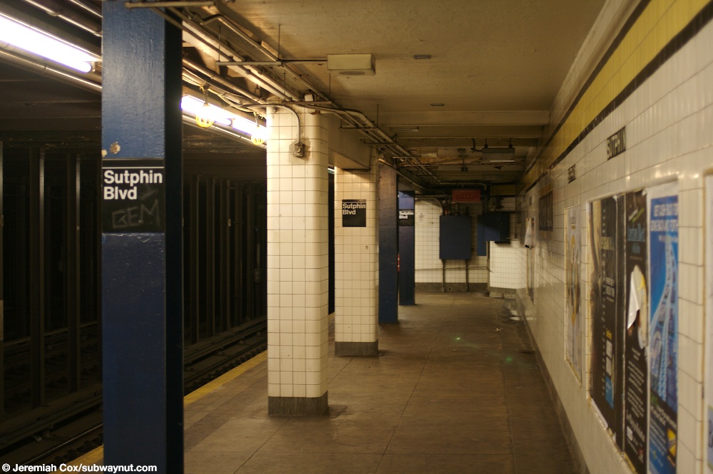
In conjunction with the opening of the Archer Avenue lines, service patterns were changed. E trains were rerouted via the new line, running to Jamaica Center, via the Queens Boulevard Line's express tracks, and began running express east of 71st Avenue. [40] [41] Some E trains continued to run from 179th Street as expresses during the morning rush hour. [42] :9–10 Service at local stations, such as Sutphin Boulevard, was replaced by the R, which was extended to 179th Street from Continental Avenue. The R extension allowed F trains to continue running express to 179th Street. [43] [44] The changes in subway service angered riders at local stations east of 71st Avenue because they lost direct Queens Boulevard Express service. Local elected officials pressured the MTA to eliminate all-local service at these stations. [45] On September 30, 1990, the R was cut back to 71st Avenue outside of rush hours. Local service to 179th Street was replaced by F trains, which provided Queens Boulevard Express service, during middays, evenings, and weekends, and local G service during late nights. [46] In 1992, the MTA decided to have F trains run local east of 71st Avenue on a six-month trial basis to replace R service, which would be cut back to 71st Avenue at all times. [47] The test started on October 26, 1992 and was implemented on a permanent basis six months later, eliminating express service along Hillside Avenue. [48] [45]

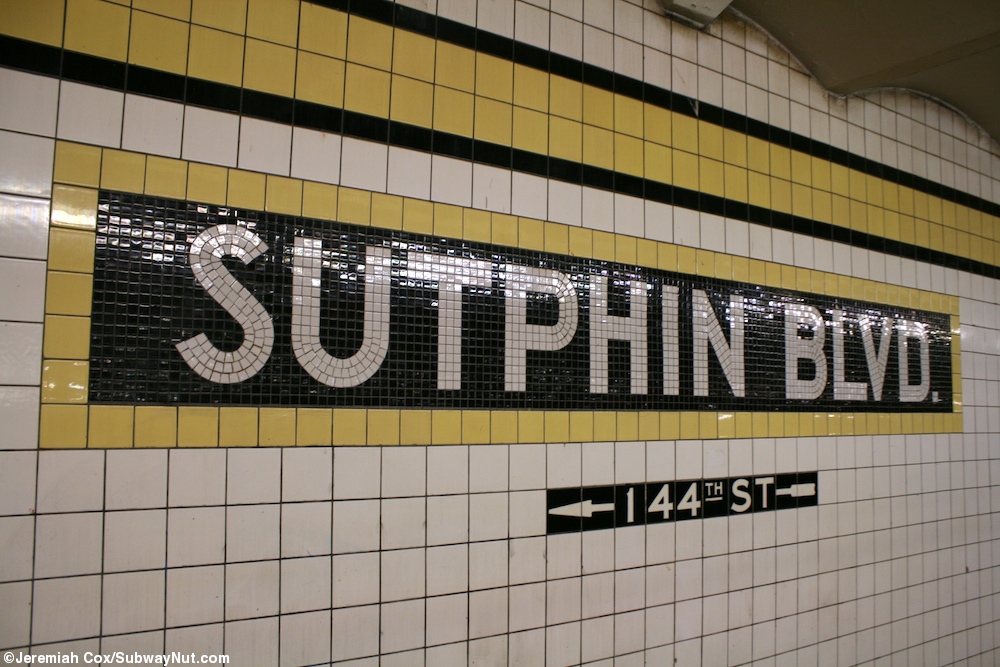
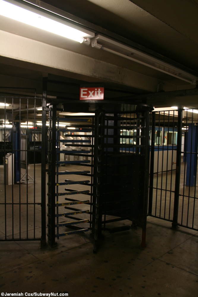
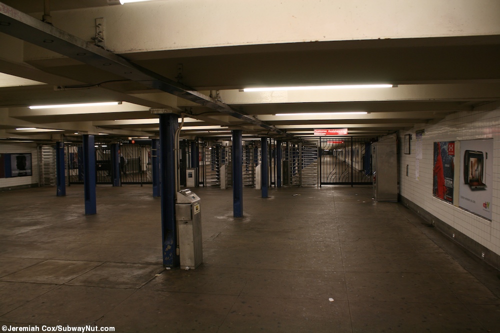
In 2003, Metropolitan Transportation Authority proposed closing 177 part-time token booths, later reduced to 62, [49] across the subway system and replace them with MetroCard Vending Machines and High-Entry/Exit Turnstiles to help cut the MTA's $1 billion deficit. The closure of booths began in August 2003. [50] The station's part-time token booth at 144th Street was closed on August 17, 2003, [51] and automatic entrance to the 144th Street exits was provided at all times. [52]

Station layout

GroundStreet levelExit/entrance
MezzanineFare control, station agent, MetroCard machines
Platform level Side platform
Southbound local NYCS-bull-trans-F-Std.svg NYCS-bull-trans-Fd-Std.svg toward Coney Island–Stillwell Avenue (Briarwood)
Southbound express NYCS-bull-trans-E-Std.svg does not stop here (select rush hour trips)
Northbound express NYCS-bull-trans-E-Std.svg does not stop here (select rush hour trips) →
Northbound local NYCS-bull-trans-E-Std.svg toward Jamaica–179th Street (two p.m. rush hour trips) (Parsons Boulevard)
NYCS-bull-trans-F-Std.svg NYCS-bull-trans-Fd-Std.svg toward Jamaica–179th Street (Parsons Boulevard)
Side platform

This underground station has four tracks and two side platforms. [53] [54] The F train stops here at all times. [55] The station is between Briarwood to the west and Parsons Boulevard to the east. [56] The two center express tracks are used by the limited rush hour E service to Jamaica–179th Street. [54] Some of the black columns separating the local and express tracks have white signs reading "Sutphin" in black lettering. [57]

Both platforms have a yellow trim line with a black border and mosaic name tablets reading "SUTPHIN BLVD." in white sans-serif lettering on a black background and yellow border. [58] The tile band is part of a color-coded tile system used throughout the IND. [59] The tile colors were designed to facilitate navigation for travelers going away from Lower Manhattan. As such, a different tile color is used at Parsons Boulevard, the next express station to the east. The yellow tiles used at the Sutphin Boulevard station were also used at Kew GardensUnion Turnpike, the next express station to the west, and Briarwood, the only other local station between Union Turnpike and Parsons Boulevard. [60] [61] Small "SUTPHIN" and directional tile captions run below the trim line and name tablets. [62]

Blue I-beam columns run along both platforms at regular intervals with alternating ones having the standard black station name plate in white lettering. [62] At the northern end of the station, there are a few wider columns that are tiled. [63] The I-beam piers are located every 15 feet (4.6 m) and support girders above the platforms. The roof girders are also connected to columns in the walls adjoining each platform. [64] :3 This station has a full length mezzanine above the platforms and tracks supported by blue I-beam columns, and allows for free crossovers between directions. [65]

The tunnel is covered by a U-shaped trough that contains utility pipes and wires. The outer walls of this trough are composed of columns, spaced approximately every 5 feet (1.5 m) with concrete infill between them. There is a 1-inch (25 mm) gap between the tunnel wall and the platform wall, which is made of 4-inch (100 mm)-thick brick covered over by a tiled finish. The columns between the tracks are also spaced every 5 feet (1.5 m), with no infill. [64] :3

144th Street stair Sutphin IND sta laundry 144 jeh.jpg
144th Street stair

Exits

The main fare control area, formerly the station's full-time entrance, [66] is at the east (railroad north) end. It has a turnstile bank, full-time token booth, and three street stairs; in 2007, the turnstile bank consisted of five regular turnstiles, a High Entry-Exit Turnstile, and a high exit-only turnstile. [53] Two stairs ascend to either southern corner of the T-intersection of Sutphin Boulevard and Hillside Avenue, and the other to the northwest corner of 148th Street and Hillside Avenue. [53] [67] On the opposite side of the full-time turnstile bank, there was an unstaffed fare control area that has a single staircase going down to each platform and is now gated off. The staircase to the Manhattan-bound platform is closed (directional mosaic signs still exist), [68] but the one to the 179th Street-bound platform remains open and has an exit-only turnstile. [69]

The other fare control area at the station's west end is unstaffed, containing just full-height turnstiles; [70] in 2007, this fare control area contained two High Entry-Exit Turnstiles and two high exit-only turnstiles. [53] There are two street stairs going up to the southwest and northeast corners of 144th Street and Hillside Avenue. [53] [67] Its part-time token booth was removed in 2003. [51]

In the movie Coming to America , Eddie Murphy's character, Akeem, tries to persuade his love interest to marry him and go to Zamunda, a fictional kingdom in Africa. He follows her onto a New York City Subway train. When the train stops, she tells him "no" and gets off. Akeem stays on, dejected, and as the train leaves the station, "Sutphin" can be seen on the wall tiles. [71]

See also

Notes

  1. The subway cars on the IND were built to be 60 feet (18.3 m) long. These cars typically operated in 10-car trains, with an entire train length being 600 feet (182.9 m). When platforms at stations such as Sutphin Boulevard were lengthened to accommodate 11-car trains, the platforms had to be extended an additional car length, or 60 feet (18.3 m), making the platform at least 660 feet (201.2 m) long. [29] :185

Related Research Articles

<span class="mw-page-title-main">E (New York City Subway service)</span> New York City Subway service

The E Queens Boulevard Express/
Eighth Avenue Local
is a rapid transit service in the B Division of the New York City Subway. Its route emblem, or "bullet", is blue since it uses the IND Eighth Avenue Line in Manhattan.

The IND Queens Boulevard Line, sometimes abbreviated as QBL, is a line of the B Division of the New York City Subway in Manhattan and Queens, New York City, United States. The line, which is underground throughout its entire route, contains 23 stations. The core section between 50th Street in Hell's Kitchen, Manhattan, and 169th Street in Jamaica, Queens, was built by the Independent Subway System (IND) in stages between 1933 and 1940, with the Jamaica–179th Street terminus opening in 1950. As of 2015, it is among the system's busiest lines, with a weekday ridership of over 460,000 people.

The Archer Avenue lines are two rapid transit lines of the New York City Subway, mostly running under Archer Avenue in the Jamaica neighborhood of Queens. The two lines are built on separate levels: trains from the IND Queens Boulevard Line serve the upper level, and trains from the BMT Jamaica Line serve the lower.

<span class="mw-page-title-main">F (New York City Subway service)</span> New York City Subway service

The F and <F> Queens Boulevard Express/Sixth Avenue Local are two rapid transit services in the B Division of the New York City Subway. Their route bullets are colored orange, since they use and are part of the IND Sixth Avenue Line in Manhattan.

<span class="mw-page-title-main">Sutphin Boulevard–Archer Avenue–JFK Airport station</span> New York City Subway station in Queens

The Sutphin Boulevard–Archer Avenue–JFK Airport station is a two-level station on the IND and BMT Archer Avenue Lines of the New York City Subway. It is located at the intersection of Sutphin Boulevard and Archer Avenue in Jamaica, Queens. It is served by the E and J trains at all times, as well as the Z train during rush hours in the peak direction. This station has four tracks and two island platforms, with two platform levels: E trains stop on the upper level while J/Z trains stop on the lower level.

<span class="mw-page-title-main">Briarwood station</span> New York City Subway station in Queens

The Briarwood station is a local station on the IND Queens Boulevard Line of the New York City Subway. Located at the intersection of 84th Drive, Main Street, Queens Boulevard, and the Van Wyck Expressway, in Briarwood, Queens, bordering Kew Gardens, it is served by the F train at all times, the E train at all times except rush hours and middays, and the <F> train during rush hours in the reverse peak direction.

<span class="mw-page-title-main">75th Avenue station</span> New York City Subway station in Queens

The 75th Avenue station is a local station on the IND Queens Boulevard Line of the New York City Subway. Located at the intersection of 75th Avenue and Queens Boulevard in Forest Hills, Queens, it is served by the F train at all times, the E train at all times except weekday rush hours and middays, and the <F> train during rush hours in the reverse peak direction.

<span class="mw-page-title-main">Jamaica Center–Parsons/Archer station</span> New York City Subway station in Queens

The Jamaica Center–Parsons/Archer station is the northern terminal station of the IND and BMT Archer Avenue Lines of the New York City Subway, located at Parsons Boulevard and Archer Avenue in Jamaica, Queens. It is served by E and J trains at all times, as well as Z trains during rush hours in the peak direction.

<span class="mw-page-title-main">Jamaica–179th Street station</span> New York City Subway station in Queens

The Jamaica–179th Street station is an express terminal station on the IND Queens Boulevard Line of the New York City Subway. Located under Hillside Avenue at 179th Street in Jamaica, Queens, it is served by the F train at all times, the <F> train during rush hours in the reverse peak direction, and a few rush-hour E trains. The station has 15 entrances, including two at Midland Parkway in Jamaica Estates.

<span class="mw-page-title-main">Parsons Boulevard station</span> New York City Subway station in Queens

The Parsons Boulevard station is an express station on the IND Queens Boulevard Line of the New York City Subway. Located at the intersection of Parsons Boulevard and Hillside Avenue in Queens, it is served by the F train at all times, the <F> train during rush hours in the reverse peak direction, and a few rush-hour E trains.

<span class="mw-page-title-main">169th Street station (IND Queens Boulevard Line)</span> New York City Subway station in Queens

The 169th Street station is a local station on the IND Queens Boulevard Line of the New York City Subway. Located at the intersection of 169th Street and Hillside Avenue in Queens, it is served by the F train at all times, the <F> train during rush hours in the reverse peak direction, and a few rush-hour E trains to Jamaica–179th Street during p.m. rush hours.

<span class="mw-page-title-main">Elmhurst Avenue station</span> New York City Subway station in Queens

The Elmhurst Avenue station is a local station on the IND Queens Boulevard Line of the New York City Subway. Located at the intersection of Elmhurst Avenue, 45th Avenue, and Broadway in Elmhurst, Queens, it is served by the M train on weekdays, the R train at all times except nights, and the E and F trains at night.

<span class="mw-page-title-main">67th Avenue station</span> New York City Subway station in Queens

The 67th Avenue station is a local station on the IND Queens Boulevard Line of the New York City Subway. Located at the intersection of 67th Avenue and Queens Boulevard in Forest Hills, Queens, it is served by the M train on weekdays, the R train at all times except nights, and the E and F trains during late nights.

<span class="mw-page-title-main">63rd Drive–Rego Park station</span> New York City Subway station in Queens

The 63rd Drive–Rego Park station is a local station on the IND Queens Boulevard Line of the New York City Subway, consisting of four tracks. Located at 63rd Drive and Queens Boulevard in the Rego Park neighborhood of Queens, it is served by the M train on weekdays, the R train at all times except nights, and the E and F trains at night.

<span class="mw-page-title-main">Woodhaven Boulevard station (IND Queens Boulevard Line)</span> New York City Subway station in Queens

The Woodhaven Boulevard station is a local station on the IND Queens Boulevard Line of the New York City Subway, consisting of four tracks. Located in Elmhurst, Queens, it is served by the M train on weekdays, the R train at all times except nights, and the E and F trains at night. The station serves the adjacent Queens Center Mall, as well as numerous bus lines.

<span class="mw-page-title-main">Grand Avenue–Newtown station</span> New York City Subway station in Queens

The Grand Avenue–Newtown station is a local station on the IND Queens Boulevard Line of the New York City Subway. Located under private property at the northeast corner of the intersection of Grand Avenue, Broadway, and Queens Boulevard in the neighborhood of Elmhurst, Queens, it is served by the M train on weekdays, the R train at all times except nights, and the E and F trains at night.

<span class="mw-page-title-main">46th Street station (IND Queens Boulevard Line)</span> New York City Subway station in Queens

The 46th Street station is a local station on the IND Queens Boulevard Line of the New York City Subway. Located at the intersection of 46th Street and Broadway in Astoria, Queens, it is served by the M train on weekdays, the R train at all times except nights, and the E and F trains at night.

<span class="mw-page-title-main">Steinway Street station</span> New York City Subway station in Queens

The Steinway Street station is a local station on the IND Queens Boulevard Line of the New York City Subway. Located under Steinway Street between Broadway and 34th Avenue, it is served by the M train on weekdays, the R train at all times except nights, and the E and F trains at night.

<span class="mw-page-title-main">36th Street station (IND Queens Boulevard Line)</span> New York City Subway station in Queens

The 36th Street station is a local station on the IND Queens Boulevard Line of the New York City Subway. Located at the intersection of 36th Street and Northern Boulevard in Queens, it is served by the M train on weekdays, the R train at all times except nights, and the E and F trains at night. The <F> train skips this station when it operates.

<span class="mw-page-title-main">168th Street station (BMT Jamaica Line)</span> New York City Subway station in Queens (closed 1977)

The 168th Street station was the terminal station on the demolished section of the BMT Jamaica Line in Queens, New York City. It was located between 165th and 168th Streets on Jamaica Avenue.

References

  1. "Glossary". Second Avenue Subway Supplemental Draft Environmental Impact Statement (SDEIS) (PDF). Vol. 1. Metropolitan Transportation Authority. March 4, 2003. pp. 1–2. Archived from the original (PDF) on February 26, 2021. Retrieved January 1, 2021.
  2. 1 2 "New Subway Link to Jamaica Opened; La Guardia, City Officials and Civic Groups Make Trial Run on 10-Car Train". The New York Times. April 25, 1937. Retrieved March 8, 2019.
  3. 1 2 "Annual Subway Ridership (2018–2023)". Metropolitan Transportation Authority. 2023. Retrieved April 20, 2024.
  4. "6:40 PM - 7:28 PM Jamaica-179 St – OpenMobilityData". transitfeeds.com. August 10, 2021. Archived from the original on August 10, 2021. Retrieved August 10, 2021.
  5. See:
  6. "Queens Lauded as Best Boro By Chamber Chief". The Brooklyn Daily Eagle. September 23, 1929. p. 40. Retrieved October 4, 2015.
  7. "New Subway Routes in Hylan Program to Cost $186,046,000" (PDF). The New York Times. March 21, 1925. p. 1. ISSN   0362-4331 . Retrieved March 27, 2020.
  8. "$17,146,500 Voted For New Subways; Estimate Board Appropriates More Than $9,000,000 for Lines in Brooklyn. $6,490,000 For The Bronx Smaller Items for Incidental Work --Approves the Proposed Queens Boulevard Route". The New York Times. October 5, 1928. ISSN   0362-4331 . Retrieved August 4, 2016.
  9. "178th Street Subway Stop Now Assured. Place Is Designated for Station by Transportation Board" (PDF). Long Island Daily Press. December 1, 1930. p. 1. Retrieved April 25, 2019.
  10. "22 Stations On New Subway Into Queens: Five Are Designated Express Stops on Transit Route, Which Ends at Jamaica". New York Herald Tribune. July 23, 1933. p. H2. ISSN   1941-0646. ProQuest   1114650593.
  11. 1 2 "New Subway to Jamaica Ahead of Schedule Time". New York Daily News. September 17, 1933. Retrieved September 12, 2019.
  12. Hirshon, Nicholas; Romano, Foreword by Ray (January 1, 2013). Forest Hills. Arcadia Publishing. ISBN   978-0-7385-9785-0.
  13. "Two Subway Links Opened In Queens" (PDF). The New York Times. August 19, 1933. p. 13. ISSN   0362-4331 . Retrieved December 11, 2016.
  14. "Unfinished Sections of Subway Lines To Be Completed" (PDF). The New York Sun . December 13, 1933. p. 47. Retrieved July 30, 2016.
  15. 1 2 "Trains Testing Jamaica Link Of City Subway". The Brooklyn Daily Eagle. April 10, 1937. p. 3. Retrieved April 24, 2018.
  16. 1 2 Neufeld, Ernest (August 23, 1936). "Men Toil Under Earth to Build Subway" (PDF). Long Island Daily Press. p. 2 (Section 2). Retrieved August 12, 2016.
  17. See:
  18. Neufeld, Ernest (August 23, 1936). "Men Toil Under Earth to Build Subway" (PDF). Long Island Daily Press. p. 2 (Section 2). Retrieved August 12, 2016.
  19. 1 2 "Two Crews Rush to Finish Last 200 Feet of Subwav: Work Must End April 3 to Allow Time for Tests" (PDF). Long Island Daily Press. March 19, 1937. p. 1. Retrieved April 25, 2019.
  20. "City Subway Opens Queens Link Today". The New York Times. December 31, 1936. p. 3. ISSN   0362-4331 . Retrieved April 26, 2016.
  21. "Jamaica Ready For Opening of Subway April 24: Mayor Announcers Program Including Official Trip, Luncheon and a Parade". New York Herald Tribune. April 10, 1937. p. 13. ISSN   1941-0646. ProQuest   1267763254.
  22. Kramer, Frederick A. (1990). Building the Independent Subway. Quadrant Press. ISBN   978-0-915276-50-9.
  23. "Jamaica Linked To City Subway With Ceremony: LaGuardia Assures 2,000 Queens Celebrants 'We'll Build More,' if Funds Hold Express Service Begun Official Inspection Held as Civic Groups Parade". New York Herald Tribune. April 25, 1937. p. 13. ISSN   1941-0646. ProQuest   1222259975.
  24. "Jamaica Will Greet Subway" (PDF). The New York Sun. April 23, 1937. p. 8. Retrieved April 24, 2018.
  25. "Transit Link Open Today; 8th Ave. Line Extended to Jamaica—Celebration Arranged". The New York Times. April 24, 1937. ISSN   0362-4331 . Retrieved August 4, 2016.
  26. "LaGuardia Heads Speakers Marking Subway Opening Ceremonies Planned Saturday Celebrating Hillside Avenue Extension" (PDF). North Shore Daily Journal. April 23, 2017. p. 3. Retrieved November 19, 2017.
  27. See:
  28. Sansone, Gene (October 25, 2004). New York Subways: An Illustrated History of New York City's Transit Cars. JHU Press. ISBN   9780801879227.
  29. 1 2 Ingalls, Leonard (August 28, 1953). "2 Subway Lines to Add Cars, Another to Speed Up Service" (PDF). The New York Times. ISSN   0362-4331 . Retrieved January 25, 2016.
  30. Bennett, Charles G. (November 20, 1949). "Transit Platforms on Lines in Queens to Be Lengthened; $3,850,000 Program Outlined for Next Year to Care for Borough's Rapid Growth". The New York Times. ISSN   0362-4331 . Retrieved May 23, 2023.
  31. "37 Platforms On Subways To Be Lengthened: All Stations of B. M. T. and I.R.T.in Queens Included in $5,000,000 Program". New York Herald Tribune. November 20, 1949. p. 32. ISSN   1941-0646. ProQuest   1325174459.
  32. Proceedings of the New York City Board of Transportation. New York City Board of Transportation. 1951. pp. 53, 145, 255.
  33. Noonan, Dan (March 6, 1951). "Transit Board To Add 1 Car to Fulton St. IND Trains. 11-Car Units Will Ease Rush Hour Jam In Boro". The Brooklyn Daily Eagle. Retrieved September 12, 2019.
  34. Report. New York City Transit Authority. 1953.
  35. "16-Point Plan Can Give Boro Relief Now". Long Island Star–Journal. August 10, 1962. Retrieved April 24, 2018.
  36. Johnson, Kirk (December 9, 1988). "Big Changes For Subways Are to Begin". The New York Times. ISSN   0362-4331 . Retrieved July 5, 2009.
  37. Cox, Jeremiah (January 3, 2012). "Painted text still says To L.I.R.R. this was the closest IND station to it until the Archer Avenue extension in 1988". subwaynut.com. Retrieved August 26, 2019.
  38. Johnson, Kirk (December 9, 1988). "Big Changes For Subways Are to Begin". The New York Times. ISSN   0362-4331 . Retrieved June 6, 2016.
  39. Alternatives Analysis/Supplemental Draft Environmental Impact Statement for the Queens Subway Options Study. United States Department of Transportation, Metropolitan Transportation Authority, Urban Mass Transit Administration. May 1990. Retrieved August 13, 2016.
  40. Archer Avenue Corridor Transit Service Proposal. New York City Transit Authority, Operations Planning Department. August 1988.
  41. Polsky, Carol (December 11, 1988). "New Subway Line Finally Rolling Through Queens". Newsday.
  42. "Archer Avenue Extension Opens December 11". Welcome Aboard: Newsletter of the New York City Transit Authority. 1 (4). New York City Transit Authority: 1. 1988.
  43. 1 2 "Service Change Monitoring Report Six Month Evaluation of F/R Queens Boulevard Line Route Restructure" (PDF). www.laguardiawagnerarchive.lagcc.cuny.edu. Metropolitan Transportation Authority. April 1993. Retrieved December 28, 2018.
  44. "Service Changes September 30, 1990" (PDF). subwaynut.com. New York City Transit Authority. September 30, 1990. Archived from the original (PDF) on October 26, 2014. Retrieved May 1, 2016.
  45. "Van Wyck Blvd Station" (PDF). www.laguardiawagnerarchive.lagcc.cuny.edu. Metropolitan Transportation Authority. May 1992. Retrieved December 28, 2018.
  46. "October 1992 New York City Subway Map". Flickr. New York City Transit Authority. October 1992. Retrieved October 30, 2016.
  47. "An Examination of the Finances of the Metropolitan Transportation Authority April 2003" (PDF). Office of the State Deputy Comptroller for the City of New York. April 2003. p. 35. Retrieved August 26, 2019.
  48. Newman, Philip (August 6, 2003). "Closing of token booths draws near for borough". Queens Courier. Retrieved August 26, 2019.
  49. 1 2 Newman, Philip (August 13, 2003). "MTA to close token booths at 9 boro sites". Queens Courier. Retrieved August 26, 2019.
  50. Markowitz, Michael (February 24, 2003). "Token Booth Closings". Gotham Gazette. Retrieved August 26, 2019.
  51. 1 2 3 4 5 "Chapter 17: Transit and Pedestrians". Jamaica Rezoning Final Environmental Impact Statement (PDF). New York City Department of City Planning. 2007. p. 17.4. Retrieved April 1, 2021.
  52. 1 2 Dougherty, Peter (2006) [2002]. Tracks of the New York City Subway 2006 (3rd ed.). Dougherty. OCLC   49777633 via Google Books.
  53. "FSubway Timetable, Effective August 28, 2023". Metropolitan Transportation Authority . Retrieved August 26, 2023.
  54. "Subway Map" (PDF). Metropolitan Transportation Authority. September 2021. Retrieved September 17, 2021.
  55. Cox, Jeremiah (June 2, 2008). "A small, original 'Sutphin' sign along the pillars between the express and local tracks at Sutphin Blvd". subwaynut.com. Retrieved August 26, 2019.
  56. Cox, Jeremiah (June 2, 2008). "A name tablet at Sutphin Blvd with the arrowed tiling for 144th St underneath it". subwaynut.com. Retrieved August 26, 2019.
  57. "Tile Colors a Guide in the New Subway; Decoration Scheme Changes at Each Express Stop to Tell Riders Where They Are". The New York Times. August 22, 1932. ISSN   0362-4331. Archived from the original on July 1, 2022. Retrieved July 1, 2022.
  58. Carlson, Jen (February 18, 2016). "Map: These Color Tiles In The Subway System Used To Mean Something". Gothamist. Retrieved May 10, 2023.
  59. Gleason, Will (February 18, 2016). "The hidden meaning behind the New York subway's colored tiles". Time Out New York. Retrieved May 10, 2023.
  60. 1 2 Cox, Jeremiah (June 2, 2008). "A view down the Manhattan bound platform at Sutphin Blvd". subwaynut.com. Retrieved August 26, 2019.
  61. Cox, Jeremiah (June 2, 2008). "The very western end of the platform at Sutphin Blvd, there are couple of columns that have tiling around them". subwaynut.com. Retrieved August 26, 2019.
  62. 1 2 "New York MPS Elmhurst Avenue Subway Station (IND)". Records of the National Park Service, 1785 - 2006, Series: National Register of Historic Places and National Historic Landmarks Program Records, 2013 - 2017, Box: National Register of Historic Places and National Historic Landmarks Program Records: New York, ID: 05000672. National Archives.
  63. Cox, Jeremiah (January 3, 2012). "The turnstiles at the opposite end of the overpass are barely visible". subwaynut.com. Retrieved August 26, 2019.
  64. Cox, Jeremiah (February 9, 2004). "Looking out the doors of a train stopped at Sutphin Blvd with name tablet visible as well as a staircase up to the mezzanine toward the exit at Sutphin Blvd". subwaynut.com. Retrieved August 26, 2019.
  65. 1 2 "Sutphin Boulevard Neighborhood Map" (PDF). mta.info. Metropolitan Transportation Authority. April 2018. Retrieved August 26, 2019.
  66. Cox, Jeremiah (January 3, 2012). "The former secondary staircase to the end of the Brooklyn & Manhattan platform". subwaynut.com. Retrieved August 26, 2019.
  67. Cox, Jeremiah (January 3, 2012). "The high exit turnstile with a single staircase to the front of the 179 Street-bound platform" . Retrieved August 26, 2019.
  68. Cox, Jeremiah (January 3, 2012). "The high turnstiles at the 144 Street end of the station". subwaynut.com. Retrieved August 26, 2019.
  69. Schreil, Cristina (June 24, 2015). "Coming To America". Queens Chronicle. Retrieved April 28, 2016.