
Pendleton Airport is located 3 nautical miles northwest of Pendleton, Ontario, Canada, east of Ottawa. The airfield is currently operated by the Gatineau Gliding Club.

Faro Airport is located 1.5 nautical miles south of Faro, Yukon, Canada, and is operated by the Yukon government. The gravel runway is 3,997 ft (1,218 m) long and is at an elevation of 2,350 ft (716 m).

Old Crow Airport is located in Old Crow, Yukon, Canada, and is operated by the Yukon government. The gravel runway is 5,022 ft × 100 ft and is at an elevation of 816 ft (249 m). The airport is extremely important to the community, which is not accessible by road.

Teslin Airport is located on the northwest side of Teslin, Yukon, Canada, and is operated by the Yukon government. The gravel runway is 5,000 ft (1,524 m) long and is at an elevation of 2,313 ft (705 m).

Virginia Falls Water Aerodrome is located on the South Nahanni River approximately 1,300 ft (396 m) upstream from Virginia Falls, Northwest Territories, Canada. It is open from early May until mid-October.

Amos/Magny Airport is located 5 nautical miles west of Amos, Quebec, Canada.
Saint-Ferdinand Aerodrome is an aerodrome located near Saint-Ferdinand, Quebec, Canada. The runway is approximately 400 m (1,300 ft) long, and on a relatively slope down towards the lake. Approach and depart from/to the lake.
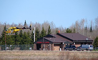
Cochrane Aerodrome is a registered aerodrome located 2 nautical miles north of Cochrane, Ontario, Canada.

Savant LakeWater Aerodrome is located 3.5 nautical miles southeast of Savant Lake, Thunder Bay District, Ontario, Canada.

Woodstock Aerodrome is located 2.5 nautical miles west of Woodstock, Ontario, Canada. The registered aerodrome is home to the Woodstock Ontario Flying Club.

Midway Aerodrome is located adjacent to Midway, British Columbia, Canada.
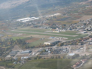
Oliver Municipal Airport is a registered aerodrome located adjacent to Oliver, British Columbia, Canada. The airport has been considered for expansion.

Uranium City Airport is located 4 nautical miles east of Uranium City, Saskatchewan, Canada. It is classified as a Code 2 airport.
Gahcho Kue Aerodrome is an airport located 1.4 nautical miles east southeast of the Gahcho Kue Diamond Mine Project, Northwest Territories, Canada. The airport is owned and operated by De Beers Canada and serves the Gahcho Kue Diamond Mine Project. The airport originally was an ice runway on Kennady Lake and was 5,146 ft (1,569 m) in length and numbered 08/26. The ice runway was only open from January to April.

Minto Aerodrome is a registered aerodrome in Yukon, Canada. It is a 4,495 ft × 100 ft gravel strip orientated 17/35. It was built by Minto Explorations Ltd. to service their Minto Mine copper and gold mining operation. This aerodrome should not be confused with the reopened Minto Landing Aerodrome at Minto Landing, adjacent to the Yukon River approximately 18 km (11 mi) to the east.
Minto Landing Aerodrome is a registered aerodrome located next to Minto on the Yukon River in Yukon, Canada. It is a 3,583 ft × 100 ft turf/gravel strip orientated 09/27. This aerodrome should not be confused with the reopened Minto Aerodrome at Minto Mine approximately 18 km (11 mi) to the west.

