Stony Point, Michigan

Last updated

Stony Point, Michigan
Stony-point-michigan-aerial.jpg
Stony Point from the air, looking southwest.
Location within Monroe County
USA Michigan location map.svg
Red pog.svg
Stony Point
Location within the state of Michigan
Usa edcp location map.svg
Red pog.svg
Stony Point
Location within the United States
Coordinates: 41°56′29″N83°15′54″W / 41.94139°N 83.26500°W / 41.94139; -83.26500
CountryUnited States
State Michigan
County Monroe
Township Frenchtown
Area
[1]
  Total1.23 sq mi (3.19 km2)
  Land1.21 sq mi (3.13 km2)
  Water0.02 sq mi (0.05 km2)
Elevation
577 ft (176 m)
Population
 (2020)
  Total1,784
  Density1,469.52/sq mi (567.34/km2)
Time zone UTC-5 (Eastern (EST))
  Summer (DST) UTC-4 (EDT)
ZIP code(s)
48166 (Newport)
Area code 734
FIPS code 26-76720 [2]
GNIS feature ID0638920 [3]

Stony Point is an unincorporated community and census-designated place (CDP) in Monroe County in the U.S. state of Michigan. The population was 1,784 at the 2020 census. The CDP is located within Frenchtown Charter Township.

Contents

Geography

According to the U.S. Census Bureau, the CDP has a total area of 1.23 square miles (3.19 km2), of which 1.21 square miles (3.13 km2) is land and 0.02 square miles (0.05 km2) (1.63%) is water. [1]

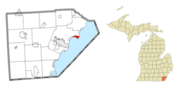
The community is the shores of Lake Erie about 7.0 miles (11.3 km) northeast of downtown Monroe. The area defined by the CDP is bounded on the west by Burke Road, on the northwest by Brest Road, and on the north by Point aux Peaux Road. The CDP of Woodland Beach is about 3.0 miles (4.8 km) to the west. The Enrico Fermi Nuclear Generating Station is adjacent to the north.

Demographics

Historical population
CensusPop.Note
1990 1,598
2000 1,77511.1%
2010 1,724−2.9%
2020 1,7843.5%
U.S. Decennial Census [4]

At the 2000 census, [2] there were 1,775 people, 616 households and 492 families residing in the CDP. The population density was 1,553.6 inhabitants per square mile (599.8/km2). There were 674 housing units at an average density of 589.9 per square mile (227.8/km2). The racial makeup of the CDP was 96.17% White, 0.56% African American, 1.30% Native American, 0.34% Asian, 0.11% Pacific Islander, 0.51% from other races, and 1.01% from two or more races. Hispanic or Latino of any race were 2.25% of the population.

There were 616 households, of which 43.7% had children under the age of 18 living with them, 63.1% were married couples living together, 11.0% had a female householder with no husband present, and 20.1% were non-families. 16.1% of all households were made up of individuals, and 5.5% had someone living alone who was 65 years of age or older. The average household size was 2.88 and the average family size was 3.23.

30.5% of the population were under the age of 18, 7.6% from 18 to 24, 33.6% from 25 to 44, 21.5% from 45 to 64, and 6.8% who were 65 years of age or older. The median age was 32 years. For every 100 females, there were 109.1 males. For every 100 females age 18 and over, there were 103.1 males.

The median household income was $49,167 and the median family income was $59,583. Males had a median income of $46,542 compared with $30,385 for females. The per capita income for the CDP was $22,667. About 3.3% of families and 4.2% of the population were below the poverty line, including 3.3% of those under age 18 and 5.5% of those age 65 or over.

Related Research Articles

<span class="mw-page-title-main">Stony River, Alaska</span> Census-designated place in Alaska, United States

Stony River is a census-designated place (CDP) in Bethel Census Area, Alaska, United States. The population was 54 at the 2010 census, down from 61 in 2000.

<span class="mw-page-title-main">Fox River, Alaska</span> Census-designated place in Alaska, United States

Fox River is a census-designated place (CDP) in Kenai Peninsula Borough, Alaska, United States. At the 2010 census the population was 685, up from 616 in 2000. It was first reported by the U.S. Geological Survey in 1895. The Fox River, which flows by the CDP, might have been named for Theodore Fox, a local mining magnate.

<span class="mw-page-title-main">Lakes of the Four Seasons, Indiana</span> Census-designated place in Indiana, United States

Lakes of the Four Seasons is a census-designated place (CDP) in Lake and Porter counties in the U.S. state of Indiana. The population was 7,033 at the 2010 census.

Claiborne is an unincorporated community and census-designated place (CDP) in Ouachita Parish, Louisiana, United States. The population was 9,830 at the 2000 census. It is part of the Monroe Metropolitan Statistical Area.

<span class="mw-page-title-main">South Monroe, Michigan</span> Census-designated place & unincorporated community in Michigan, United States

South Monroe is an unincorporated community and census-designated place (CDP) in Monroe County in the U.S. state of Michigan. The population was 6,468 at the 2020 census. The CDP is located within Monroe Charter Township.

<span class="mw-page-title-main">Temperance, Michigan</span> Census-designated place & unincorporated community in Michigan, United States

Temperance is an unincorporated community and census-designated place (CDP) in Monroe County in the U.S. state of Michigan. The population was 9,188 at the 2020 census. The CDP is located within Bedford Township.

<span class="mw-page-title-main">West Monroe, Michigan</span> Census-designated place & unincorporated community in Michigan, United States

West Monroe is an unincorporated community and census-designated place (CDP) in Monroe County in the U.S. state of Michigan. The population was 3,227 at the 2020 census. The CDP is located within Monroe Charter Township.

<span class="mw-page-title-main">Woodland Beach, Michigan</span> Census-designated place & unincorporated community in Michigan, United States

Woodland Beach is a census-designated place (CDP) and unincorporated community in Monroe County in the U.S. state of Michigan. The population was 1,899 at the 2020 census. The CDP is located within Frenchtown Charter Township.

<span class="mw-page-title-main">Walton Park, New York</span> CDP in New York, United States

Walton Park is a census-designated place (CDP) in Orange County, New York, United States. As of the 2020 census, the CDP had a total population of 3,907. Walton Park is on the town line separating the towns of Chester and Monroe. Street addresses within Walton Park are usually assigned to Monroe, not Chester.

<span class="mw-page-title-main">Stony Prairie, Ohio</span> CDP in Ohio, United States

Stony Prairie is a census-designated place (CDP) in Sandusky County, Ohio, United States. The population was 1,218 at the 2020 census.

Stony Point is a census-designated place (CDP) in Sequoyah County, Oklahoma, United States. It is part of the Fort Smith, Arkansas-Oklahoma Metropolitan Statistical Area. The population was 177 at the 2000 census.

<span class="mw-page-title-main">Russellton, Pennsylvania</span> Census-designated place in Pennsylvania, United States

Russellton is a census-designated place (CDP) in Allegheny County, Pennsylvania, United States. The population was 1,330 at the 2020 census.

<span class="mw-page-title-main">Lower Alsace Township, Pennsylvania</span> Township in Pennsylvania, United States

Lower Alsace Township is a township in Berks County, Pennsylvania, United States. The population was 4,475 at the 2010 census. By area, it is the smallest township in Berks County.

Arlington Heights is a census-designated place (CDP) in Monroe County, Pennsylvania, United States. The population was 6,331 at the 2020 census. One notable location in Arlington Heights is the Stroud Mall.

<span class="mw-page-title-main">Brodheadsville, Pennsylvania</span> Census-designated place in Pennsylvania, United States

Brodheadsville is a census-designated place (CDP) in Monroe County, Pennsylvania, United States. The population was 1,700 at the 2020 census. The community is served by Pleasant Valley School District.

<span class="mw-page-title-main">Skokomish, Washington</span> CDP in Washington, United States

Skokomish is a census-designated place (CDP) in Mason County, Washington, United States. The population was 617 at the 2010 census. The town is the headquarters of the Skokomish Indian Tribe.

<span class="mw-page-title-main">Switzer, West Virginia</span> Census-designated place in West Virginia, United States

Switzer is an unincorporated community and census-designated place (CDP) in Logan County, West Virginia, United States. The CDP includes the neighboring unincorporated community of Micco. The total CDP population was 595 at the 2010 census.

<span class="mw-page-title-main">Stony Point, North Carolina</span> Census-designated place in North Carolina, United States

Stony Point is a census-designated place (CDP) in Alexander and Iredell counties in the U.S. state of North Carolina. The population was 1,317 at the 2010 census. It is part of the Hickory–Lenoir–Morganton Metropolitan Statistical Area.

<span class="mw-page-title-main">Stony Point (CDP), New York</span> Census-designated place in New York, United States

Stony Point is a hamlet and census-designated place in the town of Stony Point, Rockland County, New York, United States. It is located north of West Haverstraw, east of Harriman State Park, south of Tomkins Cove, and west of the Hudson River. The population was 12,147 at the 2010 census.

<span class="mw-page-title-main">Clearbrook, New Jersey</span> Populated place in Middlesex County, New Jersey, US

Clearbrook is a gated community and census-designated place (CDP) located in Monroe Township, Middlesex County, in the U.S. state of New Jersey. It is in the western part of the township, bordered to the north by Encore at Monroe and to the east by Concordia and The Ponds. It is 3.5 miles (5.6 km) southwest of Jamesburg and 5 miles (8 km) northeast of Hightstown.

References

  1. 1 2 "2020 U.S. Gazetteer Files". United States Census Bureau. Retrieved May 21, 2022.
  2. 1 2 "U.S. Census website". United States Census Bureau . Retrieved January 31, 2008.
  3. U.S. Geological Survey Geographic Names Information System: Stony Point, Michigan
  4. "Census of Population and Housing". Census.gov. Retrieved June 4, 2016.