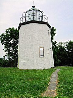
Stony Point is a triangle-shaped town in Rockland County, New York, United States. It is part of the New York City Metropolitan Area. The town is located north of the town of Haverstraw, east and south of Orange County, New York, and west of the Hudson River and Westchester County. The population was 15,059 at the 2010 census. The name of the town is derived from a prominent projection into the Hudson River.

Stony Stratford is a constituent town of Milton Keynes, Buckinghamshire, England. Historically it was a market town on the important route from London to Chester. It is also a civil parish with a town council within the Borough of Milton Keynes. It is in the north west corner of Milton Keynes, bordering Northamptonshire and separated from it by the River Great Ouse.

Jamaica Plain is a neighborhood of 4.4 square miles (11 km2) in the city of Boston, Massachusetts, USA. Founded by Boston Puritans seeking farm land to the south, it was originally part of the town of Roxbury. The community seceded from Roxbury as a part of the new town of West Roxbury in 1851, and became part of Boston when West Roxbury was annexed to Boston in 1874. In the 19th century, Jamaica Plain became one of the first streetcar suburbs in America and home to a significant portion of Boston's Emerald Necklace of parks, designed by Frederick Law Olmsted. According to the 2010 Census, it had a population of 37,468.
Stony River may refer to the following:

Stony Clove Creek is a 10.3-mile-long (16.6 km) creek in the Catskill Mountains in New York. It is a tributary of Esopus Creek, which in turn is a tributary of the Hudson River. It joins the Esopus in the village of Phoenicia, and has two smaller tributaries up north of Phoenicia.

Stony Crossing is a locality in the south western part of the Riverina. It is situated by road, about 22 kilometres (14 mi) south east from Kyalite and 35 kilometres (22 mi) north west from Swan Hill.

Stony Brook is a rapid transit station in Boston, Massachusetts. It serves the MBTA Orange Line, and is located below grade at Boylston Street in the Jamaica Plain neighborhood. The station opened on May 4, 1987 as part of the Southwest Corridor project, replacing an earlier station that was open from 1897 to 1940. After nearby Green Street station, it is the second-least-busy station on the Orange Line, with 3,652 daily boardings by a 2013 count.
The May Pen to Frankfield railway was a railway in Jamaica built to serve the fast developing citrus industry in the upper Clarendon regions of Chapelton and Frankfield.

The Dry River is a river in St Mary, Jamaica.

The Great River (Jamaica) is one of Jamaica's major rivers, and forms the boundary of the parish of St James with Westmoreland and Hanover.

The Guava River rises just north of the Grand Ridge of the Blue Mountains on the border of Portland Parish in Jamaica. From here it runs east then north and then east again to its confluence with the Rio Grande.
The Hope River (Jamaica) is a river of Jamaica. It flows from 15 miles north of Kingston and then forms a delta at Kingston.
The Martha Brae River is a river of Jamaica. It is located (primarily?) in Trelawny Parish on the north coast of Jamaica, towards the western edge, about 6 miles south of Falmouth, Trelawny, Jamaica. The river features rafting.

The One-Eye River is a river in the parishes of Manchester and St Elizabeth in Jamaica. It is a tributary of the Black River.
The Rio Nuevo is a river in Jamaica. It runs through the parish of Saint Mary, meeting the Caribbean Sea in the Rio Nuevo Bay, on the north Jamaican coast. In 1658, it was the site of the Battle of Rio Nuevo between Spanish and English forces, the largest battle to have been fought on Jamaican soil.

Stony Hill is a residential neighbourhood in St. Andrew Parish, Surrey County, on the northern outskirts of Kingston, Jamaica. As of 2009 it had a population of 8,388.

Stony Brook is a major watercourse, now almost entirely covered, in the city of Boston, USA. It runs through a culvert for 7.5 miles, along almost its entire length; despite being underground, it is the largest tributary stream of the lower Charles River. It originates at Turtle Pond in the Stony Brook Reservation; it flows through Hyde Park, Roslindale, Jamaica Plain, and Roxbury. It empties into the Charles River Basin just upstream of the Massachusetts Avenue bridge; it formerly emptied into the Back Bay when that was a tidal estuary of the Charles River.
The Stony River is a 26.7-mile-long (43.0 km) tributary of the North Branch Potomac River in Grant County in West Virginia's Eastern Panhandle. The Stony River joins with the North Branch at the Mineral County border. Its source lies north of the Dolly Sods Wilderness on the Tucker County border in the Allegheny Front.


