Related Research Articles
Bull Bay is an area located on the southeast coast of Jamaica, 10 miles (16 km) to the east of Kingston on the border between St Andrew and St Thomas, beside Cow Bay. According to folklore, both bays were so named because cattle once roamed the whole area and were slaughtered to provide food for buccaneers and English colonists. Industry in the area includes quarrying for gypsum.
Harbour View is a community in Kingston, Jamaica. It is administered by the Kingston and St. Andrew Corporation and is served by the Kingston 17 Post Office. Harbour View was built in 1963, one year after the country's Independence in 1962. The community was the first in Jamaica to have a community paper and its residents claim that the community was the first to host street dances. Harbour View is located in East Kingston and can be described as one of the best communities to live and raise families.
The Alligator Hole River is a river of Jamaica.
The Annotto River is a river of Jamaica.
The Buff Bay River is a river of Jamaica.
The Cabarita River, originally the Cabaritta, is a river in Jamaica. The Mayfield River is a tributary.
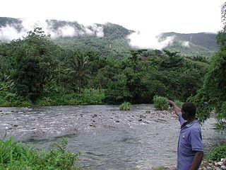
18°12′0″N77°21′0″W
The Ferry River is a river of Jamaica.
The Hope River (Jamaica) is a river of Jamaica. It flows from 15 miles north of Kingston and then forms a delta at Kingston.
The Morant River is a river of Jamaica.
The Plantain Garden River is a river in the parish of St Thomas on the island of Jamaica. It is the only major river in Jamaica that does not flow in a northerly or southerly direction.
The Otram River is a river in St Mary, Jamaica. It reaches the sea in the parish capital of Port Maria.
The Rio Grande is a river of Jamaica, found in the parish of Portland. It was named when the Spanish occupied Jamaica in the 15th and 16th centuries. One of the largest rivers in Jamaica, it was named "Big River" by the Spanish, and today is one of the many tourist attractions in Portland, mainly for rafting.
The Smith River (Jamaica) is a river of Jamaica.
The Spanish River is a river of Jamaica. It flows from south to north, the height of its delta is 0-40m. The Spring Garden, near the Spanish River, was one of the earliest sugar plantations in Jamaica. This river tends to be in very shady regions.
The Sweet River is a river of Jamaica.
The Swift River (Jamaica) is a river of Jamaica.The river had massive floods during the 1930s {1932-1940},which nearly brought the only major settlement,which shares the same name, to extinction.
The Wag Water River is one of Jamaica's rivers. It is dammed by the Hermitage Dam.
The Y.S. River is a river found in the southern parish of St Elizabeth on the island of Jamaica. It has the famous Y.S. Falls of Jamaica.
The Yallahs River is a river in the parish of Saint Thomas, Jamaica.
References
- GEOnet Names Server
- OMC Map
- CIA Map
- Ford, Jos C. and Finlay, A.A.C. (1908).The Handbook of Jamaica. Jamaica Government Printing Office
Coordinates: 18°24′N76°57′W / 18.400°N 76.950°W

A geographic coordinate system is a coordinate system that enables every location on Earth to be specified by a set of numbers, letters or symbols. The coordinates are often chosen such that one of the numbers represents a vertical position and two or three of the numbers represent a horizontal position; alternatively, a geographic position may be expressed in a combined three-dimensional Cartesian vector. A common choice of coordinates is latitude, longitude and elevation. To specify a location on a plane requires a map projection.
| This article related to a river in Jamaica is a stub. You can help Wikipedia by expanding it. |