
The Parish of Manchester is an parish located in west-central Jamaica, in the county of Middlesex. Its capital, Mandeville, is a major business centre. Its St. Paul of the Cross Pro-Cathedral is the episcopal see of the Latin Catholic Diocese of Mandeville.
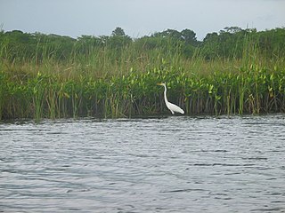
The Black River is one of the longest rivers in Jamaica. At a length of 53.4 km (33.2 mi), it was believed to be the longest until it was discovered that the Rio Minho was 92.8 km long. Its name refers to the darkness of the river bed caused by thick layers of decomposing vegetation. Over 100 species of birds have been recorded in the Black River morass.

Mavis Bank is a rural coffee farming community approximately 10 miles (16 km) north east of Kingston, Jamaica in east rural St. Andrew in the Blue Mountains, close to the border of Portland.
South Negril Point is the westernmost point of mainland Jamaica. It is located a little south of the resort town of Negril and a little north of Negril Lighthouse.
The Lost River is a river that rises in Vernon Township, Washington County, Indiana, and discharges into the East Fork of the White River in Lost River Township, Martin County, Indiana. The river's unusual hydrology has led to two of its features being named as National Natural Landmarks.

A stream is a body of water with surface water flowing within the bed and banks of a channel. The flow of a stream is controlled by three inputs – surface water, subsurface water and groundwater. The surface and subsurface water are highly variable between periods of rainfall. Groundwater, on the other hand, has a relatively constant input and is controlled more by long-term patterns of precipitation. The stream encompasses surface, subsurface and groundwater fluxes that respond to geological, geomorphological, hydrological and biotic controls.
Balaclava is a small town in Northern St Elizabeth parish, Jamaica. It used to be an important town in the north of the parish.
The Cane River rises at twin sources in the vicinity of Derby Peak in eastern Saint Andrew Parish, Jamaica from where it flows south to the Caribbean Sea.
The Dry River is a river in St Mary, Jamaica.
The Great River (Jamaica) is one of Jamaica's major rivers, and forms the boundary of the parish of St James with Westmoreland and Hanover.
The Guava River rises just north of the Grand Ridge of the Blue Mountains on the border of Portland Parish in Jamaica. From here it runs east then north and then east again to its confluence with the Rio Grande.
The South Negril River is a river in Westmoreland, Jamaica.

The Rio Cobre is a river of Jamaica. Its source is unclear, the headwaters being a writhing of unnamed, seasonally dry tributaries. The highest of these rise just above the 1,750 feet (530 m) contour. From here it flows to meet the Caribbean Sea in the north west corner of Kingston Harbour. It is dammed by the Rio Cobre Dam just above Spanish Town.
The Stony River (Jamaica) rises just north of Coopers Hill in Saint Catherine Parish, Jamaica. From here it flows primarily north until it reaches its confluence with the New River.
Hodges, Jamaica is located in Saint Elizabeth, Jamaica. It is a small hamlet on the main A2 road about 2 miles (3.2 km) north-west of Black River. It was the plantation village of Hodges estate which is bordered by the Caribbean Sea to the south and is east of Crawford, Jamaica.
Portland Cottage light structure formerly Portland Lighthouse sometimes Portland Point Lighthouse is situated on the summit of Portland Ridge, Clarendon, near the southernmost part of Jamaica.
Porous is a village in Manchester, Jamaica that overlooks a plain to the south, with hills behind it to the north. A tributary of the Rio Minho runs parallel to the main road, helping to keep the atmosphere cool.
The Rotten Gut River is a short river in the parish of Manchester, Jamaica and a tributary of the One Eye River.

The Juan de Bolas River rises in Saint Catherine, Jamaica, and flows through Saint Catherine and Clarendon. It is one of two rivers in Jamaica named after Juan de Bolas, the first Chief of the Jamaican Maroons.

