
Westmoreland is the westernmost parish in Jamaica, located on the south side of the island. It is situated to the south of Hanover, the southwest of Saint James, and the northwest of Saint Elizabeth, in the county of Cornwall. The chief town and capital is Savanna-la-Mar. Negril, a famous tourist destination, is also situated in the parish.

Hanover is a parish located on the northwestern tip of the island of Jamaica. It is a part of the county of Cornwall, bordered by St. James in the east and Westmoreland in the south. With the exception of Kingston, it is the smallest parish on the island. Hanover is the birth parish of Alexander Bustamante, labour leader, first head of government of Jamaica under universal suffrage, and one of seven Jamaican National Heroes. Its capital is Lucea.
The Broad River is a river in Jamaica. It flows into the Black River at the Great Morass in St. Elizabeth.
The Buff Bay River is a river of Jamaica.
The Cabarita River, originally the Cabaritta, is a river in Jamaica. The Mayfield River is a tributary.
The Ferry River is a river of Jamaica.
The Lucea West River is a river of Jamaica that borders the town of Lucea.
The Morant River is a river of Jamaica.
The New Savannah River is a river of Jamaica.
The Oracabessa River is a river of Jamaica.
The Rio Grande is a river of Jamaica, found in the parish of Portland. It was named when the Spanish occupied Jamaica in the 15th and 16th centuries. One of the largest rivers in Jamaica, it was named "Big River" by the Spanish, and today is one of the many tourist attractions in Portland, mainly for rafting.
The Smith River (Jamaica) is a river of Jamaica.
The Sweet River is a river of Jamaica.
The Swift River (Jamaica) is a river of Jamaica.The river had massive floods during the 1930s {1932-1940},which nearly brought the only major settlement,which shares the same name, to extinction.
The Thicket River is a river of Jamaica.
The Wag Water River is one of Jamaica's rivers. It is dammed by the Hermitage Dam.
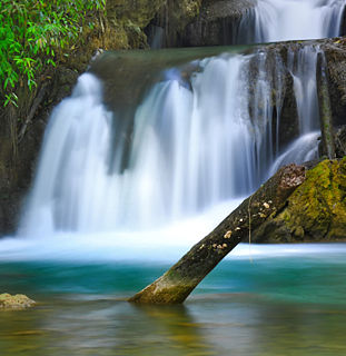
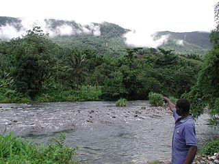
The Y.S. River is a river found in the southern parish of St Elizabeth on the island of Jamaica. It has the famous Y.S. Falls of Jamaica.


