Related Research Articles

The Arctic Archipelago, also known as the Canadian Arctic Archipelago, is an archipelago lying to the north of the Canadian continental mainland, excluding Greenland.
Pedro Bank is a large bank of sand and coral, partially covered with seagrass, about 80 km south and southwest of Jamaica, rising steeply from a seabed of 800 metres depth. It slopes gently from Pedro Cays to the west and north with depths from 13 to 30 metres. The total area of the bank within the 100-metre (328-foot) isobath measures 8,040 square kilometres. The area of a depth to 40 metres is triangular, 70 kilometres long east-west, and 43 kilometres wide. 2,400 square kilometres are less than 20 metres deep. With its islets, cays and rocks, a total land area of 270,000 m2 (2,906,256 sq ft), it is the location of one of the two offshore island groups of Jamaica, the other one being the Morant Cays. The bank is centered at 17°06′N78°20′W.
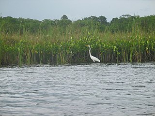
The Black River is one of the longest rivers in Jamaica. At a length of 53.4 km (33.2 mi), it was believed to be the longest until it was discovered that the Rio Minho was 92.8 km long. Its name refers to the darkness of the river bed caused by thick layers of decomposing vegetation. Over 100 species of birds have been recorded in the Black River morass.
Harbour View is a community in Kingston, Jamaica. It is administered by the Kingston and St. Andrew Corporation and is served by the Kingston 17 Post Office. Harbour View was built in 1963, one year after the country's Independence in 1962. The community was the first in Jamaica to have a community paper and its residents claim that the community was the first to host street dances. Harbour View is located in East Kingston and can be described as one of the best communities to live and raise families.
The Alligator Hole River is a river of Jamaica.
The Broad River is a river in Jamaica. It flows into the Black River at the Great Morass in St. Elizabeth.
18°12′0″N77°21′0″W
Coleburns Gully is a river of Jamaica.
The Hectors River is a river of Jamaica.
The Hope River (Jamaica) is a river of Jamaica. It flows from 15 miles north of Kingston and then forms a delta at Kingston.
The Martha Brae River is a river of Jamaica. It is located in Trelawny on the north coast of Jamaica, towards the western edge, about 6 miles south of Falmouth which is in Trelawny Jamaica. The river features rafting.
The Milk River is a river of Jamaica.
The Montego River is a river of Jamaica.
The Rio Bueno is a river of Jamaica.
The Rio Doro is a river of Jamaica.
The Rio Magno is a river of Jamaica.
The Rio Pedro is a river of Jamaica.
Salt River (Jamaica)' is a small community in Jamaica, Clarendon. As of 2020 or later ,it will officially be considered a tourist attraction by the tourism ministry. Salt River Has A variety of tourist attractions, for example : the most popular tourist attraction at salt river is the main infamous 'mineral bath'. There are many other small rivers and beaches but when tourists visit salt river, they mainly visit for the mineral bath.
The Sweet River is a river of Jamaica.
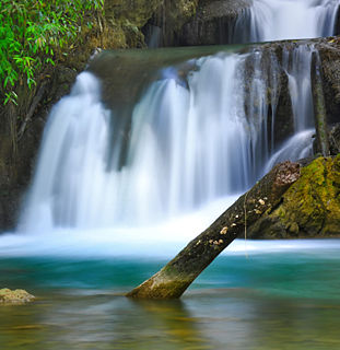
The Y.S. River is a river found in the southern parish of St Elizabeth on the island of Jamaica. It has the famous Y.S. Falls of Jamaica.
References
- GEOnet Names Server
- OMC Map
- CIA Map
- Ford, Jos C. and Finlay, A.A.C. (1908).The Handbook of Jamaica. Jamaica Government Printing Office
Coordinates: 18°06′N77°43′W / 18.100°N 77.717°W