Guava is a common tropical fruit cultivated in many tropical and subtropical regions. Psidium guajava is a small tree in the myrtle family (Myrtaceae), native to Mexico, Central America, and northern South America. Although related species may also be called guavas, they belong to other species or genera, such as the "pineapple guava" Acca sellowiana. In 2016, India was the largest producer of guavas with 41% of the world total.

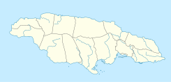
Black River is the capital of St. Elizabeth Parish, in southwestern Jamaica. It developed as a port around the mouth of the river of the same name. Today the city is a centre of environmental tourism and a gateway to the Treasure Beach resort area. Treasure Beach and Crane Beach are to the south-east, with Luana Beach to the west. In the 18th and early 19th centuries, it was a thriving sugar port with a market for African slaves.

The Saint-François River is a river in the Canadian province of Quebec.

Mavis Bank is a rural coffee farming community about 10 miles north east of Kingston, Jamaica in east rural St. Andrew in the Blue Mountains, close to the border of St. Thomas.
Orange Bay is the name of two small bays in Jamaica. One is located at 18.3669076°N 78.3139372°W in the parish of Westmoreland, to the north of the resort town of Negril. The other is at 18.2267018°N 76.6111422°W in the east, in the parish of Portland, 15 miles west of the capital, Port Antonio. Here the name is shared by a small village on the shore of the bay.

The Perquilauquén River is a tributary of the Loncomilla river, in the Maule Region of Chile. The river joins the Longaví to form the Loncomilla, a tributary of the Maule river.

Treasure Beach is the name given to a stretch of four Jamaican coves and their associated settlements: Billy's Bay, Frenchman's Bay, Calabash Bay and Great Pedro Bay.
The Cane River rises at twin sources in the vicinity of Derby Peak in eastern Saint Andrew Parish, Jamaica from where it flows south to the Caribbean Sea.
The Dry River is a river in St Mary, Jamaica.
The Great River (Jamaica) is one of Jamaica's major rivers, and forms the boundary of the parish of St James with Westmoreland and Hanover.
The South Negril River is a river in Westmoreland, Jamaica.
The One-Eye River is a river in the parishes of Manchester and St Elizabeth in Jamaica. It is a tributary of the Black River.

The Rio Cobre is a river of Jamaica. Its source is unclear, the headwaters being a writhing of unnamed, seasonally dry tributaries. The highest of these rise just above the 1,750 feet (530 m) contour. From here it flows to meet the Caribbean Sea in the north west corner of Kingston Harbour. It is dammed by the Rio Cobre Dam just above Spanish Town.
The Stony River (Jamaica) rises just north of Coopers Hill in Saint Catherine Parish, Jamaica. From here it flows primarily north until it reaches its confluence with the New River.

The White River (Jamaica) is a river of Jamaica.
Hodges, Jamaica is located in Saint Elizabeth, Jamaica. It is a small hamlet on the main A2 road about 2 miles (3.2 km) north-west of Black River. It was the plantation village of Hodges estate which is bordered by the Caribbean Sea to the south and is east of Crawford, Jamaica.
Kingston railway terminus was built in the Jamaica Georgian architectural style using brick. It was constructed on a grand scale, symbolising its importance as the main terminus of the Jamaica railways. It has prominent arcades on both levels of the east entrance end. Victorian cast iron brackets support the roof overhang on the trackside. It has sash windows on the ground and upper floors.
The Rotten Gut River is a short river in the parish of Manchester, Jamaica and a tributary of the One Eye River.
Yallahs is a town located on the southeastern coast of Jamaica in the parish of St Thomas and is home to an estimated 10,000 inhabitants. The town may have received its name from Captain Yallahs, a 1671 privateer, or the privateer may have received his pseudonym from the town. Yallahs' name could have simply come from the Spanish word 'yalos', meaning frost, because the high white cliffs in that area have been thought to give an appearance of frost.