
The Arctic Archipelago, also known as the Canadian Arctic Archipelago, is a group of islands north of the Canadian mainland.
Kingston is one of the 14 Parishes of Jamaica. Together with neighboring St. Andrew Parish, it makes up the amalgamated Municipal Unit of Kingston and St. Andrew Corporation. The city of Kingston is the parish and national capital.

Mavis Bank is a rural coffee farming community about 10 miles north east of Kingston, Jamaica in east rural St. Andrew in the Blue Mountains, close to the border of St. Thomas.
Bull Bay is an area located on the southeast coast of Jamaica, 10 miles (16 km) to the east of Kingston on the border between St Andrew and St Thomas, beside Cow Bay. According to folklore, both bays were so named because cattle once roamed the whole area and were slaughtered to provide food for buccaneers and English colonists. Industry in the area includes quarrying for gypsum.
Harbour View is a community in Kingston, Jamaica. It is administered by the Kingston and St. Andrew Corporation and is served by the Kingston 17 Post Office. Harbour View was built in 1963, one year after the country's Independence in 1962. The community was the first in Jamaica to have a community paper and its residents claim that the community was the first to host street dances. Harbour View is located in East Kingston and can be described as one of the best communities to live and raise families.
The Annotto River is a river of Jamaica.
The Buff Bay River is a river of Jamaica.
The Ferry River is a river of Jamaica.
The Morant River is a river of Jamaica.
The Oracabessa River is a river of Jamaica.
The Plantain Garden River is a river in the parish of St Thomas on the island of Jamaica. It is the only major river in Jamaica that does not flow in a northerly or southerly direction.
The Otram River is a river in St Mary, Jamaica. It reaches the sea in the parish capital of Port Maria.
The Rio Grande is a river of Jamaica, found in the parish of Portland. It was named when the Spanish occupied Jamaica in the 15th and 16th centuries. One of the largest rivers in Jamaica, it was named "Big River" by the Spanish, and today is one of the many tourist attractions in Portland, mainly for rafting.
The Smith River (Jamaica) is a river of Jamaica.
The Swift River (Jamaica) is a river of Jamaica.The river had massive floods during the 1930s {1932-1940},which nearly brought the only major settlement,which shares the same name, to extinction.
The Wag Water River is one of Jamaica's rivers. It is dammed by the Hermitage Dam.
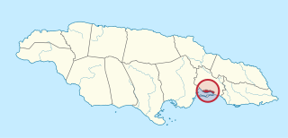
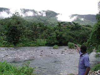
The Yallahs River is a river in the parish of Saint Thomas, Jamaica.
Edinburgh Castle, an estate and now ruined great house in St Ann, was built by Jamaica's earliest recorded serial killer, Lewis Hutchinson. It had two circular, loopholed towers diagonally at opposite corners. The ruins are on the list of National Heritage Sites in Jamaica.
Vineyard Town is a neighbourhood in Kingston, Jamaica.
Rollington Town is a neighborhood in the area of Kingston, Jamaica. Part of it is in Kingston Parish. A campus of Kingston College is in Rollington Town.
