
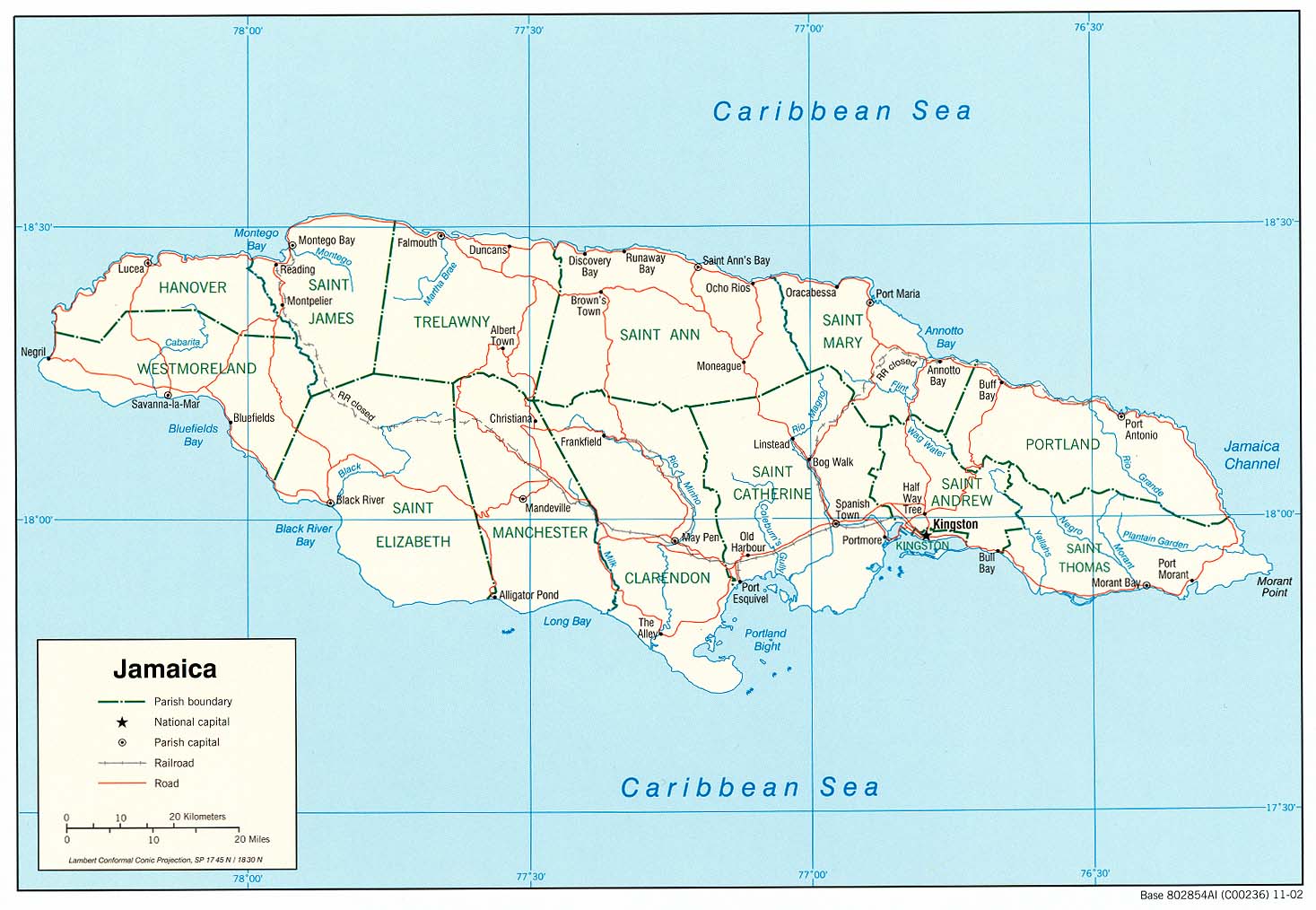
Portland, with its capital town Port Antonio, is a parish located on Jamaica's northeast coast. It is situated to the north of St Thomas and to the east of St Mary in Surrey County. It is one of the rural areas of Jamaica, containing part of the Blue Mountains, where the Jamaican Maroon communities of Moore Town and Charles Town, Jamaica are located.
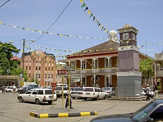
Port Antonio is the capital of the parish of Portland on the northeastern coast of Jamaica, about 100 km from Kingston. It had a population of 12,285 in 1982 and 13,246 in 1991. It is the island's third largest port, famous as a shipping point for bananas and coconuts, as well as one of its most important tourist attractions, tourism being a major contributor to the town’s economy.

Mavis Bank is a rural coffee farming community approximately 10 miles (16 km) north east of Kingston, Jamaica in east rural St. Andrew in the Blue Mountains, close to the border of Portland.
The Bog Walk to Port Antonio railway was a railway in Jamaica built to serve the banana, cacao, citrus and coconut districts of St Catherine, St Mary and Portland.
Harbour View is a community in Kingston, Jamaica. It is administered by the Kingston and St. Andrew Corporation and is served by the Kingston 17 Post Office. Harbour View was built in 1963, one year after the country's Independence in 1962. The community was the first in Jamaica to have a community paper and its residents claim that the community was the first to host street dances. Harbour View is located in East Kingston and can be described as one of the best communities to live and raise families.
The Annotto River is a river of Jamaica.
The Buff Bay River is a river of Jamaica.
The Ferry River is a river of Jamaica.
The Guava River rises just north of the Grand Ridge of the Blue Mountains on the border of Portland Parish in Jamaica. From here it runs east then north and then east again to its confluence with the Rio Grande.
The Martha Brae River is a river of Jamaica. It is located in Trelawny on the north coast of Jamaica, towards the western edge, about 6 miles south of Falmouth which is in Trelawny Jamaica. The river features rafting.
The New Savannah River is a river of Jamaica.
The Oracabessa River is a river of Jamaica.
The Rio Bueno is a river of Jamaica.
The Rio Doro is a river of Jamaica.
The Rio Magno is a river of Jamaica.
The Rio Pedro is a river of Jamaica.
The Spanish River is a river of Jamaica. It flows from south to north, the height of its delta is 0-40m. The Spring Garden, near the Spanish River, was one of the earliest sugar plantations in Jamaica. This river tends to be in very shady regions.
The Swift River (Jamaica) is a river of Jamaica. The river had massive floods during the 1930s {1932-1940}, which nearly brought the only major settlement, which shares the same name, to extinction.
The Wag Water River is one of Jamaica's rivers. It is dammed by the Hermitage Dam.
