Related Research Articles
Discovery Bay is a town in Saint Ann Parish on the northern coast of Jamaica. The city is also known locally as Dry Harbour, and gives its name to the Dry Harbour Mountains in St. Ann. There is a dispute as to whether Christopher Columbus first landed in Discovery Bay or Sevilla la Nueva in 1494. Near to the city are Puerto Seco Beach and several historic sites, such as the Green Grotto Caves and Columbus Park. Visitors to the Green Grotto Caves can see relics of the native Taíno Arawak lifestyle there. It is said that many Spaniards escaped the English invasion of 1655 through secret passages in the caves with the help of Arawaks and African slaves, in exchange for their freedom.
Runaway Bay is a town in Saint Ann Parish on the northern coast of Jamaica and is considered one of the most naturally beautiful places on the island. It is a notable tourist destination located 16 km (9.9 mi) west of Ocho Rios, and slightly east of Discovery Bay, where Christopher Columbus landed in 1494. Ocean View Beach is a private beach situated at Runaway Bay.
Hopewell is a settlement in Manchester Parish, Jamaica.
Hopewell is a settlement in Clarendon Parish, Jamaica.
The Alligator Hole River is a river of Jamaica.
The Broad River is a river in Jamaica. It flows into the Black River at the Great Morass in St. Elizabeth.
18°12′0″N77°21′0″W
Coleburns Gully is a river of Jamaica.
The Hectors River is a river of Jamaica.
The Martha Brae River is a river of Jamaica. It is located (primarily?) in Trelawny Parish on the north coast of Jamaica, towards the western edge, about 6 miles south of Falmouth, Trelawny, Jamaica. The river features rafting.
The Milk River is a river of Jamaica.
The Rio Bueno is a river of Jamaica.
The Rio Doro is a river of Jamaica.
The Rio Magno is a river of Jamaica.
The Rio Pedro is a river of Jamaica.
The Salt River (Jamaica) is a river of Jamaica.
The Smith River (Jamaica) is a river of Jamaica.
The Sweet River is a river of Jamaica.
The Swift River (Jamaica) is a river of Jamaica.The river had massive floods during the 1930s {1932-1940},which nearly brought the only major settlement,which shares the same name, to extinction.
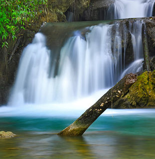
The Y.S. River is a river found in the southern parish of St Elizabeth on the island of Jamaica. It has the famous Y.S. Falls of Jamaica.
References
- GEOnet Names Server
- OMC Map
- CIA Map
- Ford, Jos C. and Finlay, A.A.C. (1908).The Handbook of Jamaica. Jamaica Government Printing Office
Coordinates: 18°28′N77°56′W / 18.467°N 77.933°W

A geographic coordinate system is a coordinate system that enables every location on Earth to be specified by a set of numbers, letters or symbols. The coordinates are often chosen such that one of the numbers represents a vertical position and two or three of the numbers represent a horizontal position; alternatively, a geographic position may be expressed in a combined three-dimensional Cartesian vector. A common choice of coordinates is latitude, longitude and elevation. To specify a location on a plane requires a map projection.
| This article related to a river in Jamaica is a stub. You can help Wikipedia by expanding it. |