Strachan | |
---|---|
Strachan village, view looking west | |
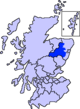
Location within Aberdeenshire | |
OS grid reference | NO674922 |
Council area | |
Lieutenancy area | |
Country | Scotland |
Sovereign state | United Kingdom |
Post town | BANCHORY |
Postcode district | AB31 |
Dialling code | 01330 |
Police | Scotland |
Fire | Scottish |
Ambulance | Scottish |
UK Parliament | |
Scottish Parliament | |
Strachan is a village in Aberdeenshire, Scotland that lies along the Water of Feugh, a tributary of the River Dee, Aberdeenshire, a few miles southwest of Banchory. [1]
The village of Strachan is located in the Grampian Highlands of Scotland, about 20 miles southwest of Aberdeen. Its name is derived from the Scottish Gaelic word "STRATH" meaning broad valley, and "Aan" pronounced "awn" like lawn.
To the northeast of the village is Scolty Hill, best known for the 20m tall tower monument, built in 1840 as a memorial to General Burnett who fought alongside the Duke of Wellington.
To the south, the B974 road crosses the river, and heads over the mountain pass of Cairn o' Mount on its way to the village of Fettercairn. [1]
Inverurie is a town in Aberdeenshire, Scotland at the confluence of the rivers Ury and Don, about 16 miles (26 km) north-west of Aberdeen.
Banchory is a burgh or town in Aberdeenshire, Scotland. It is about 18 miles (29 km) west of Aberdeen, near where the Feugh River meets the River Dee.
Ballater is a village in Aberdeenshire, Scotland, on the River Dee, immediately east of the Cairngorm Mountains. Situated at an elevation of 213 metres, Ballater is a centre for hikers and known for its spring water, once said to cure scrofula. It is home to more than 1400 inhabitants and has had a long connection with the British royal family.
The A93 is a major road in Scotland and the highest public road in the United Kingdom. It runs north from Perth through Blairgowrie and Rattray, then through the Grampian Mountains by way of Glenshee, the Cairnwell Pass and Glen Clunie to Braemar in Aberdeenshire. At Braemar, the road then switches east down the strath of the River Dee before crossing the A90 and terminating in Aberdeen.
Aberdeenshire or the County of Aberdeen is a historic county and registration county of Scotland. The area of the county, excluding the Aberdeen City council area itself, is also a lieutenancy area. The county borders Kincardineshire, Angus and Perthshire to the south, Inverness-shire and Banffshire to the west, and the North Sea to the north and east. It has a coast-line of 65 miles (105 km). The county gives its name to the modern Aberdeenshire council area, which covers a larger area than the historic county.
Crathie is a village in Aberdeenshire, Scotland. It stands on the north bank of the River Dee.
Newtonmore is a village in the Highland council area of Scotland. The village is only a few miles from a location that is claimed to be the exact geographical centre of Scotland.
Torphins is a village in Royal Deeside, Aberdeenshire, Scotland which lies about 22 miles (35 km) west of Aberdeen. It is situated on the A980, about 7 miles (11 km) north-west of Banchory, and was once served by the Great North of Scotland Railway.
Newmachar is a village in Aberdeenshire, Scotland, about 10 miles (16 km) to the north-west of Aberdeen.
Clan Strachan is a Scottish clan originating from the barony of Strachan, in Aberdeenshire. The clan does not have a chief, therefore it is considered by Court of the Lord Lyon and the Stand Council of Scottish Chiefs as an Armigerous clan.
Glenbervie is located in the north east of Scotland in the Howe o' the Mearns, one mile from the village of Drumlithie and eight miles south of Stonehaven in Aberdeenshire. The river Bervie runs through the village. The rural area is the location of Glenbervie House and estate. The parish was formerly named Overbervie.
Cornhill is a small village close to Banff, Aberdeenshire, Scotland. It lies 5 miles (8.0 km) to the south of Portsoy. The village was originally a burgh of a feudal barony and is now a farming community.
Strichen is a village in Aberdeenshire, Scotland. It sits on the A981, connecting it to New Deer 7.2 miles (12 km) to the southwest and Fraserburgh 8 miles (13 km) to the north-northeast, and the B9093, connecting it to New Pitsligo about 4 miles (6.4 km) due west. The village got its name from Lord Strachen. It is situated on the River Ugie at the foothills of Mormond Hill. The Strichen White Horse is constructed of quartz on Mormond Hill, some 1,500 m (1,600 yd) northeast of Strichen.
Blackburn is a rapidly growing village northwest of Aberdeen, Scotland, and is situated in Aberdeenshire. Local amenities include an industrial estate, primary school, nursing home, post office, Starbucks Drive Thru, local Co-op and a community hall.
Netherley, Scotland is a village in Aberdeenshire, situated approximately five miles northwest of Stonehaven. Netherley is located in the Mounth area of the Grampian Highlands. At the eastern edge of Netherley is a significant wetland bog known as Red Moss. To the southwest of Netherley lie Meikle Carewe Hill and Curlethney Hill. At the south edge of Netherley is the peak of Craggie Cat.
Auchenblae is a village in the Kincardine and Mearns area of Aberdeenshire, formerly in Kincardineshire, Scotland. The village was known for its weavers, a whisky distillery and the annual Paldie's Fair horse market.
The North Esk is a river in Angus and Aberdeenshire, Scotland. It is formed by the meeting of the Water of Mark and the Water of Lee, and enters the North Sea four miles north of Montrose. It forms the boundary between Angus and Aberdeenshire at certain stages in its course. It was also noted in the 19th century as a good point for fishing.
Hatton of Fintray, commonly referred to as Fintray, is a village on the River Don in Aberdeenshire, Scotland, in the parish of Fintray. It was a textile village and its church dates from 1821, and there used to be a nearby ferry crossing the river.
Cairn Catto is a Neolithic long cairn near the village of Longside, Aberdeenshire, Scotland. Historic Environment Scotland established the site as a scheduled monument in 1973.
Sunhoney is a stone circle of the recumbent type, which is common in the Grampian region, in particular at the River Dee. Sunhoney is situated about 2 km west of Echt in Aberdeenshire, near to the Cullerlie and Midmar stone circles. It is designated a scheduled ancient monument