Strattanville, Pennsylvania

Last updated
Strattanville, Pennsylvania
Main from Ridge in Strattanville.jpg
Clarion County Pennsylvania Incorporated and Unincorporated areas Strattanville Highlighted.svg
Location of Strattanville in Clarion County, Pennsylvania.
Map of Pennsylvania highlighting Clarion County.svg
Map showing Clarion County in Pennsylvania
USA Pennsylvania location map.svg
Red pog.svg
Strattanville
Coordinates: 41°12′09″N79°19′44″W / 41.20250°N 79.32889°W / 41.20250; -79.32889
Country United States
State Pennsylvania
County Clarion
Settled1828
Incorporated1850
Government
  TypeBorough Council
Area
[1]
  Total0.50 sq mi (1.30 km2)
  Land0.50 sq mi (1.30 km2)
  Water0.00 sq mi (0.00 km2)
Elevation
1,531 ft (467 m)
Population
 (2020) [2]
  Total537
  Estimate 
(2021) [3]
538
  Density996.00/sq mi (384.34/km2)
Time zone UTC-5 (Eastern (EST))
  Summer (DST) UTC-4 (EDT)
ZIP code
16258
FIPS code 42-74728

Strattanville is a borough in Clarion County, Pennsylvania, United States. The population was 537 at the 2020 census. [2]

Contents

History

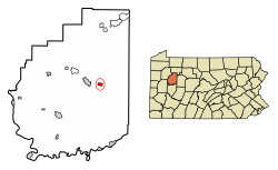
Originally laid out in 1828 by John Strattan Sr., Strattanville lays claim to be the oldest town in Clarion County. Indeed, the first settlement of the town predates the county by 11 years. In 1850 the village incorporated into a borough. As one of the three original towns of Clarion County, it was once in consideration for the county seat. Due to the political turmoil of the time, it was elected to erect a new, separate municipality to hold the county offices in Clarion, Pennsylvania only three miles away. Strattanville still has many auspices of this age in its history. The old school house now houses the local American Legion. The original store owned by Mr. Strattan still stands at the southeastern corner of Market St. and Main St. However, only the drug and furniture store are easily identifiable of the "four dry goods and grocery stores, a postoffice, one drug store, one hardware store, one foundry, two boot and shoe shops, two millinery establishments, one blacksmith shop, one tannery, one furniture store and undertaking establishment, one barber shop, a Western Union telegraph office, two hotels, one livery stable, and a lumber office" [4] that once populated the borough.

Geography

Strattanville is located in eastern Clarion County at 41°12′9″N79°19′44″W / 41.20250°N 79.32889°W / 41.20250; -79.32889 (41.202482, -79.328934). [5] U.S. Route 322 passes through the borough, leading west 3 miles (5 km) to Clarion, the county seat, and east 4.5 miles (7.2 km) to Interstate 80. Exit 64 on I-80 is 3 miles (5 km) southwest of Strattanville via secondary roads.

According to the United States Census Bureau, the borough has a total area of 0.51 square miles (1.31 km2), all land. [6]

Demographics

Historical population
CensusPop.Note
1860 323
1870 35610.2%
1880 317−11.0%
1890 3314.4%
1900 262−20.8%
1910 37643.5%
1920 46122.6%
1930 4875.6%
1940 60424.0%
1950 562−7.0%
1960 547−2.7%
1970 5592.2%
1980 555−0.7%
1990 490−11.7%
2000 54210.6%
2010 5501.5%
2020 537−2.4%
2021 (est.)538 [3] 0.2%
Sources: [7] [8] [9]

As of the census [8] of 2000, there were 542 people, 243 households, and 150 families residing in the borough. The population density was 1,013.6 inhabitants per square mile (391.4/km2). There were 254 housing units at an average density of 475.0 per square mile (183.4/km2). The racial makeup of the borough was 97.79% White, 0.92% African American, 0.37% Asian, and 0.92% from two or more races.

There were 243 households, out of which 29.6% had children under the age of 18 living with them, 43.2% were married couples living together, 12.8% had a female householder with no husband present, and 37.9% were non-families. 29.6% of all households were made up of individuals, and 9.9% had someone living alone who was 65 years of age or older. The average household size was 2.22 and the average family size was 2.73.

In the borough the population was spread out, with 23.2% under the age of 18, 9.6% from 18 to 24, 33.0% from 25 to 44, 19.4% from 45 to 64, and 14.8% who were 65 years of age or older. The median age was 36 years. For every 100 females there were 88.2 males. For every 100 females age 18 and over, there were 81.7 males.

The median income for a household in the borough was $25,833, and the median income for a family was $31,125. Males had a median income of $28,125 versus $18,929 for females. The per capita income for the borough was $14,506. About 11.3% of families and 15.8% of the population were below the poverty line, including 34.8% of those under age 18 and 5.4% of those age 65 or over.

Related Research Articles

<span class="mw-page-title-main">South Bethlehem, Pennsylvania</span> Borough in Pennsylvania, United States

South Bethlehem is a borough in Armstrong County, Pennsylvania, United States. The population was 489 at the 2020 census.

<span class="mw-page-title-main">Callensburg, Pennsylvania</span> Borough in Pennsylvania, United States

Callensburg is a borough in Clarion County, Pennsylvania, United States. The population was 207 at the 2010 census.

<span class="mw-page-title-main">Clarion Township, Clarion County, Pennsylvania</span> Township in Pennsylvania, United States

Clarion Township is a township in Clarion County, Pennsylvania, United States. The population was 3,649 at the 2020 census, a decrease from the figure of 4,116 tabulated in 2010, which was, in turn, an increase over the total of 3,273 at the 2000 census.

<span class="mw-page-title-main">East Brady, Pennsylvania</span> Borough in Pennsylvania, United States

East Brady is a borough in Clarion County, Pennsylvania, United States. The population was 822 at the 2020 census.. Clarion County's designated tourism agency is the Clarion County Economic Development Corporation

<span class="mw-page-title-main">Elk Township, Clarion County, Pennsylvania</span> Township in Pennsylvania, United States

Elk Township is a township in Clarion County, Pennsylvania, United States. The population was 1,432 at the 2020 census, a decrease from the figure of 1,490 tabulated in 2010.

<span class="mw-page-title-main">Foxburg, Pennsylvania</span> Borough in Pennsylvania, United States

Foxburg is a borough in Clarion County, Pennsylvania, United States. It is located along the east bank of the Allegheny River, about 2 miles (3 km) north of the mouth of the Clarion River. As of the 2020 census it had a population of 181.

<span class="mw-page-title-main">Highland Township, Clarion County, Pennsylvania</span> Township in Pennsylvania, United States

Highland Township is a township which is located in Clarion County, Pennsylvania, United States.

<span class="mw-page-title-main">Knox, Pennsylvania</span> Borough in Pennsylvania, United States

Knox is a borough in Clarion County, Pennsylvania, United States. The population was 1,102 at the 2020 census.

<span class="mw-page-title-main">Knox Township, Clarion County, Pennsylvania</span> Township in Pennsylvania, United States

Knox Township is a township that is located in Clarion County, Pennsylvania, United States. As of the 2020 census, the township population was 993, a decrease from the figure of 1,036 that was tabulated in 2010.

<span class="mw-page-title-main">Licking Township, Clarion County, Pennsylvania</span> Township in Pennsylvania, United States

Licking Township is a township that is located in Clarion County, Pennsylvania, United States. The population was 573 at the time of the 2020 census, an increase from the figure of 536 tabulated in 2010.

<span class="mw-page-title-main">New Bethlehem, Pennsylvania</span> Borough in Pennsylvania, United States

New Bethlehem is a borough in Clarion County, Pennsylvania, United States. The population was 979 at the 2020 census. The borough is situated at the southwestern corner of the Pennsylvania Wilds Conservation Landscape. Its main street, PA Route 28-66, is a major thoroughfare between the Pittsburgh metropolitan region and northcentral Pennsylvania.

<span class="mw-page-title-main">Paint Township, Clarion County, Pennsylvania</span> Township in Pennsylvania, United States

Paint Township is a township in Clarion County, Pennsylvania, United States. The population was 1,645 at the 2020 census, a decrease from the figure of 1,699 tabulated in 2010.

<span class="mw-page-title-main">Richland Township, Clarion County, Pennsylvania</span> Township in Pennsylvania, United States

Richland Township is a township in Clarion County, Pennsylvania, United States. The population was 473 at the 2020 census, a decrease from the figure of 494 tabulated in 2010.

<span class="mw-page-title-main">Rimersburg, Pennsylvania</span> Borough in Pennsylvania, United States

Rimersburg is a borough in Clarion County in the U.S. state of Pennsylvania. The population was 945 at the 2020 census.

<span class="mw-page-title-main">Shippenville, Pennsylvania</span> Borough in Pennsylvania, United States

Shippenville is a borough in Clarion County, Pennsylvania, United States. The population was 446 at the 2020 census.

<span class="mw-page-title-main">Sligo, Pennsylvania</span> Borough in Pennsylvania, United States

Sligo is a borough in Clarion County, Pennsylvania, United States. The population was 686 at the 2020 census.

<span class="mw-page-title-main">St. Petersburg, Pennsylvania</span> Borough in Pennsylvania, United States

St. Petersburg is a borough in Clarion County, Pennsylvania, United States. The population was 338 at the 2020 census.

<span class="mw-page-title-main">Toby Township, Pennsylvania</span> Township in Pennsylvania, United States

Toby Township is a township in Clarion County, Pennsylvania, United States. The population was 984 at the 2020 census, a decrease from the figure of 991 in 2010 census, which was, in turn, a decline from 1,166 at the 2000 census.

<span class="mw-page-title-main">Corsica, Pennsylvania</span> Borough in Pennsylvania, United States

Corsica is a borough in Jefferson County, Pennsylvania, United States. The population was 357 at the 2010 census. It was named for the island of Corsica, birthplace of Napoleon Bonaparte. The mayor of the borough is Dave Leadbetter.

<span class="mw-page-title-main">Penn, Pennsylvania</span> Borough in Pennsylvania, United States

Penn is a borough in Westmoreland County, Pennsylvania, United States. The population was 475 at the time of the 2010 census.

References

  1. "2019 U.S. Gazetteer Files". United States Census Bureau. Retrieved July 28, 2020.
  2. 1 2 "2020 Decennial Census". census.gov. US Census Bureau. Retrieved December 10, 2022.
  3. 1 2 Bureau, US Census. "City and Town Population Totals: 2020-2021". Census.gov. US Census Bureau. Retrieved 17 July 2022.
  4. http://history.rays-place.com/pa/clar-strittanville.htm [ dead link ]
  5. "US Gazetteer files: 2010, 2000, and 1990". United States Census Bureau. 2011-02-12. Retrieved 2011-04-23.
  6. "Geographic Identifiers: 2010 Census Summary File 1 (G001): Strattanville borough, Pennsylvania". U.S. Census Bureau, American Factfinder. Archived from the original on April 24, 2015. Retrieved April 24, 2015.
  7. "Census of Population and Housing". U.S. Census Bureau. Retrieved 11 December 2013.
  8. 1 2 "U.S. Census website". United States Census Bureau . Retrieved 2008-01-31.
  9. "Incorporated Places and Minor Civil Divisions Datasets: Subcounty Resident Population Estimates: April 1, 2010 to July 1, 2012". Population Estimates. U.S. Census Bureau. Archived from the original on 11 June 2013. Retrieved 11 December 2013.