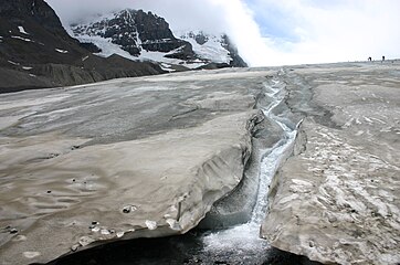
Jasper National Park is a national park in Alberta, Canada. It is the largest national park within Alberta's Rocky Mountains spanning 11,000 km2 (4,200 sq mi). Its location is north of Banff National Park and west of Edmonton. The park contains the glaciers of the Columbia Icefield, springs, lakes, waterfalls and mountains.

The Athabasca River is a river in Alberta, Canada, which originates at the Columbia Icefield in Jasper National Park and flows more than 1,231 km (765 mi) before emptying into Lake Athabasca. Much of the land along its banks is protected in national and provincial parks, and the river is designated a Canadian Heritage River for its historical and cultural importance. The scenic Athabasca Falls is located about 30 km (19 mi) upstream from Jasper.

Mushroom Peak is a mountain located in the Sunwapta River valley of Alberta, Canada's Jasper National Park, lying just over a kilometre east of Diadem Peak. The mountain was named in 1947 by Noel E. Odell who made the first ascent (solo). Upon reaching the summit, he found that the dark limestone rocks there resembled mushrooms. The mountain can be seen from the Icefields Parkway.

Sunwapta Peak is a peak located in the Sunwapta River valley of Jasper National Park, just north of the Columbia Icefield in Alberta, Canada. The peak was named in 1892 after the Stoney language word sunwapta meaning "turbulent river". The mountain can be seen from the Icefields Parkway.
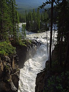
Sunwapta Falls is a pair of waterfalls of the Sunwapta River located in Jasper National Park, Alberta, Canada.

Maligne Lake is a lake in Jasper National Park, Alberta, Canada. The lake is famed for the colour of its azure water, the surrounding peaks, the three glaciers visible from the lake, and Spirit Island, a frequently and very famously photographed islet. The lake is located 44 km (27 mi) south of Jasper town, and is accessible by motor vehicle, including shuttle buses from Jasper. Boat tours run to Spirit Island in the spring to autumn season. The 44 km Skyline Trail, Jasper's most popular, highest and above treeline, multi-day hike, begins at Maligne Lake and finishes near the town of Jasper. Other popular day hikes include the Opal Hills and Bald Hills loops. Winter activities include cross-country skiing and snowboarding.

The Athabasca Glacier is one of the six principal 'toes' of the Columbia Icefield, located in the Canadian Rockies. The glacier currently loses depth at a rate of about 5 metres (16 ft) per year and has receded more than 1.5 km (0.93 mi) and lost over half of its volume in the past 125 years. Easily accessible, it is the most visited glacier in North America. The leading edge of the glacier is within easy walking distance; however, travel onto the glacier is not recommended unless properly equipped. Hidden crevasses have led to the deaths of unprepared tourists.

Mount Wilcox is a 2,884-metre (9,462-foot) mountain summit located in the Canadian Rockies of Alberta, Canada. It is located in Jasper National Park right beside the Columbia Icefield visitor centre with the Icefields Parkway traversing the western base of the mountain. Its nearest higher peak is Nigel Peak, 3.35 km (2.08 mi) to the northeast. Mount Wilcox is a moderate scramble from Wilcox Pass. Due to its location, it provides one of the best views of the Athabasca Glacier.

Alberta's Rockies comprises the Canadian Rocky Mountains in Alberta, Canada. On the southwestern part of the province along the British Columbia border, the region covers all but the south of Census Division 15.
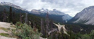
Sunwapta Pass is a mountain pass in the Canadian Rockies in the province of Alberta. Sunwapta Pass is the low point of the saddle created between Mount Athabasca and Nigel Peak. The pass marks the boundary between Banff and Jasper National Parks. The Icefields Parkway travels through Sunwapta Pass 108 km (67 mi) southeast of the town of Jasper and 122 km (76 mi) northwest of the Parkway's junction with the Trans-Canada Highway near Lake Louise. The pass is the second highest point on the Icefields Parkway. Bow Summit in Banff National Park is the highest point on the parkway.

The Chaba River is a short river in western Alberta, Canada. It flows from the Canadian Rockies, and joins the Athabasca River.

The Fiddle River is a medium-sized tributary of the Athabasca River, flowing into the river near the east gate of Jasper National Park in Alberta, Canada. The Fiddle River forms at the base of Fiddle Pass, with meltwater from Mount Bryant, Mount Gregg, Mount Sir Harold Mitchel, and Mount Barry. The river flows in a general northeast direction before its confluence with the Athabasca. The Fiddle River parallels the road to the popular Miette Hotsprings for a portion of its course.
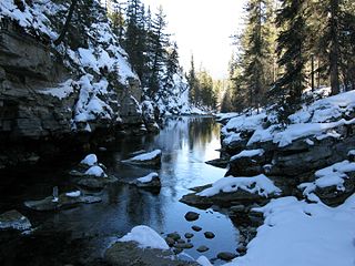
The Maligne River is a medium-sized river in the Canadian Rockies. It runs through parts of Jasper National Park in Alberta, Canada. The Maligne is a major tributary of the Athabasca River. The river takes from the French word for malignant or wicked. It is theorised that a Belgian priest voyageur created this name in reference to the current of the river near its confluence with the Athabasca River.
The Jackpine River is an early tributary of the Smoky River. It forms in the Canadian Rockies, within Willmore Wilderness Park, in the province of Alberta, north of Jasper National Park. The river collects the runoff from Resthaven Mountain, Barricade Mountain, Jackpine Mountain, Mount Holmes, Perseverance Mountain, and Draco Peak.

The Snake Indian River is a large tributary of the Athabasca River, exiting entirely within Jasper National Park. The Snake Indian forms at Snake Indian Pass, south of Monte Christo Mountain and Snake Indian Mountain, north of Calumet Peak. The river travels in a general northwest direction before turning sharply south. The river plummets over the massive Snake Indian Falls before joining the Athabasca River downstream of Jasper Lake, near the east gate of Jasper National Park.

The Snaring River is a medium-sized river in the Canadian Rockies. It runs through parts of Jasper National Park in Alberta, Canada. The Snaring River is a significant tributary of the Athabasca River. The Snaring is named after a former local tribe of first nations people who lived in dugouts and trapped animals with snares.

The Astoria River is a short river in Jasper National Park, Alberta, Canada. It is an early tributary of the Athabasca River.
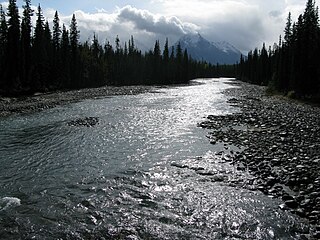
The Whirlpool River is a short river in Jasper National Park, Alberta, Canada. It is an early tributary of the Athabasca River.

Nigel Peak is a 3,211-metre (10,535-foot) mountain summit located on the shared border of Banff National Park and Jasper National Park, in the Canadian Rockies of Alberta, Canada. Nigel has two peaks, the north summit is the highest point. The nearest higher peak is Mount Athabasca, 6.4 km (4.0 mi) to the south-southwest. Nigel Peak is situated immediately north of Sunwapta Pass and can be seen from the Icefields Parkway and from Athabasca Glacier.

Tangle Ridge is a 3,000-metre (9,800 ft) mountain summit located in Jasper National Park, in the Canadian Rockies of Alberta, Canada. Tangle Ridge is situated south of Beauty Creek and north of Tangle Creek, in the Sunwapta River valley. Views from the top of Tangle Ridge provide photographers with an opportunity to capture the peaks surrounding the Columbia Icefield, some of which, such as Mount Columbia and Mount Alberta, are otherwise hidden from view along the Icefields Parkway.

