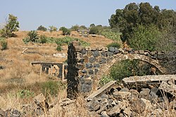
Syrian towns and villages depopulated in the Arab–Israeli conflict

Last updated
Map of location of Syrian localities whose residents have been displaced since 1967 overlaid on top of the modern demographic map of the area Demographic map of the Golan Heights and Syrian localities depopulated during and after the 1967 War - Legend.png
Map of location of Syrian localities whose residents have been displaced since 1967 overlaid on top of the modern demographic map of the area

Before the Six-Day War and Yom Kippur War, the Golan Heights comprised 312 inhabited areas, including 2 towns, 163 villages, and 108 farms. [1] In 1966, the Syrian population of the Golan Heights was estimated at 147,613. [2] Israel seized about 70% of the Golan Heights in the closing stages of the Six-Day War. [3] Many of these residents fled during the fighting, [4] or were driven out by the Israeli army, [5] [6] and some were evacuated by the Syrian army. [5] The Washington Report on Middle East Affairs in 1992 characterized Israel's actions as "ethnic cleansing". [7]

Contents

Israel forcibly expelled Syrians from the Golan Heights. [8] [9] There were also instances of Israeli soldiers killing Syrian residents including blowing up their home with people inside. [10]

A cease-fire line was established and large parts of the region came under Israeli military control, including the town of Quneitra, about 139 villages and 61 farms. [1] Of these, the Census of Population 1967 conducted by the Israeli Defence Forces listed only eight, including Quneitra. [1] One of the remaining populated villages, Shayta, was partially destroyed in 1967 and a military post built in its place. [11] Between 1971–72 it was eradicated, with the remaining population forcibly transferred to Mas'ade, another of the populated villages under Israeli control. [11] [12] Focaal reports that "95% of the Syrian indigenous population was forcibly displaced and only five villages, out of 340 villages and farms, remained." [13]

The Israeli Head of Surveying and Demolition Supervision for the Golan Heights proposed the demolition of 127 unpopulated villages, with about 90 abandoned villages to be demolished shortly after May 15, 1968. [14] [15] The demolitions were carried out by contractors hired for the job. [6] [15] [16] [17] [18] [19] After the demolitions, the lands were given to Israeli settlers. [20] There was an effort to preserve buildings of archaeological significance and buildings useful for the planned Jewish settlements. [15]

After the 1973 Yom Kippur War, parts of the occupied Golan Heights were returned to Syrian control, including Quneitra, which had changed hands several times during the war. According to a United Nations Special Committee, Israeli forces had deliberately destroyed the city before their 1974 withdrawal. [21]

Depopulated and demolished towns and villages

See also

Related Research Articles

<span class="mw-page-title-main">Shebaa Farms</span> Disputed territory in the Levant

The Shebaa Farms, also spelled Sheba'a Farms, also known as Mount Dov, is a strip of land on the Lebanese–Syrian border that is currently occupied by Israel. Lebanon claims the Shebaa Farms as its own territory, and Syria agrees with this position. Israel claims it is part of the Golan Heights, Syrian territory that it has occupied since 1967 and effectively annexed in 1981. This dispute plays a significant role in contemporary Israel–Lebanon relations.

<span class="mw-page-title-main">Quneitra</span> Place in Syria

Quneitra is the largely destroyed and abandoned capital of the Quneitra Governorate in south-western Syria. It is situated in a high valley in the Golan Heights at 1,010 metres (3,313 feet) above sea level. Since 1974, pursuant to United Nations Security Council Resolution 350 and the Agreement on Disengagement between Israel and Syria, the city is inside the UN-patrolled buffer zone.

<span class="mw-page-title-main">Quneitra Governorate</span> Governorate of Syria

Quneitra Governorate is one of the fourteen governorates (provinces) of Syria. It is situated in southern Syria, notable for the location of the Golan Heights. The governorate borders the countries of Lebanon, Jordan and Israel, and the Syrian governorates of Daraa and Rif Dimashq. Its area varies, according to different sources, from 685 km2 to 1,861 km2. The governorate had a population of 87,000 at the 2010 estimate. The nominal capital is the now abandoned city of Quneitra, destroyed by Israel before their withdrawal in June 1974 in the aftermath of the Yom Kippur War; since 1986, the de facto capital is Ba'ath City.

<span class="mw-page-title-main">Golan Heights</span> Syrian territory occupied by Israel since 1967

The Golan Heights, or simply the Golan, is a basaltic plateau at the southwest corner of Syria. It is bordered by the Yarmouk River in the south, the Sea of Galilee and Hula Valley in the west, the Anti-Lebanon mountains with Mount Hermon in the north and Wadi Raqqad in the east. Two thirds of the area was occupied by Israel following the 1967 Six-Day War and then effectively annexed in 1981 – an action unrecognized by the international community, which continues to consider it Israeli-occupied Syrian territory. In 2024 Israel occupied the remaining one third of the area.

<span class="mw-page-title-main">Neve Ativ</span> Israeli settlement in the Golan Heights

Neve Ativ, is an Israeli settlement in the Golan Heights, organized as a small Alpine-styled moshav. Located on the slopes of Mount Hermon, 2 kilometers (1.2 mi) west of Majdal Shams. it falls under the jurisdiction of Golan Regional Council. In 2022 it had a population of 140.

<span class="mw-page-title-main">Fiq, Syria</span> Abandoned Syrian town in the Golan Heights

Fiq was a Syrian town in the Golan Heights that administratively belonged to Quneitra Governorate. It sat at an altitude of 349 meters (1,145 ft) and had a population of 2,800 in 1967. It was the administrative center of the Fiq District, the southern district of the Golan. Fiq was evacuated during and after the Six-Day War in June 1967. The Israeli settlement of Kibbutz Afik was built close by.

<span class="mw-page-title-main">Beer Ajam</span> Village in Quneitra, Syria

Beer Ajam is a Syrian Circassian village in the Quneitra Governorate in the Syrian controlled portion of the Golan Heights. It has been inhabited for about 150 years. Its first houses were built in 1872. Nearby localities include Quneitra to the north, Naba al-Sakhr to the northeast, al-Harra to the east, Namer to the southeast and Bariqa to the south. According to the Syria Central Bureau of Statistics (CBS), Beer Ajam had a population of 353 in the 2004 census. Its inhabitants are Circassians from the Abadzekh and Kebertei tribes.

<span class="mw-page-title-main">Katzrin ancient village and synagogue</span> Museum and archaeological site in the Golan Heights

The Katzrin ancient village and synagogue (Hebrew: קצרין העתיקה; also Qasrin, Kasrin, from is an open-air museum located in the Golan Heights on the outskirts of the Israeli settlement of Katzrin. It features the partially reconstructed remains of a village from the 4th-8th century CE, that is: mainly from the Byzantine period, but starting from the Late Roman and extending into the Early Muslim era, or in Jewish historiography, the Talmudic period.

Yehudiya or Yehudiyye is an abandoned village and archeological site in the center of the Golan Heights, about 5 kilometers south of Katzrin within the Yehudiya Forest Nature Reserve.

Shayta, also spelled Suhayta, S'heita or Su'heita, was a Syrian village located in the Golan Heights. It was one of only six Syrian villages in the Golan Heights still populated following the Six-Day War. After Israel occupied the area in 1967, Shayta's population census was 176 people, down from 200 in 1960. In 1967, Shayta was partially destroyed and a military post built in its place. Israel completely destroyed the village in 1971-72 and its population was forcibly transferred to the neighboring village of Mas'ade. Today, its former inhabitants are still campaigning for the return to their village. Shayta was located near the ceasefire line between Syrian and Israeli forces.

Jubata ez-Zeit was a Syrian village situated in the northern the Golan Heights. According to an Arab resident of a nearby town, it had a population of around 1,500 to 2,000 people prior to the forced expulsion of the town's residents in 1968.

<span class="mw-page-title-main">Al-Marsad</span> Human rights organization

Al-Marsad – Arab Human Rights Centre in Golan Heights is an independent, not-for-profit international human rights organization with no religious or political affiliation that operates in the Golan Heights. The Golan Heights region is internationally recognised as Syrian territory occupied by Israel, although Israel asserts it has a right to retain control over the area. The organisation was created in October 2003 and is run from Majdal Shams. It was the first human rights organisation founded in the Golan.

The 2012–2014 Quneitra Governorate clashes began in early November 2012, when the Syrian Army began engaging with rebels in several towns and villages of the Quneitra Governorate. The clashes quickly intensified and spilled into the UN-supervised neutral demilitarized zone between Syrian controlled territory and the Israeli-occupied Golan Heights.

<span class="mw-page-title-main">Khushniyeh</span> Abandoned Syrian village in the Golan Heights

Khushniyeh is a former Syrian town located in the Golan Heights.

<span class="mw-page-title-main">Israeli occupation of the Golan Heights</span> International legal status of the plateau near the Israel–Syria border

The Golan Heights are a rocky plateau in the Levant region of Western Asia that was captured by Israel from Syria in the 1967 Six-Day War. The international community, with the exception of Israel and the United States, considers the Golan Heights to be Syrian territory held by Israel under military occupation. Following the war, Syria dismissed any negotiations with Israel as part of the Khartoum Resolution.

The Golan Subdistrict is an area administered by Israel as a subdistrict of Northern District. The subdistrict encompasses the Israeli-occupied territories of Golan Heights, occupied from Syria during the Six-day war and annexed to Israel under the Golan Heights Law. Thus this region is internationally recognized to encompass Quneitra Governorate, which itself is composed of 2 districts and 5 subdistricts.

Za'ura, was a Syrian Alawite village situated in the northwestern Golan Heights.

As-Summaqah, Sumaqa or Samaqa, is a former Syrian village located in the Golan Heights.

<span class="mw-page-title-main">Er-Ramthaniyye</span> Depopulated Syrian village in the Golan Heights

Er-Ramthaniyye, or Ramsaniyye is a former Syrian village located in the Golan Heights.

Mansura,, is a former Syrian village located in the Golan Heights.

References

  1. 1 2 3 Davis, Uri (1983). "The Golan Heights under Israeli Occupation 1967–1981" (PDF).
  2. "Submission to UN Committee on the Elimination of Racial Discrimination" (PDF). Al Marsad, the Arab Center for Human Rights in the Golan Heights. January 2007.
  3. 1 2 Murphy & Gannon 2008, p. 24
  4. BBC News, Regions and territories: The Golan Heights
  5. 1 2 "Destroyed Villages in the Golan Heights". Archived from the original on 2012-02-18.
  6. 1 2 CatchWord (1979). The Round table, Volume 69, Issues 273–276. Round Table Limited. p. 77.
  7. Israel, Shahak (November 1992). "Memory of 1967 "Ethnic Cleansing" Fuels Ideology of Golan Settlers". Washington Report on Middle East Affairs.
  8. Sulimani & Kletter 2022 , p. 55-56
  9. Fogelman, Shay (2010-07-30). "The Disinherited". Haaretz.com. Retrieved 2024-08-15.
  10. Sulimani & Kletter 2022 , p. 55-56: "Avishay Katz, the commander of reserve Engineer Regiment 602,testified: At this stage [during the war] the instruction that we have received was to go and check that no ‘guys’ are left hiding. We did it in the first villages [conquered] on top of the [Golan] Heights . . . . There were a few cases that I don’t want to talk about.’ What does it mean? Katz: ‘They killed people that should not have been killed. Syrian citizens’ . . . There were a few guys of mine who killed some Arab citizens’ . . . Why did they kill them? ‘It was out of stupidity, something that should not have been done, and they were kicked out of the regiment. All the rest of the Golan dwellers were deported. Not one remained’. How did it happen? ‘They destroyed a house on top of its dwellers . . . It was a war crime. . . . It drove me out of my mind’"
  11. 1 2 Murphy, Ray; Gannon, Declan (2008). "Changing the Landscape: Israel's Gross Violations of International Law in the Occupied Syrian Golan". Yearbook of International Humanitarian Law. 11. Cambridge University Press: 147.
  12. Sakr Abu Fakhr, "Voices from the Golan", Journal of Palestine Studies, Vol. 29, No. 4 (Autumn, 2000), University of California Press, p. 7.
  13. Editor, Focaal Web (2023-11-16). "Maria Kastrinou: Looking at ethnic cleansing in Palestine from the occupied Syrian Golan". www.focaalblog.com. Retrieved 2024-07-18.{{cite web}}: |last= has generic name (help)
  14. Kimmerling, Baruch (2003). Politicide: Ariel Sharon's War Against the Palestinians . Verso. p.  28. ISBN   978-1-84467-532-6.
  15. 1 2 3 "The Fate of Abandoned Arab Villages, 1965–1969" by Aron Shai, History & Memory Volume 18, Number 2, Fall/Winter 2006, pp. 86–106. "As the pace of the surveys increased in the West Bank, widespread operations also began on the Golan Heights, which had been captured from Syria during the war (figure 7). Dan Urman, whose official title was Head of Surveying and Demolition Supervision for the Golan Heights, was responsible for this task. Urman submitted a list of 127 villages for demolition to his bosses. … The demolitions were executed by contractors hired for the job. Financial arrangements and coordination with the ILA and the army were recorded in detail. Davidson commissioned surveys and demolition supervision from the IASS [Israel Archaeological Survey Society]. Thus, for example, in a letter dated 15 May 1968, he wrote to Ze'ev Yavin: 'Further to our meeting, this is to inform you that within a few days, we will start demolishing about 90 abandoned villages on the Golan Heights (see attached list)."
  16. Edgar S. Marshall (2002). Israel: Current Issues and Historical Background. Nova Science Publishers. p. 33. ISBN   1-59033-325-X.
  17. Dorothy Weitz Drummond (2004). Holy land, Whose Land?: Modern Dilemma, Ancient Roots. Fairhurst Press. p. 43. ISBN   0-9748233-2-5.
  18. Philip Louis Gabriel (1978). In the Ashes: The Story of Lebanon . Whitmore Pub Co. p.  121. ISBN   0-87426-046-9.
  19. (2001) Report of the Special Committee to Investigate Israeli Practices Affecting the Human Rights of the Palestinian People and Other Arabs of the Occupied Territories J. Destruction of built-up areas and looting of property: "Following the occupation of the territory in 1967, the occupation authorities destroyed 244 villages and built-up areas in the Golan and expelled their population, sparing only five villages (Majdal Shams, Buq'ata, ‘Ayn Qunyah, Mas'ade and al-Ghajar)."
  20. "The Golan Heights under Israeli Occupation 1967–1981" p.5. "The remainder of 131 agricultural villages and 61 individual farms were wiped off the face of the earth by the Israeli occupation authorities immediately following the Israeli victory in the 1967 war. They were razed to the ground and their lands handed over to exclusive Israeli-Jewish settlement."
  21. (1974) Report of the Special Committee to Investigate Israeli Practices Affecting the Human Rights of the Population of the Occupied Territories Archived 2011-01-03 at the Wayback Machine
  22. 1 2 3 4 5 6 7 8 9 10 11 12 13 14 15 16 17 18 19 20 21 22 23 24 25 26 27 28 29 30 31 32 33 34 35 36 37 38 39 40 41 42 43 44 45 46 47 48 49 50 51 52 53 54 55 56 57 58 59 60 61 62 63 64 65 66 67 68 69 70 71 72 73 74 75 76 77 78 79 80 81 82 83 84 85 86 87 88 89 90 91 92 93 94 95 96 97 98 99 100 101 102 103 104 105 106 107 108 109 110 111 112 113 114 115 116 117 Kipnis, Yigal (2013). The Golan Heights: Political History, Settlement and Geography since 1949. Routledge. pp. 240–246. ISBN   978-0-203-56869-9.
  23. 1 2 3 4 5 6 7 8 9 10 11 12 13 14 15 16 17 18 19 20 21 22 23 24 25 26 27 28 29 30 31 32 33 34 35 36 37 38 39 40 41 42 43 44 45 46 47 48 49 50 51 52 53 54 55 56 57 58 59 60 61 62 "The Occupied Golan Heights". Archived from the original on 2013-08-21. – Map showing destroyed Arab villages.
  24. 1 2 3 4 5 6 7 8 9 10 11 12 13 14 15 16 17 18 19 20 21 22 23 24 25 26 27 28 29 30 31 32 33 34 35 36 37 38 39 40 41 42 43 44 45 46 47 48 49 50 51 Murphy & Gannon 2008, p28 + p69
  25. 1 2 3 4 5 6 7 8 9 10 11 12 13 14 15 16 17 18 19 20 21 22 23 24 25 26 27 28 29 30 31 32 33 34 35 36 37 38 39 40 41 42 43 44 45 46 47 48 49 50 51 52 53 54 55 56 57 58 59 60 Golan Heights and vicinity: October 1994 – CIA map showing abandoned/dismantled Syrian villages.
  26. 1 2 3 4 5 6 7 8 9 10 11 12 13 14 15 16 17 18 19 20 21 22 23 24 25 26 27 28 29 30 Murphy & Gannon 2008, p28 + p70
  27. 1 2 3 4 5 6 7 8 9 10 11 12 13 14 15 16 17 18 19 20 21 22 23 24 25 26 27 28 29 30 31 32 33 34 35 36 37 38 39 40 41 42 43 44 45 46 47 48 Murphy & Gannon 2008, p28 + p68
  28. 1 2 3 4 5 6 7 8 9 10 11 12 13 14 15 16 17 18 19 20 21 22 23 24 25 26 27 28 29 30 31 Murphy & Gannon 2008, p28 + p67
  29. 1 2 South Lebanon and Vicinity 1976, CIA map.
  30. Murphy & Gannon 2008, p 48
  31. Yaqut al-Hamawi, cited in le Strange, 1890, p. 485
  32. U.S. Committee for Refugees and Immigrants [ permanent dead link ]

Bibliography