
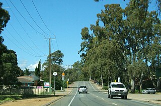
Uraidla is a small town in the Adelaide Hills of South Australia, Australia. At the 2016 census, Uraidla had a population of 575. However it also sits at the centre of a larger population catchment of rural townships which include Summertown, Piccadilly, Ashton, Basket Range, Carey Gully, Norton Summit and Cherryville.

Marion is a suburb in the City of Marion, around 10 kilometres (6.2 mi) south-west of the city centre of Adelaide, the capital of South Australia. Founded as a rural village in 1838 on the banks of the Sturt River, Marion was found to have rich soil and the population expanded rapidly. Colonel William Light laid out the plan for the village, as he had done with the City of Adelaide itself.
Waterfall Gully is an eastern suburb of the South Australian capital city of Adelaide. It is located in the foothills of the Mount Lofty Ranges around 5 km (3.1 mi) east-south-east of the Adelaide city centre. For the most part, the suburb encompasses one long gully with First Creek at its centre and Waterfall Gully Road running adjacent to the creek. At the southern end of the gully is First Falls, the waterfall for which the suburb was named. Part of the City of Burnside, Waterfall Gully is bounded to the north by the suburb of Burnside, from the north-east to south-east by Cleland National Park, to the south by Crafers West, and to the west by Leawood Gardens and Mount Osmond.

Para Hills is a residential suburb of Adelaide, South Australia. There is a light aircraft airport close to its boundary, and numerous sporting facilities, abundant parks and schools and two medium-sized shopping centres. Most of the suburb is in the City of Salisbury while some is in the City of Tea Tree Gully.

Marble Hill was the Vice-Regal summer residence for the Governor of South Australia for seventy-five years, from 1880 to 1955. It is also the name of a ward of the Adelaide Hills Council, and a suburb, both named after the residence and in which the residence is located. It is about 20 kilometres (12 mi) east of Adelaide between the towns of Ashton and Cherryville, and has expansive views of the Adelaide Hills to the North and East, and the Adelaide Plains to the West.

Clarendon is a small town in the Adelaide Hills, about 25–30 kilometres (16–19 mi) south of the Adelaide city centre and now regarded as an outer suburb of Adelaide. It lies within the City of Onkaparinga council area. The Clarendon Weir is located in the town area, on the Onkaparinga River.
Happy Valley is a metropolitan suburb of Adelaide, South Australia. It is located 20 km south of the Central Business District of Adelaide.
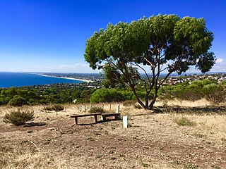
Marino is a coastal suburb in the south of Adelaide, South Australia that's surrounded by a conservation park and rugged coastline. Most houses have sea views and access to meandering public open spaces. The suburb even has its own working lighthouse. Marino's elevated position provides panoramic views of the ocean – Gulf St Vincent, the metropolitan beaches and Adelaide CBD. Marino has access to the North or South via Brighton Road, has two railway stations on the main Seaford Line and a host of walking and cycle trails to the neighbouring beaches and wine region. A community cooperative has purchased a restaurant building on the beachfront on Marine Parade. It's called Marino Rocks Social. The cooperative's first project is to run a cafe. The cooperative has 250 members, all with equal status, who have invested money or effort and is completely independent of other local community associations.

Athelstone is a suburb of Adelaide in the City of Campbelltown. It was established in the 19th century but only became part of suburban Adelaide in the second half of the 20th century.
Hazelwood Park is an upper class suburb in the City of Burnside, Adelaide, South Australia with a census area population of 1,717 people. The suburb is about 5 kilometres east of the Central business district. Hazelwood Park, a suburban park inside the suburb, is the major attraction in the suburb and is the start of the flat country of the Adelaide Plains at the bottom of the Adelaide Hills. Adjacent Howard Terrace is considered to be the end of the Plains and the start of the foothills. Hazelwood Park includes the Burnside Swimming Centre, a popular site in the summer. Much of the remainder of the suburb is residential but there is a small shopping area along Glynburn Road on the eastern edge. The area was first settled by Europeans in 1848 but has seen many community changes over the years.
Rosslyn Park is an eastern suburb of Adelaide in the City of Burnside.

Morialta is a single-member electoral district for the South Australian House of Assembly. It is a 356 km2 electorate stretching from the Adelaide Hills to the outer eastern and north-eastern suburbs of Adelaide, taking in the suburbs and localities of Auldana, Ashton, Athelstone, Basket Range, Birdwood, Castambul, Cherryville, Cudlee Creek, Forest Range, Gumeracha, Highbury, Kenton Valley, Lenswood, Lobethal, Marble Hill, Montacute, Mount Torrens, Norton Summit, Rostrevor, Summertown, Teringie, Uraidla and Woodforde, as well as part of Chain of Ponds.

The Little Para River is a seasonal creek running across the Adelaide Plains in the Australian state of South Australia, whose catchment fills reservoirs that supply some of the water needs of Adelaide’s northern suburbs.

Mile End is an inner western suburb of Adelaide, located in the City of West Torrens, around 2 kilometres from the Adelaide city centre. It has a census area population of 4,413 people (2011). Much of the suburb is residential, but there are small commercial areas along Henley Beach Road and South Road.

Beaumont House, occasionally known as Claremont, is an eclectic Romanesque-Classical brick residence located at 631 Glynburn Road in Beaumont, South Australia. Beaumont House was constructed for Augustus Short, the first Anglican bishop of Adelaide and founder of St Peter's Cathedral. It was constructed on land initially owned by Sir Samuel Davenport, a wealthy Adelaide landlord. Following Short's move back to England, Davenport purchased the house—the second of five eventual owners. Following three sales between 1907 and 1911, the house was then transferred to the National Trust of South Australia in 1968 and has been listed on the South Australian Heritage Register since 24 July 1980.
Vale Park is a suburb of Adelaide in the Town of Walkerville, South Australia. It is located northeast of the Adelaide city centre between North East Road and the River Torrens, astride Ascot Avenue, part of the A17 highway which is the major eastern ring route bypass of Adelaide.

Lands administrative divisions of Australia are the cadastral divisions of Australia for the purposes of identification of land to ensure security of land ownership. Most states term these divisions as counties, parishes, hundreds, and other terms. The eastern states of Queensland, New South Wales, Victoria, and Tasmania were divided into counties and parishes in the 19th century, although the Tasmanian counties were renamed land districts in the 20th century. Parts of South Australia (south-east) and Western Australia (south-west) were similarly divided into counties, and there were also five counties in a small part of the Northern Territory. However South Australia has subdivisions of hundreds instead of parishes, along with the Northern Territory, which was part of South Australia when the hundreds were proclaimed. There were also formerly hundreds in Tasmania. There have been at least 600 counties, 544 hundreds and at least 15,692 parishes in Australia, but there are none of these units for most of the sparsely inhabited central and western parts of the country.

Glenelg East is a residential suburb 9 kilometres (5.6 mi) south-west of the centre of Adelaide, South Australia. It is characterised by quarter-acre blocks with heritage homes and parks intermingled with contemporary modern homes and low-rise multi-dwelling units.
Magill Road is a major arterial road in the South Australian capital of Adelaide, connecting its inner eastern suburbs past Magill at the western foot of the Mount Lofty Ranges. It has been designated part of route B27.
Penfield is a northern suburb of Adelaide, South Australia, in the City of Playford.
