Tlaltenango, Puebla

Last updated
Tlaltenango
Municipality and town
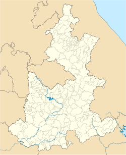
Mexico Puebla location map.svg
Red pog.svg
Tlaltenango
Location of the municipality in Puebla
Mexico States blank map.svg
Red pog.svg
Tlaltenango
Tlaltenango (Mexico)
Coordinates: 19°10′22″N98°20′40″W / 19.17278°N 98.34444°W / 19.17278; -98.34444
CountryFlag of Mexico.svg  Mexico
State Puebla
Time zone UTC-6 (Zona Centro)
Website tlaltenango.puebla.gob.mx

Tlaltenango is a town and its surrounding municipality in the Mexican state of Puebla. [1]
References

  1. "-". Enciclopedia de los Municipios de México. Instituto Nacional para el Federalismo y el Desarrollo Municipal . Retrieved January 4, 2010.