Trafalgar, South Africa

Last updated

Trafalgar
Stump on Trafalgar Beach - panoramio.jpg
Trafalgar Beach
South Africa KwaZulu-Natal location map.svg
Red pog.svg
Trafalgar
South Africa adm location map.svg
Red pog.svg
Trafalgar
Coordinates: 30°57′29″S30°17′31″E / 30.958°S 30.292°E
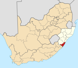
 / -30.958; 30.292
Country South Africa
Province KwaZulu-Natal
District Ugu
Municipality Ray Nkonyeni
Main Place Southbroom
Area
[1]
  Total2.63 km2 (1.02 sq mi)
Population
 (2011) [1]
  Total397
  Density150/km2 (390/sq mi)
Racial makeup (2011)
[1]
   Black African 21.4%
   Coloured 0.5%
   White 78.1%
First languages (2011)
[1]
   English 50.6%
   Afrikaans 35.3%
   Zulu 6.5%
   Xhosa 3.5%
  Other4.0%
Time zone UTC+2 (SAST)
PO box
4275

Trafalgar is a seaside resort village in Ugu District Municipality in the KwaZulu-Natal province of South Africa. Trafalgar is on the north bank of the Mpenjati river which enters the Indian Ocean at the Mpenjati Nature Reserve. The town is located in lush coastal forest, sitting on a small rise overlooking the beach.

Trafalgar is a neat and well maintained town with clean streets, landscaping and municipal services. There are no potholes on the streets, a considerable accomplishment by South African standards, versus the many towns in the country that have poor quality of municipal service delivery.

The town has an active rate payers association involving local volunteers who undertake considerable activity on behalf of the community and have invested in good relations with municipal officials. Trafalgar is a happy town, people here know each and work together for common purpose. This is invaluable for any community in contemporary South Africa.

Trafalgar is popular as both a destination for tourists who can stay at one of several guest houses. It is also a lifestyle community valued by residents who appreciate the peace, calm and beauty of the town. Increasingly more residents have taken up full time residence and are mid-career people, able to work from home.

The main beach on the north side of town has a "Blue Flag" designation, meaning that it conforms to international standards regarding water quality and environmental protection and that there is a Life Guard present. Visitors can park here and access the beach which is a public space. The beach is good for surfing and swimming as well as snorkelling the reef offshore. There are shark nets on this section of beach also. The beach at Mpenjati Nature Reserve has been used by naturists for many years.

There are two restaurants and a local grocer, which bakes fresh bread and pastry, daily. Shopping and services are easily accessible at the nearby towns of South Broom, Shelly Beach and Port Edward. There is a private hospital at Shelly Beach.

Transport

Trafalgar can be accessed by turning off the R61 (to Port Edward and Port Shepstone) onto Trafalgar Drive, the single access road into village. Direct, scheduled, flights to Johannesburg are available at Margate Airport, 22km away. The N2 Road from Durban is well maintained and is in good condition, making the town easily accessible.

Related Research Articles

<span class="mw-page-title-main">Mombasa</span> City in Mombasa County, Kenya

Mombasa is a coastal city in southeastern Kenya along the Indian Ocean. It was the first capital of British East Africa, before Nairobi was elevated to capital status in 1907. It now serves as the capital of Mombasa County. The town is known as "the white and blue city" in Kenya. It is the country's oldest and second-largest city after Nairobi, with a population of about 1,208,333 people according to the 2019 census.

<span class="mw-page-title-main">Mornington Peninsula</span> Peninsula and region of Victoria, Australia

The Mornington Peninsula is a peninsula located south of Melbourne, Victoria, Australia. It is surrounded by Port Phillip to the west, Western Port to the east and Bass Strait to the south, and is connected to the mainland in the north. Geographically, the peninsula begins its protrusion from the mainland in the area between Pearcedale and an area north of Frankston. The area was originally home to the Mayone-bulluk and Boonwurrung-Balluk clans, and formed part of the Boonwurrung nation's territory prior to European settlement.

<span class="mw-page-title-main">Somers, Victoria</span> Town in Victoria, Australia


Somers is a small coastal town on the Mornington Peninsula in Melbourne, Victoria, Australia, 67 km (42 mi) south-east of Melbourne's Central Business District, located within the Shire of Mornington Peninsula local government area. Somers recorded a population of 1,857 at the 2021 census.

Belitung is an island on the east coast of Sumatra, Indonesia in the Java Sea. It covers 4,859 km2 (1,876.1 sq mi), and had a population of 309,097 at the 2020 Census; the official estimate as at mid 2023 was 320,500. Administratively, it forms two regencies within the province of Bangka-Belitung Islands. The island is known for its pepper and for its tin. It was in the possession of the United Kingdom from 1812 until Britain ceded control of the island to the Netherlands in the Anglo-Dutch Treaty of 1824. Its main town is Tanjung Pandan. The United Nations Educational, Scientific and Cultural Organization has declared 17 tourist attractions in the Belitung Geopark as world geoparks.

<span class="mw-page-title-main">Ezemvelo KZN Wildlife</span> South African wildlife conservation organisation

Ezemvelo KZN Wildlife is a governmental organisation responsible for maintaining wildlife conservation areas and biodiversity in KwaZulu-Natal Province, South Africa. Their headquarters is in Queen Elizabeth Park situated on the northern slopes of Pietermaritzburg, the KwaZulu-Natal provincial capital. Prior to 1994, it was known as the Natal Parks Board.

<span class="mw-page-title-main">Margate, South Africa</span> Resort town in KwaZulu-Natal, South Africa

Margate is a coastal resort town in the KwaZulu-Natal province, about 20 kilometres south-west of Port Shepstone and 127 kilometres south-west of Durban. The river which flows into the sea at Margate is called "Nkhongweni" (place of entreaty) as the original inhabitants of the area were reputed to be so mean resulting in travellers begging for hospitality.

<span class="mw-page-title-main">Port Shepstone</span> Coastal town in KwaZulu-Natal, South Africa

Port Shepstone is a large town situated on the mouth of the Mzimkhulu River, the largest river on the KwaZulu-Natal South Coast of South Africa. It is located halfway between Hibberdene and Margate and is positioned 120 km south of Durban. It serves as the administrative, educational, industrial and commercial centre for southern Natal.

<span class="mw-page-title-main">Port Edward, South Africa</span> Seaside town in KwaZulu-Natal, South Africa

Port Edward is a small resort town situated on the south coast of KwaZulu-Natal in South Africa and lies on the border between KwaZulu-Natal and the Eastern Cape. It is situated on the R61 road between Port Shepstone and Lusikisiki.

<span class="mw-page-title-main">Woodstock, Cape Town</span> Suburb of Cape Town, in Western Cape, South Africa

Woodstock is one of the earliest suburbs of Cape Town, South Africa, between the docks of Table Bay and the lower slopes of Devil's Peak, about 1 kilometre (0.6 mi) east of the city centre of Cape Town. Woodstock is served by Woodstock and Esplanade railway stations, and has the postal code 7925 for street addresses and 7915 for post office box deliveries.

<span class="mw-page-title-main">Noordhoek, Cape Town</span> Place in Western Cape, South Africa

Noordhoek is a seaside town in the Western Cape, South Africa, located below Chapman's Peak on the west coast of the Cape Peninsula and is approximately 35 kilometres (22 mi) to the south of Cape Town. The name "Noordhoek" was taken from Dutch and literally means "north corner". It was given this name in 1743 as being the northern corner of the Slangkop farm. The first permanent resident of European origin is Jaco Malan who built his house there. In 1857, the region was divided into six plots, most of which were bought by a single family, that of the de Villiers. Noordhoek nevertheless remains a predominantly rural area where farmers grow vegetables to supply ships calling at Simon's Town. It is best known for its shoreline and its long, wide, sandy beach, which stretches south to the neighbouring village of Kommetjie. Near the southern end of this beach is the wreck of the steamship "Kakapo", which ran aground in 1900, when the captain mistook Chapman's Peak for the Cape of Good Hope and put the helm over to port.

<span class="mw-page-title-main">Port Rowan</span> Community of Norfolk County, Ontario, Canada

Port Rowan is a town in Norfolk County, Ontario, Canada. It is located on Lake Erie, adjacent to Long Point. The lakeside community has a population of 1,357 people as of 2021 and sports a number of traditional small businesses which have been operating in the town for decades.

<span class="mw-page-title-main">Hourtin</span> Commune in Nouvelle-Aquitaine, France

Hourtin is a commune of southwestern France, located in the Gironde department, administrative region of Nouvelle-Aquitaine. It is located in the canton Le Sud-Médoc, part of the district of Lesparre-Médoc. It is a member of the Community of Communes of Médoc Atlantique.

<span class="mw-page-title-main">Nude beach</span> A beach where public nudity is practiced

A nude beach, sometimes called a clothing-optional or free beach, is a beach where users are at liberty to be nude. Nude beaches usually have mixed bathing. Such beaches are usually on public lands, and any member of the public is allowed to use the facilities without membership in any movement or subscription to any personal belief. The use of the beach facilities is normally anonymous. Unlike a naturist resort or facility, there is normally no membership or vetting requirement for the use of a nude beach. The use of nude beach facilities is usually casual, not requiring pre-booking. Nude beaches may be official, unofficial, or illegal.

North Cornelly is a moderately sized village in Bridgend County Borough, Wales. It is four miles from the seaside resort of Porthcawl and six miles from the town of Bridgend. The Kenfig nature reserve is less than a mile away.

<span class="mw-page-title-main">Southbroom</span> Coastal village in KwaZulu-Natal, South Africa

Southbroom is a coastal village on the South Coast of the KwaZulu-Natal province of South Africa situated approximately halfway between Port Shepstone – 23 km (14 mi) and Port Edward – 18 km (11 mi).

Palm Beach is a seaside town in Ugu District Municipality in the KwaZulu-Natal province of South Africa.

<span class="mw-page-title-main">Shelly Beach, South Africa</span> Place in KwaZulu-Natal, South Africa

Shelly Beach is a coastal resort town on the South Coast of the KwaZulu-Natal province of South Africa, located more or less halfway between Margate and Port Shepstone.

<span class="mw-page-title-main">South Coast (KwaZulu-Natal)</span> Coastal region in KwaZulu-Natal, South Africa

KwaZulu-Natal South Coast is a region along the southern stretch of coastline of KwaZulu-Natal, South Africa, south of the coastal city of Durban.

The Rocherpan Marine Protected Area is a small coastal conservation region on the West Coast of the Western Cape province, in the territorial waters of South Africa. It is about 25 km north of Velddrif on the road to Elands Bay, north of Dwarskersbos.

References

  1. 1 2 3 4 "Sub Place Trafalgar". Census 2011.