Allentown is a city in Bleckley, Laurens, Twiggs, and Wilkinson counties in the U.S. state of Georgia, primarily in Wilkinson County. As of the 2010 census, the city had a population of 169, down from 287 at the 2000 census. In 2020, its population was 195. The Twiggs County portion is part of the Macon metropolitan statistical area, while the Laurens County portion is part of the Dublin micropolitan statistical area. The remaining Wilkinson and Bleckley County portions are not part of any metropolitan or micropolitan area.

Temple is a city in Carroll and Haralson counties in the U.S. state of Georgia. The population was 5,089 at the 2020 census, up from 4,228 in 2010, a 20.36% increase.
Sharpsburg (ˈʃɑrpsbɝg) is a town in Coweta County, Georgia, United States. It is part of the Atlanta metropolitan area. Its population was 327 at the 2020 census.
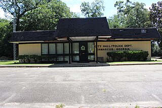
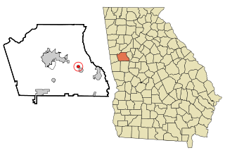
Damascus is a city in Early County, Georgia, United States. The population was 212 in the 2020 census, down from 254 in the 2010 census.

Garfield is a city in Emanuel County, Georgia, United States. The population was 257 in 2020.
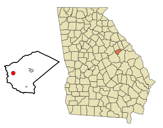
Mitchell is a town in Glascock County, Georgia, United States. The population was 199 at the 2010 census, and 153 in 2020. Mitchell is home to the Mitchell Depot Historical Museum.

Loganville is a city in Walton and Gwinnett counties, Georgia, United States. The population was 14,127 in 2020. Loganville is located about 36 mi (58 km) east of Atlanta and is part of the Atlanta metropolitan area.

Hoschton is a city in Jackson County, Georgia, United States. The population was 1,377 at the 2010 census. As of 2018 the estimated population was 1,916.

Talmo is a town in Jackson County, Georgia, United States. The population was 257 at the 2020 census.

Cadwell is a town in Laurens County, Georgia, United States. The population was 381 in 2020.

Dasher is a town in Lowndes County, Georgia, United States. The population was 890 in 2020.

Lake Park is a city in Lowndes County, Georgia, United States. The population was 932 in 2020, up from 733 in 2010.

Ideal is a city in Macon County, Georgia, United States. The population was 407 at the 2020 census, down from 499 in 2010.
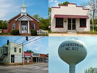
Luthersville is a city in Meriwether County, Georgia, United States. The population was 776 at the 2020 census, down from 874 in 2010.

Woodbury is a city in Meriwether County, Georgia, United States. The population was 908 at the 2020 census.

Meigs is a city in Thomas County, Georgia, United States, with a small portion extending north into Mitchell County. The population was 928 at the 2020 census, down from 1,035 in 2010.

Higgston is a town in Montgomery County, Georgia, United States. The population was 314 at the 2020 census.

Tarrytown is a town in Montgomery County, Georgia, United States. The population was 66 at the 2020 census, down from 87 in 2010.

Uvalda is a city in Montgomery County, Georgia, United States. The population was 439 at the 2020 census, down from 598 in 2010.
Bostwick is a city in Morgan County, Georgia, United States. As of the 2020 census, the city had a population of 378.