Tusculum, Tennessee

Last updated

Tusculum
Shiloh Cumberland Presbyterian Church Tusculum Tennessee 9-29-2006.jpg
Shiloh Cumberland Presbyterian Church in Tusculum
Flag of Tusculum, Tennessee.png
City of Tusculum Official Seal.png
Motto: 
"First in Education" [1]
Greene County Tennessee Incorporated and Unincorporated areas Tusculum Highlighted 4775560.svg
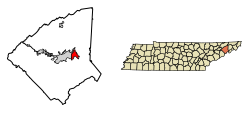
Location of Tusculum in Greene County, Tennessee.
Coordinates: 36°10′30″N82°44′43″W / 36.17500°N 82.74528°W / 36.17500; -82.74528
Country United States
State Tennessee
County Greene
Incorporated1959 [2]
Named for Ancient Tusculum [3]
Government
  MayorAlan Corley
  Vice MayorBarbara Britton
  City CommissionerMike Burns
Area
[4]
  Total4.86 sq mi (12.59 km2)
  Land4.86 sq mi (12.59 km2)
  Water0.00 sq mi (0.00 km2)
Elevation
[5]
1,457 ft (444 m)
Population
 (2020) [6]
  Total3,298
  Density678.32/sq mi (261.91/km2)
Time zone UTC-5 (Eastern (EST))
  Summer (DST) UTC-4 (EDT)
ZIP codes
37616 & 37745
FIPS code 47-75560 [7]
GNIS feature ID2405615 [5]
Website www.tusculumcity.org

Tusculum is a city in Greene County, Tennessee, United States. The population was 3,298 at the 2020 census. [8] It is the site of Tusculum University, the oldest university in Tennessee and the 28th oldest in the United States. Tusculum is a suburb of nearby Greeneville. The population of both Greeneville and Tusculum combined was approximately 18,777 at the 2020 census.

Contents

Geography

According to the United States Census Bureau, the city has a total area of 4.8 square miles (12.5 km2), all land. [9]

Neighborhoods

Demographics

Historical population
CensusPop.Note
1960 1,433
1970 1,180−17.7%
1980 1,2425.3%
1990 1,91854.4%
2000 2,0044.5%
2010 2,66332.9%
2020 3,29823.8%
Sources: [10] [11] [6]

2020 census

Tusculum racial composition [12]
RaceNumberPercentage
White (non-Hispanic)2,63279.81%
Black or African American (non-Hispanic)1996.03%
Native American 190.58%
Asian 551.67%
Pacific Islander 10.03%
Other/Mixed 1143.46%
Hispanic or Latino 2788.43%

As of the 2020 United States census, there were 3,298 people, 641 households, and 461 families residing in the city.

2000 census

At the 2000 census, [7] there were 2,004 people, 590 households and 437 families residing in the city. The population density was 445.4 per square mile (172.0/km2). There were 620 housing units at an average density of 137.8 per square mile (53.2/km2). The racial makeup of the city was 95.41% White, 3.64% African American, 0.05% Native American, 0.50% Asian, 0.05% from other races, and 0.35% from two or more races. Hispanic or Latino of any race were 0.30% of the population.

There were 590 households, of which 24.4% had children under the age of 18 living with them, 64.4% were married couples living together, 7.3% had a female householder with no husband present, and 25.8% were non-families. 23.1% of all households were made up of individuals, and 9.2% had someone living alone who was 65 years of age or older. The average household size was 2.28 and the average family size was 2.66.

12.7% of the population were under the age of 18, 18.3% from 18 to 24, 25.4% from 25 to 44, 28.8% from 45 to 64, and 14.9% who were 65 years of age or older. The median age was 41 years. For every 100 females, there were 106.2 males. For every 100 females age 18 and over, there were 104.2 males.

The median household income was $37,460 and the median family income was $50,074. Males had a median income of $31,607 and females $23,594. The per capita income was $15,834. About 5.8% of families and 6.1% of the population were below the poverty line, including 3.4% of those under age 18 and 9.0% of those age 65 or over.

Education

Tusculum is the site of the main campus of Tusculum University.

Greene County Public Schools operates one elementary school in Tusculum, Doak Elementary School, serving grades Pk-5. Chuckey-Doak Middle School and Chuckey-Doak High School are also located in Tusculum city limits but both have an Afton address. They are also operated by Greene County Public Schools.

Postal service

Tusculum has a branch post office located on the college campus. The main zip code for Tusculum is 37745, although some portions of the city are in Afton's zip code, 37616.

Tusculum shares the zip code 37745 with Baileyton and Greeneville.

Recreation

The City of Tusculum operates and manages Tusculum City Park and Tusculum Linear Park Trail (Greenway)

Transportation

State Route 107 formerly went through downtown Tusculum, it has since been rerouted along U.S. Route 11E and US Route 321 on the north side of the city and on a new alignment of SR-107 on the east side of the city, titled Tusculum Bypass. US-11E and US-321 run concurrently on the north side of the city. SR-351 also junctions with SR-107 on the southeast side of the city. The main road through downtown is Erwin Highway (the former SR-107).

Related Research Articles

<span class="mw-page-title-main">Washington County, Tennessee</span> County in Tennessee, United States

Washington County is a county located in the U.S. state of Tennessee. As of the 2020 census, the population was 133,001. Its county seat is Jonesborough. The county's largest city and a regional educational, medical and commercial center is Johnson City. Washington County is Tennessee's oldest county, having been established in 1777 when the state was still part of North Carolina. Washington County is part of the Johnson City, TN Metropolitan Statistical Area, which is a component of the Johnson City–Kingsport–Bristol, TN-VA Combined Statistical Area, commonly known as the "Tri-Cities" region.

<span class="mw-page-title-main">Jefferson County, Tennessee</span> County in Tennessee, United States

Jefferson County is an exurban county located in the U.S. state of Tennessee. As of the 2020 census, the population was 54,683. Its county seat is Dandridge. Jefferson County is part of the Morristown Metropolitan Statistical Area with neighboring Grainger and Hamblen counties. The county, along with the Morristown MSA, is included in the Knoxville-Morristown-Sevierville Combined Statistical Area.

<span class="mw-page-title-main">Greene County, Tennessee</span> County in Tennessee, United States

Greene County is a county located on the eastern border of the U.S. state of Tennessee. As of the 2020 census, the population was 70,152. Its county seat is Greeneville. Greene County comprises the Greeneville, TN Micropolitan Statistical Area.

<span class="mw-page-title-main">Greene County, Ohio</span> County in Ohio, United States

Greene County is located in the southwestern portion of Ohio. As of the 2020 census, the population was 167,966. Its county seat is Xenia and its largest city is Beavercreek. The county was established on March 24, 1803 and named for General Nathanael Greene, an officer in the Revolutionary War. Greene County is part of the Dayton, OH Metropolitan Statistical Area.

<span class="mw-page-title-main">Republic, Missouri</span> City in Missouri, United States

Republic is a city in Christian and Greene counties in the U.S. state of Missouri. As of the 2020 census, the city's population was 18,750. In 2019, its population was 16,938, making it the second largest city in Greene County in the U.S. state of Missouri. It is also the fourth largest city in the Springfield, Missouri, Metropolitan Statistical Area.

<span class="mw-page-title-main">Parrottsville, Tennessee</span> Town in Tennessee, United States

Parrottsville is a town in Cocke County, Tennessee, United States. The population was 263 at the 2010 census.

<span class="mw-page-title-main">Baileyton, Tennessee</span> Town in Tennessee, United States

Baileyton is a town in northern Greene County, Tennessee, United States. The population was 431 at the 2010 census, down from 504 at the 2000 census. Baileyton is located 13 miles (21 km) north of Greeneville and 18 miles (29 km) southeast of Rogersville.

<span class="mw-page-title-main">Greeneville, Tennessee</span> County seat of Greene County, Tennessee, United States

Greeneville is a town in and the county seat of Greene County, Tennessee, United States. The population as of the 2020 census was 15,479. The town was named in honor of Revolutionary War hero Nathanael Greene, and it is the second oldest town in Tennessee. It is the only town with this spelling in the United States, although there are numerous U.S. towns named Greenville. The town was the capital of the short-lived State of Franklin in the 18th-century history of East Tennessee.

<span class="mw-page-title-main">Mosheim, Tennessee</span> Town in Tennessee, United States

Mosheim is a town in Greene County, Tennessee, United States. The population was 2,479 at the 2020 census.

<span class="mw-page-title-main">Bulls Gap, Tennessee</span> Town in Tennessee, United States

Bulls Gap is a town in Hawkins County, Tennessee, United States. The population was 756 at the 2020 census. It is part of the Metropolitan Statistical Area, which is a component of the Johnson City-Kingsport-Bristol, TN-VA Combined Statistical Area – commonly known as the "Tri-Cities" region.

<span class="mw-page-title-main">Jonesborough, Tennessee</span> Oldest town in Tennessee, United States

Jonesborough is a town in, and the county seat of, Washington County, Tennessee, in the Southeastern United States. Its population was 5,860 as of 2020. It is "Tennessee's oldest town".

<span class="mw-page-title-main">Waynesboro, Tennessee</span> City in Tennessee, United States

Waynesboro is a city in and the county seat of Wayne County, Tennessee, United States. The population was 2,449 at the 2010 census, up from 2,228 in 2000.

<span class="mw-page-title-main">Fall Branch, Tennessee</span> CDP in Tennessee, United States

Fall Branch is a census-designated place (CDP) in Washington and Greene counties in the U.S. state of Tennessee. The population was 1,291 at the 2010 census. Some areas in Sullivan also use the Fall Branch ZIP code.

<span class="mw-page-title-main">Tri-Cities, Tennessee</span> Region in East Tennessee

The Tri-Cities is the region comprising the cities of Kingsport, Johnson City, and Bristol and the surrounding smaller towns and communities in Northeast Tennessee and Southwest Virginia. All three cities are located in Northeast Tennessee, while Bristol has a twin city of the same name in Virginia.

<span class="mw-page-title-main">U.S. Route 11E</span> Suffixed U.S. Highway in Tennessee and Virginia in the United States

U.S. Route 11E (US 11E) is a divided highway of US 11 in the U.S. states of Tennessee and Virginia. The United States Numbered Highway, which is complemented by US 11W to the north and west, runs 120.94 miles (194.63 km) from US 11, US 11W, and US 70 in Knoxville, Tennessee, north and east to US 11, US 11W, US 19, and US 421 in Bristol, Virginia. US 11E connects Knoxville and the twin cities of Bristol, Virginia, and Bristol, Tennessee, with the East Tennessee communities of Morristown, Greeneville, and Johnson City. The U.S. Highway runs concurrently with US 70 and US 25W east of Knoxville, US 321 from Greeneville and Johnson City, and both US 19W and US 19 between Johnson City and Bristol. US 11E also has an unsigned concurrency with State Route 34 (SR 34) for almost all of its course in Tennessee.

<span class="mw-page-title-main">Limestone, Tennessee</span> Town in Tennessee, United States

Limestone is an unincorporated community on the western border of Washington County and the eastern border of Greene County in the northeastern part of the U.S. state of Tennessee. Its zip code is 37681. Limestone is part of the Johnson City Metropolitan Statistical Area, which is a component of the Johnson City-Kingsport-Bristol, TN-VA Combined Statistical Area – commonly known as the "Tri-Cities" region.

<span class="mw-page-title-main">Tennessee State Route 107</span> Highway in Tennessee

State Route 107 is a 78.77-mile (126.77 km) state highway in eastern Tennessee, United States. It begins at an intersection with Round Mountain Road south of Del Rio and ends at the North Carolina state line east of Unicoi, where it becomes NC 226.

<span class="mw-page-title-main">Afton, Tennessee</span> Unincorporated community in Tennessee, United States

Afton is an unincorporated community in Greene County, Tennessee.

<span class="mw-page-title-main">Tennessee State Route 351</span> Highway in Tennessee

State Route 351 is a state highway in Greene County, Tennessee. It begins at State Routes 70 and 107 in southern Greene County and ends at State Route 93 in northern Greene County. It forms a half loop around Greeneville and Tusculum.

Chuckey-Doak High School is located in Tusculum, Tennessee, United States, with an Afton address. It is one of four high schools in the Greene County, Tennessee School System and serves the eastern part of the county, including the city of Tusculum and the communities of Afton, Chuckey and the Greene County portion of Limestone. Chucky-Doak is the top high school in the Greene County education system. Their marching band has many notable achievements, similar to their football team.

References

  1. "Homepage". City of Tusculum. Retrieved August 14, 2020.
  2. Tennessee Blue Book , 2005-2006, pp. 618-625.
  3. Nancy Capace, Encyclopedia of Tennessee (North American Book Distributors, 2000), p. 226.
  4. "ArcGIS REST Services Directory". United States Census Bureau. Retrieved October 15, 2022.
  5. 1 2 U.S. Geological Survey Geographic Names Information System: Tusculum, Tennessee
  6. 1 2 "Census Population API". United States Census Bureau. Retrieved October 15, 2022.
  7. 1 2 "U.S. Census website". United States Census Bureau . Retrieved January 31, 2008.
  8. "Profile of General Population and Housing Characteristics: 2010 Demographic Profile Data (DP-1): Tusculum city, Tennessee". United States Census Bureau . Retrieved August 3, 2012.
  9. "Geographic Identifiers: 2010 Demographic Profile Data (G001): Tusculum city, Tennessee". United States Census Bureau . Retrieved August 3, 2012.
  10. "Census of Population and Housing: Decennial Censuses". United States Census Bureau . Retrieved March 4, 2012.
  11. "Incorporated Places and Minor Civil Divisions Datasets: Subcounty Resident Population Estimates: April 1, 2010 to July 1, 2012". Population Estimates. U.S. Census Bureau. Archived from the original on June 11, 2013. Retrieved December 11, 2013.
  12. "Explore Census Data". data.census.gov. Retrieved December 27, 2021.